The Heart of “La Ruta 40” – Part III: Mendoza’s Patagonia

I was heading south through “Mendoza’s Patagonia,” – the part of Argentina in the province of Mendoza that is located just north of the “official” Patagonia, which starts in the province of Neuquen. (I may have made up the term “Mendoza’s Patagonia” but it works.)

I had heard that the Patagonia is known for being more expensive than the north of Argentina, except for gas prices, because it is the major fossil fuel production region of Argentina. So it wasn’t so surprising that one of my first encounters was a guy about my age that worked in oil and gas. Martín lived in Buenos Aires but worked for an oil and gas company that was paying for him and his family to live in Malargüe, and they had been there for about a year. Those perks came at a price though because he said that weekend was going to be the first weekend he had off of work in the whole month.

Later I met Claudia, one of those unique and wonderful people that I connected with in a special way despite the fact that we were very different. I immediately recognized that she had a kind spirit, complemented by a strong personality, with a subtle hint of underlying anxiety.

She is a teacher in the tiny town of Ranquil Norte but lives in Malargüe (about 3-4 hours away). During the school year she stays the week in Ranquil Norte, living with a family there, and then takes the bus to be in Malargüe with her husband for the weekends.

Her husband just retired and didn’t know what to do with himself since she’s still working, so was coaching him through it (“you can visit your kids, go see new places, and when I retire we’ll go see new places, and sometimes just go to the park and drink mate”). Because she’s a teacher in a rural area, she’ll get to retire in a couple of years too. In Argentina, men retire at 65 and women at 60, but for teaching in a rural area one can retire a few years early.

Claudia taught me the proper way to pour hot water into the mate (“mah-tay“), because there is a technique that seems to be common across all of Argentina, and as her co-pilot, I was responsible for keeping the mate filled. She had a special electric mate that I had never seen before – it could be kept warm by plugging it in to the cigarette lighter in the car.

As we got to know each other, Claudia shared some personal stories about a rough and abusive young adulthood that she had ultimately overcome to find a peaceful and healthy life with her current husband. However, she confided in me, something had recently triggered some of her past traumas to resurface and she was working through them now (which might have explained the nervousness I sensed in her). She used a really great analogy that stuck with me. “Sometimes we do a good job of cleaning up the house and keeping it well maintained, but we left that one room in the back of the house with all the junk in it, locked up. Well, now is the time where I have to open up that room and start cleaning it out.”

One of the reasons we connected well was because we both really love writing, and she is the second person in my life that has told me that everyone should write a book in their life.*

We passed incredible landscapes of mountains, hills, and volcanoes. In fact, I couldn’t believe the number of volcanoes I saw off off to the left as we were heading south! I pulled out my map and realized that we were in fact passing through the Land of the Volcanoes. (I made that term up. If you look on a map, there is one area along the highway teeming with volcanoes, so it seems appropriate.)

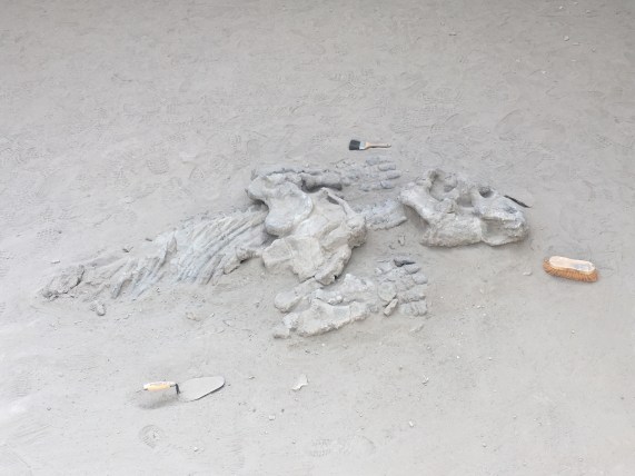
The volcanoes are located in an area that has been named a provincial reserve called La Payunia, and includes more than 800 volcanic cones. (As a traveler one learns that there is no possible way that you can see everything that you want to see, and so this one was one of those places added to the list for future exploration.) But along the road, we could see huge black rocks – clearly dried lava from a past eruption, and even a canyon made of black lava rock.


In Ranquil Norte, the only place to get wifi was in the municipality building, so I headed there to log my whereabouts. The municipal building was basically a house – with kitchen, rooms with bunk beds, and a reception area. Since it is such a small town, people from the district municipality often come through and spend the night there as they make their way around the different rural towns administering services. I had arrived just as a group of three guys from the district municipality had grilled out for lunch and they invited me to share the “asado” (sausage and steak cooked on the grill) with them.


Along the highway I had seen quite a few bikers, and when I got to Chos Malal, I actually got the pleasure of meeting one of them. Dario is from Rosario and works with water pumps in high-rise buildings and had taken a month-long vacation on his motorcycle to explore the south. He had hesitated about doing something so “selfish”, but his (grown) children had encouraged him to do it. He said he was glad he had listened to them because it had been an incredible experience. Although he had had his moments of doubts that very same day.

That day we had passed a long section (more than an hour) of road that was not paved. Even Claudia in her pickup truck was really nervous about driving on that part, so I wasn’t surprised to hear that on a motorcycle it was tough. Apparently, it was so tough that Dario even asked himself a multiple times what he had been thinking and doubted if he would make it through. But he got through it and at the end of the day he was glad he had survived it and had overcome the challenge to be able to continue his journey and arrive in that cute little town of Chos Malal.

Chos Malal is located where “Neuquen” is written on the map. (Source: Wikipedia)


In addition to being a cute town, Chos Malal is the half-way point along La Ruta 40, which connects the northern border of Argentina (in the city of La Quiaca) with the southern-most part of Argentina to el Cabo Virgenes.

Most travelers who want to visit the Argentinian Patagonia take a flight to Bariloche, El Califate, or Ushuaia. After-all, the distances in Argentina are long – crossing Argentina from north to south is about the same distance as crossing the length of the US from east to west. (The journey I was taking, from Jujuy in the north to Ushuaia in the south, along La Ruta 40, is about 5,000 km or 3,100 mi – the equivalent of driving from Augusta, Maine to Los Angeles, CA.)

Spoiler alert: I only ever made it into northern Patagonia, but I don’t regret any minute of it! Stay tuned for the last chapter of my journeys along La Ruta 40.

Famous Footnotes

*Maybe this will one day turn into a book, but for now, here is my story in bite-sized pieces.

The Heart of “La Ruta 40” – Part II: Malargüe

Heading south from Mendoza along “La Ruta 40”, one passes through Malargüe, which is a small, enchanting little town, where I met some really wonderful people.

Guillermo is an agricultural engineer that lives in Malargüe and runs a farm that grows potatoes and garlic. He is involved in the Workaway program and hosts travelers from all over the world that help out on the farm and stay for free at his place. He also happens to teach at one of the rural schools and is doing a project with his students where they make potable water by evaporating water in a green-house-like system, capturing and condensing the vapor.

Headed south towards Malargüe, we travel parallel to the cordillera (mountain range) that divides Argentina and Chile, with an amazing view of those majestic mountains out the passenger side window.

For some reason, the movie “Alive” about the rugby team whose airplane crashed into the snowy mountains came to mind. Moments later, Guillermo pointed to one of the peaks saying that it was the mountain where the Uruguay rugby team crashed! (I have no idea how my brain made that association; the subconscious is a powerful thing!) He went on to explain that if they had walked towards the Argentine side of the mountain, it would have actually been a shorter and easier hike to salvation, but they had no idea from where they were and they hiked through the toughest and longest part towards Chile.

That afternoon, I came across this great little spot along the highway, kind of in the middle of nowhere, called Manqui Malal. I went to investigate and found that it was a privately-owned conservation area. There was a restaurant, a campsite, and a few cabins, and they offered guided tours of the surrounding canyon-like area. And there were dogs, sheep, and chickens wandering around. Exactly the type of place where I wanted to stay! #eco-tourism!

Luckily, I had arrived just in time for the afternoon guided tour! I didn’t have time to store my things in the cabin, but they assured me it was safe to just leave them there in the restaurant. It may seem like a crazy thing to do – to trust strangers in the middle of place where you’ve never been before. But I got such a good vibe from the staff and the family eating there in the restaurant, and having had such good experiences in all the small, rural towns I’d been through, I actually felt completely comfortable trusting people here.

The guide was a young woman who did an awesome job explaining the different rock formations we saw – how they were formed and where they fit into the history of the Earth.


I was not the only participant on the tour – there was a woman and a man about my age and three kids between 5 and 10 years old. I could not believe it when I learned that the woman was an American from Minnesota! She had lived in Argentina for about 7 years, married an Argentine man and they were currently living in MN but visiting Argentina for about a month. I could not believe that I had run into another American in this tiny little spot on the side of the highway (not even a major tourist attraction) in the middle of Argentina!

As we explored the area and hiked to a waterfall, I chatted with the American woman. Her kids were growing up speaking Spanish and English and they were doing homeschool. (In retrospect, I realize that the social distancing measures must not be impacting their lessons!) She explained that she really loved the experience of home schooling so far, especially because they found that they had quite a lot of free time to do more active things after the lessons – which both she and the kids liked. She was really proud that her kids had scored really well on the state tests they take every year, and her 10-ish year-old daughter interjected, explaining that she had scored really well in math and science and less in English, and then continued to talk about her lessons. It was pretty cute to see her interest in her education and her ability to talk easily and confidently with adults.

After enjoying the refreshing waterfall, I hiked through the canyon where I met a couple my age from Buenos Aires sitting on a large boulder and drinking mate.

The sky had clouded up and the guide had warned me that if it started raining I should immediately start heading back because the canyon is prone to flash floods. So I headed quickly to the end of the canyon, and as it started to drizzle I hurried back, leaping from boulder to boulder, until I arrived at the base camp.

Having arrived here after spending a few days in the city (Mendoza), I was amazed by the absolute, complete silence (except for once every hour when a car passed on the highway). I had one of the best night’s sleep of my whole journey that night – which was much-needed to prepare me for my long journey ahead.

Ischigualasto and Rainbow Canyon

I woke up early that morning in “Baldecitos”*, not really sure where I would be sleeping that night.

The French couple I had met, Silvia and Michel, were going to pick me up at 8am to tour the famous Parque Ischigualasto together, so I was pretty excited about that! (I would get a chance to get to know them, and I had overcome the challenge of seeing the park without my own car!)

But after that, my future was uncertain. I was learning to get comfortable with taking things day by day. Sometimes even hour by hour.

(In my travels, I keep a spreadsheet of dates and locations, transportation times and costs, etc., but it is more like a rough guide than a fixed plan. And the last few days I had really be improvising, especially as I’d discovered cute small towns and these national parks! Squirrel!)

A few minutes before 8am, I headed outside and found a car parked out front where we’d agreed to meet. As I approached, I was greeted by the bright smiling faces of Silvia and Michel, and I was happy to join the excited energy of heading off for a new adventure.

When we arrived at the park we were instructed that we would be joining a caravan of about 5 other vehicles, with the guide at the helm, and we would be stopping at certain spots along the way where we would get out, walk a short way, and the guide would share information with us.

Silvia and Michel, my French friends, in front of a large “mushroom” formation, a common formation seen in Parque Ischigualasto.

At the first stop, we parked behind a white van with Texas plates. I rubbed my eyes and looked again, but it was true that I wasn’t dreaming.

After checking out the landscapes of the “valle de la luna”, I heard a couple my age speaking in English and heading towards the van. Too shy to talk to them, I never learned if they were really from Texas.

Just kidding. If you believed that, you haven’t been reading my blogs enough to know that I’m rarely too shy to talk to someone.

So, it was there in the middle of Argentina, where I met Danika and Brady, a couple that had been living in El Paso, Texas and had been planning to travel through South America. A little over a year ago, their plans started coming together and they decided to do the journey by land from Texas to the southern tip of South America. They bought a van and turned the back part of it into a mini-apartment – equipped with a bed, shelves, cabinets, a stove, and even with walls decorated with photos – and then began their journey south. And now, we had been lucky enough to cross paths here in Parque Ischigualasto!

https://www.britannica.com/science/Triassic-Period

Parque Ischigualasto was quite a gem, with fossils from as far back as the Triassic Period – 250 MILLION years ago – when Pangea existed! (Remember Pangea? Back when the majority of the continents were united as one continent.)

So the parks (Ischigualasto and Talamapaya) are UNESCO World Heritage sites because they help tell the story of the evolution of land and life on Earth across time.

With so much time on its hands, the Earth had done some pretty creative things. Like creating these perfectly-shaped spherical rocks.

Precariously balanced towers of rock.

That sometimes do topple over.

I saw where the ancient Egyptians got their idea for the Sphynx. (The natural world had already created it!)

One stop included a museum where they told us about the dinosaurs and fossils that have been found in the area (many dinosaurs have been found in Argentina!) They explained how they carefully excavate fossils and determine their age (carbon dating), how they determine where they should dig to look for interesting things, and how they try to understand the geological processes that cause changes across the millennia.

The final stop was a showcase of the rock formations in their different stages of evolution, so you could essentially see the process that leads to the creation of the mushroom formations, as it happens over thousands of years.

We promised to come back to see these formations when they are mushrooms in a few thousand years.

Loving my time with Michel and Silvia and having also made two new friends, Danika and Brady, I realized that as a group of 5, we could do the tour of “cañon arco iris” and “ciudad perdida” (Rainbow Canyon and Lost City). (This is the tour that leaves from the southern entrance of Parque Talampaya and leaves only if a group forms.) They were all interested in the idea, so instead of trying to head to San Juan, I continued on with them, back towards Parque Talamapaya.

On the way, Silvia, Michel, and I shared travel stories and talked about everything under the sun. I learned that Michel had actually been to Talampaya before, more than a decade ago, before it was a national park. At that time, he had been able to drive his vehicle through the park to see the sights. Now only the tour companies are permitted to drive in the park, to minimize the human impact.

Michel had a project collecting photos of all the different animal crossing signs they saw along the way, so I took advantage and joined in the game – which also included trying to spot all the animals from the signs.

From top left, clockwise: Ostrich, Guanaco, Liebre, Fox

We arrived at the ArcoIris entrance to Talampaya just in time to be able to do an afternoon tour, and we even picked up an extra for the group – Alicia, a woman from Mar de Plata (a city in Argentina) that was on vacation traveling by motorcycle. (We also greeted a French cyclist passing through, brave or crazy enough to be cycling through the desert.)

The hike through Cañon Arco Iris and Ciudad Perdida was time travel through millions of years. We started with the red “youngest” rock formations and as we walked along we passed through tens of millions of years, finally arriving at the grey oldest rock formations, named “Ciudad Perdida” because of their shapes.

Leaping across tens of million of years, into Ciudad Perdida

Along the way, we could see how the seismic activity that created the Andes had lifted parts of earth’s crust out of the ground, exposing different layers of rock.

And we could see how the sun, wind, and rain changes the rock over millions of years, turning it into sand and reshaping it.

We also saw where the Incas might have gotten their idea for using rectangular stones for building walls that could withstand seismic activity…right there from nature herself.

You know when you meet someone that is so passionate about something that even if you never were interested in the topic before, they transmit their energy and enthusiasm to you and ignite an interest in you? (I’ve had some really good teachers with this talent, for example.) Well, our guide was like that. He was an easy-going and soft-spoken person, and when he talked about the the rocks and plants in the park and the history and science around it all, you could tell that he was really passionate about sharing this beautiful place with others (in his easy-going, soft-spoken kind-of-way).

Our guide Camilo lives in Pagancillo and the company that offers this tour is actually a co-op of independent guides, separate from the larger company at the main entrance of the park.

We finished the tour in the evening, and luckily, Silvia and Michel also loved staying in small towns, so I was happy to have already scouted out Pagancillo, the small town near the park. And I was really happy to be returning there to be able to see the friends I had made there, Dario and Marisel, once again.

That night, sharing wine and grapes (from their grape vine) with the family, the stars were shining brightly and it was a perfect opportunity to bust out the stargazing app and look at the stars. They were fascinated, as they hadn’t had the constellations pointed out to them before. So even though I was exhausted from a long day (that started in Baldecitos and had the surprise ending of being back here in Pagancillo), we walked down to the river where there were no lights to see the night sky in all its glory.**


Famous Footnotes:

*Baldecitos is the small town of about 10 houses, that is about 15km from the entrance to Parque Ischigualasto.

**While I was impressed by the centaur, whose hind leg is made up of the southern cross (only visible in the southern hemisphere), they were more impressed by the dog Sirius and Virgo.


National Park Talampaya

The scenery on the way to the National Park Talampaya was enough to assure me that the detour to visit these parks was going to be worthwhile.

My plan was to enjoy the park all day today, and then find some nice people to give me a ride to the small town, “Baldecitos”, near the provincial park of Ischigualasto about an hour away.*

I arrived early to the park to figure out options for excursions through the park, and I opted for a group hike through a part of the canyon only accessible by foot. (If we returned early enough, I might be able to also do one of the more popular jeep rides that takes you all the way through the canyon to the other side).** Unfortunately, our hike kept getting delayed because a few of the group members that had reserved were apparently on their way but stuck in traffic.

While I was sitting at a table, trying really hard not to be impatient (I guess I had used all my patience the day before waiting in the shade of the fig tree), I overheard a group speaking in American English. My ears perked up because I haven’t met many American tourists during my travels. And while American tourists in Patagonia are fairly common, here in the middle of northern Argentina, it is not nearly as common to encounter other Americans.

I hesitated to introduce myself because they were all deeply engaged in their conversation, (and while in Latin America it would be rude NOT TO interrupt and greet someone, these were US Americans so it could be considered rude to interrupt.) I finally decided to introduce myself and I’m glad I did!

They were two couples (older than me but young at heart!) that love traveling and seeing new places around the world. They found themselves there all because American Airlines was going to stop running their route to Cordoba, Argentina, and one of the guys decided he wanted to take advantage of it before it was discontinued. And from there, things just started coming together for the two couples – who hadn’t seen each other in a long time (hence their deeply engaged conversation) – to be able to meet up there in Parque Talampaya.

It was so great to share travel stories and hear about some of their unique experiences (like Nude Zealand!), especially since they have been traveling for decades – (they gave me a few pro tips)! I was surprised to hear that their grown children were somewhat indignant about their decision to travel around the world instead of staying close by, near the grandchildren. (I don’t have children so maybe I don’t understand, but, Mom and Dad, you did your time – thank you! Now, get out and go see the world!)

When it was finally time to head out for my hike, I admit I was a little skeptical. We left at noon under the hot desert sun, and I was pretty sure we were going to shrivel up and dehydrate. But it turns out the wind picks up mid-day, and we took it slow, took advantage of shade spots, and stopped frequently, so it was actually didn’t feel like I was walking in the desert at the hottest part of the day.

The hike was all I had hoped for and more. Amazing landscapes.

Rock formations from the Triassic period (250 million years ago) – that’s before the formation of the Andes.

More recent dune formations where vegetation can grow.


Even ancient rock paintings from thousands of years ago.

The coolest part was when we came upon a herd of guanaco. Not only was it the first guanaco that I see in the wild, we were right there close to them, in their natural habitat! They let us get about 20 feet away before they finally ran off.

I think the thing that impressed me the most was that we could see where a fault line passed because there was a huge diagonal crack in the walls of the canyon on both sides.

Our guide drew a 24-hour clock in the sand and explained that if the history of the Earth were compared to one day, where the Earth formed at midnight, life appeared at about 3-4am, and the rock formations in the park (that formed 250 million years ago) formed at just one minute and 30 seconds until midnight at the end of the day! (We humans appeared at about 6-10 seconds until the end of the day!)


I stood in awe, with the beautiful, 250 milion-year-old canyon walls towering above me. I felt so tiny and at the same time I felt that I was traveling time, and through that time travel I was connecting to the extensive history of this planet, and somehow that made me both tiny and as big and as old as the planet, all at the same time.


When I got back from the hike that afternoon, it was time for that character-building activity of asking for a lift to Baldecitos, the little town near the entrance to the provincial park Ischicualasto. It shouldn’t seem like a big deal, but for a person raised in the US and raised to be self-sufficient and independent, it is a bit of a psychological challenge. One has to overcome embarrassment, shyness, and fear of rejection, all at once. So I set myself up near the parking lot and asked all the people who drove up where they were headed, and if they were going my direction if they would have room for one more person. About 5 different cars arrived and everyone was very friendly in their rejection, but they were not going my direction.

As one of the excursions returned, I found an older couple that was headed that direction and they were happy to give me a ride. The woman, Ana, was in her 60’s and she is a psychologist in Buenos Aires. They were at the end of their vacation and she had to get back to work after the holidays. She had a private practice and then also worked with the government to do psychological evaluations for people applying for commercial drivers’ licenses. She talked about how she had backpacked through Europe when she was younger and continued to travel as much as possible. They were then kind enough to go a few minutes out of their way to drop me off in Baldecitos, waiting to make sure I found a place to stay.

The woman who owned the hospedaje en Baldecitos was about my age and she lived next door with her little boy of about 12-13 years old. After I got settled in, I saw she was outside spraying the ground with a water hose to control the dust, and I came out and asked her about life in Baldecitos. She was a farmer, with milk and beef cows and also received some extra income from tourists passing through for the park. She was born and raised there in Baldecitos, which has just about 10-15 families living there permanently, with maybe up to 25-20 houses total! (Definitely the smallest town I’ve been in so far.)

A few months prior, they had constructed a cell tower in the town that was also supposed to also bring wi-fi for the community, but it was really spotty, with some of my whatsapp messages delaying a few hours to send.

I feel at home anywhere if I can do yoga with the sunset.

There was a “comedor” (small, simple, family-style restaurant) near my hospedaje where I went to see if I could get something to eat. While there, an older French couple came in also asking about dinner and about logistics for going to the park the next day. The man and older woman in the comedor told us they would serve dinner at 9pm, and that the park opened at 8am and was about 12km down the road.***

This park – Ischigualasto – is the park that you visit by driving through, caravan style, with a guide, stopping along the way to see certain parts. (I had read on blogs that many people without their own transportation look for other people to give them a lift through the park.) The couple seemed really nice and friendly, so I took that opportunity to ask if they had room for one more person, and they assented and said we could chat over dinner.

Over dinner I learned that they had rented a car and were driving down La Ruta 40, with destination Bariloche, but looking for cute little towns and beautiful, hidden gems along the way, just like me (except with a car). They already have grown kids, but they also have this beautiful child-like energy, getting really excited about the places they’ve seen and what there is to see ahead. My kind of people. We hit it off immediately and agreed to meet at 8am the next morning to go explore the Parque Ischigualasto together.


Footnotes:

* Dario (the park guide whose house I had stayed at in Pagancillo the night before) had assured me that many people go between the two parks and that I wouldn’t have a problem finding a ride from Talampaya to Ischigualasto. Since that was consistent with the blogs I’d read on the internet, I felt good about the plan.

**I like to know all the options before I make a choice, and here it took me about an hour to understand how it all works (and that’s after having done research online!) It turns out that this is only one of two different park entrances for the National Park Talampaya. At this entrance, there are two companies – one that offers excursions in jeep that leave on a set schedule every few hours, and another that offers hiking or biking excursions. It is all very confusing because the company that offers jeep excursions is also in charge of selling the Park Entrance fee, which makes it seem like their excursions are the only options. But if you ask around, you find that there’s a small office around the corner that offers hikes and bike rides if enough people are interested in forming a group. As a third option for exploring the park, there is another park entrance about 10km down the road, where a different company offers an excursion in jeep to see another part of the park called “Cañon Arco Iris” (Rainbow Canyon) and “La Ciudad Perdida” (Lost City). I also heard that there is another company forming that will do excursions to another part of the park next year.

***I chatted for a while with the couple in the comedor in Baldecitos asking them about life in Baledcitos. They presented another point of view about the park. They said that while they weren’t completely opposed to the park and tourism from the park did bring some income, they were kind of frustrated that it put restrictions on their ability to raise animals because it was a protected area (and to prevent accidents with the passing cars). They mentioned that would have liked to maintain the practices of their ancestors in the raising of guanaco and cattle in the wide open spaces. They also said that this provincially-managed park doesn’t provide the same job opportunities for people in the community of Baldecitos, like the nearby national park Talampaya which provides jobs for many people of the nearby town Pagancillo. They did mention that a consultation process was used to create the park, but they felt that their opinion was not considered. (The complexity of the situation was not lost on me, since I am reading about Latin American history during my travels. For example, I confirmed that they were specifically referring to their European ancestors who have inhabited those lands for hundreds of years. If you keep going back in time, you come to a point in time where their ancestors usurped the lands of the indigenous people living there. And maybe those indigenous people usurped the lands from someone before them.)


Trocitos Colombianos

(You can read this in English here.)

Me enamoré de Colombia, con su gente cálida, sus pueblos coloridos y ordenados y su diversidad de paisajes, climas y culturas. En varios lugares a través del país me sentí en casa y me acostumbré rápido al sitio nuevo y su gente.

En muchos sentidos, la gente acogedor y amable y la increíble diversidad geográfica no me fue nuevo, ya que son placeres que una encuentra en todos los países de Sudamérica. Cada país tiene su encanto y su sazón único.

Además, cada país tiene sus características únicas que lo distingue de los otros, que sea un dejo, palabras únicas, costumbres o tendencias. Colombia tiene suyos y seguro que yo solo capté ni siquiera un 10 por ciento de ellos, pero aquí te dejo un trocito de observaciones y diferencias que me sobresalieron de Colombia. Con esto, puedes comenzar a asimilarte al idioma y costumbres colombianos para que parezcas de allí al llegar.

Empezando en la calle…

Siendo una ciclista, me fasciné con la cantidad de gente que vi andando en bicicleta a diario. Además, en tres de las ciudades que conocí hacen “ciclovia” los domingos en la mañana (y posiblemente lo hacen en otras ciudades también). Tuve la suerte de estar en Bogotá, Medellín y Manizales cuando cerraron varias calles principales para los ciclistas, corredores, patinadores y familias que salen para caminar juntos para divertirse en el aire libre.

Otra novedad de dos llantas, es que en todos lados pude movilizarme fácilmente con taxi de moto linear. (No hablo de la moto taxi que tiene asiento con techo atrás del conductor, sino la motocicleta linear sola. Mi mochila grande de mochilera no los intimidó y con ella también nos llevaron varias motos lineares taxistas! Incluso, igual como se usa Uber o Beat para un taxi de auto, se puede contractar una moto linear taxista con el aplicativo “Picap” en varias ciudades. (Se usan los aplicativos de taxi a pesar de que son ilegales en Colombia.)

En todos lados también verás los Chiva Bus. Los reconocerás cuando escuchas la fiesta pasando por tu lado en la calle. Son buses que tocan la música, sirven bebidas alcohólicas y pasan por las calles de la ciudad. Hay unos en que podrías abordar en cualquier momento y otros podrías contractar para realizar tu fiesta con familia y amigos mientras que vayan pasando por la ciudad.

En varias ciudades vi una cantidad de parques, espacios verdes y espacios públicos en el aire libre, con equipos para hacer ejercicios, con canchas de futbol y básquet, pistas para caminar y correr y columpios para niños.

En todas partes observé el arte de grafiti que suele ser arte público con temas comunitarios, históricos o políticos (aunque también había instancias de lo que parecía de pertenecer a pandillas).

Además me impresionó que había bebederos – fuentes de agua potable – en el aeropuerto. Varias ciudades han logrado de abastecer agua potable a sus poblaciones y yo podía tomar agua del caño (“del grifo”, “de la llave”) sin preocupación.


Hablando de diferentes palabras y expresiones, me encontré con unas pequeñas diferencias del castellano peruano con que ya tengo costumbre.

Dos de mis favoritas son unas frases cotidianas que tienen un poquito más de calidez y que me hizo sentir bienvenida. Cuando dije “gracias!”, no solo fue “de nada” que alguien me sirvió o me ayudó, sino “con mucho gusto”! No solo se me despidieron con “chau,” sino “que este bien!”

Al contrario a la calidez que me sentí por escuchar siempre que me ayudaban “con gusto” y me deseaban “que este bien”, me sentí rara al escuchar “que pena” cuando alguien se me chocó conmigo en la calle o cuando algo se cayó de mis manos sin querer. En estas situaciones, tengo costumbre de escuchar “lo siento”, “disculpa”, o “perdón”. En mi experiencia previa, “qué pena” se usa para expresar sarcasmo, para darme la culpa a mi o cuando una persona culpable no acepta culpabilidad. Pero no suele ser así in Colombia, sino es costumbre decir “que pena” en lugar de “lo siento” cuando algo mal pasa sin querer, aunque sea una falla pequeña de alguien. Mi ejemplo favorito es cuando mis amigos pidieron unas bebidas en el restaurante y el mesero se equivocó. Al explicarlo que no eran las bebidas que habían pedido, les respondió, “que pena”.

Asimismo, en Colombia no solo te piden que “te colabores” con el sorteo del colegio, la pollada o para ayudar a la persona en la calle. También te piden que “colabores” cuando quieren que sigas las normativas de la empresa o las normas sociales. En una lancha en el rio amazonas nos regó el capitán, “Colabórenme y pónganse el chaleco de seguridad, por favor”.

En la mayoría de los países Latinoamérica que conozco, “tomamos fotitos” y “llegamos en un ratito”, pero en Colombia y Venezuela, “tomamos foticos” y “llegamos en un ratico”.

En Colombia, se dice a su amigo o conocido “marica”… “Oye marica! Vienes? Vamos a la playa! Salimos en un ratico!”

Una frase que es útil en el negocio, desde el principio hasta al final, es el clásico: “A la orden”. “A la orden!” te gritan los vendedores para llamar atención a sus productos. Incluso al cerrar la venta, les dices “gracias” y te responden “a la orden,” (siempre están a tu servicio).

Tengo que clarificar tambien, que hay unas palabras y frases que se usa en Colombia y Venezuela y unas que se usa en Venezuela que han llegado a Colombia debido a la llegado de muchos inmigrantes refugiados. La verdad es que a veces yo no me fije en cuales son de Venezuela originalmente; sigo aprendiendo.

Me hace recordar de las arepas, que encuentras en Colombia y en Venezuela, pero son diferentes en cada país. A mi me gustó mucho la version Venezolana.  Mi amiga venezolana en Bogotá me enseño que se puede preparar arepas con casi cualquiera combinación de comida (si lo sabes bien).

De comida colombiana, me gustó mucho la sopa “ajiaco” y el postre “obleas”.

Al final, les cuento que tuve la suerte de estar en Colombia el 7 de diciembre cuando celebran “la noche de las velitas” (o “el día de las velitas”). En la tarde, con toda la familia prenden velas en la barrera o patio fuera de la casa. Cada vela representa buenos deseos para una persona querida.

En Bogotá, familias y amigos se reunieron en parques y espacios públicos para prender las velas con sus queridos, en compañía de vecinos de la zona. Fue un ambiente muy bonito en donde uno siente en comunidad y rodeada por la buena vibra de los buenos deseos.

Ciudad Perdida

If there was one thing I wanted to see in Colombia, (besides my good friends Adam and Adrienne), it was la Ciudad Perdida (“the lost city”). To describe the impact and significance of this archaeological site, many call it the Machu Picchu of Colombia. But unlike Machu Picchu, the only way to arrive to la Ciudad Perdida is a multi-day (4-7 days) hike through the hot, humid jungle of the Sierra Nevada, Colombia.

Translated as “The Lost City”, it was found overgrown by the jungle and being looted for precious stones (like most archeological sites in the world). In the 1970s, the Colombian government and archeologists were able to protect it and begin “recovering” it, (cutting the jungle back). This revealed the historic city – neighborhoods (terraces where houses once stood and walking paths that connected the at least 500 houses of the city) and ceremonial areas overlooking the surrounding mountainside.

In the 1980’s it was opened for visitors, and now you can access this unique site by trekking through the jungle with one of the 7 authorized tour companies. (And you can ONLY access it by trekking with one of these authorized companies). During the trek, you pass through two national park reserves (parques nacionales naturales), which are protected areas.

Since all the companies by law have to charge the same price, I chose to go with Wiwa Tours, which hires guides from the four native communities whose ancestors founded Ciudad Perdida and who still live there and in the surrounding lands, still practicing many of their traditional customs.

Our guide, Juan Daza, in Ciudad Perdida, explains a traditional process of making pots

Our guide explained that the site of Ciudad Perdida was home to the Tayrona (also “Tairuna” or “Teyuna”) culture, the ancestral culture of the four present-day, distinct but connected communities of the Sierra Nevada – the Arhuaco, Kogui, Wiwa, and Kankuamo. Each has their own language, customs and leaders, but they share this sacred site.

Ciudad Perdida was as interesting and mystical as Machu Picchu was for me, though in different ways. One of the most fascinating aspects was its connection to the present – the “mamo” and “saga”, or male and female community leaders from one of the four communities still lives on the grounds of Ciudad Perdida.

Mamo’s or Saga’s house in Ciudad Perdida

The communities still live in and around the surrounding lands and are involved in management of the tourism that comes through, receiving some of the financial benefits from it.* Each September, the four communities still gather at the sacred site of Ciudad Perdida to perform ceremonies (and clean the site of any bad juju that tourists might have brought to the sacred site in their visit). (Yes, I said “juju”. Don’t hate.)

The vistas are also breath-taking. The site is on a high point in the hills, surrounded by 180 degrees of beautiful green mountains and valleys, and even a waterfall cascading down a mountain in the distance.

To arrive at this amazing site, we hiked for about a day and a half up and down through the hills of the jungle, crossing streams and the river. The jungle humidity kept me drenched in sweat the entire day, every day of hiking, and we got rained on twice – which was actually quiet refreshing! (Having done my research I knew to prepare my bag as light as possible and to water-proof it to be able to hike in the rain and cross rivers, and still have dry clothes to wear in the night and the next days.)**

I was surprised to find that these tours and their accommodations are actually a pretty well-functioning machine – they get hundreds of tourists to and from Ciudad Perdida every day of the year! First, the accommodations were surprising. There were well-equipped camp sites along the way, prepared to accommodate multiple groups at a time, some seeming to accommodate up to a hundred through-hikers each day. They had bunk beds with mosquito nets, showers, and flush toilets in every camp where we stayed. There was also a huge kitchen area where the different guide companies prepared meals for their groups – and the meals were delicious and nutritious! Since they provided all the lodging and meals, we only had to carry clothes and a few basic personal items.**

I was impressed by how they’ve scaled up a multi-day trek through the jungle, making it accessible for a wide range of ages and fitness types (there was an 80-year-old man in one of the groups) and also making it accessible for a lot of people at once. On the other hand, I might have been slightly disappointed that the crowds and accommodations did make it less exotic, mystical, and hard-core. But I was also happy to have a shower and delicious meal each night and to meet people from all over the world.

Our group had 19 people from Europe, Colombia, Chile and me, two tour guides (one Wiwa, one Kogui), and an English translator (Venezuelan).

This was actually one of the first guided hikes that I’ve done in South America where there was a good percentage of locals on the tour – nearly half of the group were Colombians, with a group of 3 Chilean women (a few years older than me), and the rest Europeans.

Almost as if to prove our worthiness, the morning of the third day we had to cross a rushing river and then climb a few hundred meters to arrive at the Ciudad Perdida.

There, we learned about some of the current and ancient customs of the Tayrona culture and the current-day communities. Interestingly, there is still disagreement between some archeologists and the current-day communities about the meaning of some of the ruins and artifacts.

One of my favorites of the artifacts were the maps etched in stone – always with the 2 snow-capped peaks of the Sierra Nevada as a reference. (These two peaks of the Sierra Nevada are very important in the culture and show up in many artifacts, artwork, and architecture of the Tayrona culture.)

“You are here”

While a little more “touristy” and expensive than I typically go for, I wouldn’t have missed this grand adventure. An incredible mix of history, culture, adventure, nature, and incredible landscapes, it embodied what I am seeking in my travels – an opportunity to invest in cultural and natural conservation, while learning and experiencing a great adventure!


Bonus Content

A peek into some traditions of the modern-day indigenous communities of the Sierra Nevada:

Throughout the 4-day hike, our guides constantly chewed coca leaves and carried a gourd-like thing, always “painting” it with a stick.

Note the bulge in the cheek where he chews his coca leaf, and the gourd and stick he is always wielding.

Finally, after arriving to the Ciudad Perdida, our guides (one Wiwa and one Kogui) explained that gourd for them was a kind of journal or a work of art. They chew the coca leaf and then spit it into the gourd “popora” where they mix it with crushed seashells. They then paint the outside of the popora with this mixture of calcium, coca leaf, and saliva, building up layers of a coating on the outside of the gourd. This coating carries all their thoughts, hopes and ponderings, and so functions as a kind of journal for them.

A tradition that probably dates back centuries before the Spanish arrived (according to archeological evidence of poporas), when men become of age, they go through a ceremony to become official members of the community, and this includes receiving their first “poporo”. When it reaches a certain size, they take it to the mamo (leader) for consultation and then receive another to start on.

The women have a similar tradition in which they weave circular bags using the fibers of the fique plant. (The fique plant is the same plant used to make the coffee sacks I mentioned in a previous blog about a coffee farm in Salento.) The bag contains all of their thoughts and stories and ponderings while making the bag, so that when the gift the bag to someone, they are also gifting them all of their thoughts during the creation of the bag. The circular design is to keep the positive energy in the bag because the energy “runs into the corners and escapes”. This circular style of bag is typically referred to as a “mochila”, or backpack, and is actually fashionable all through Colombia, used by men and women alike throughout the country.

The coca leaf is, and has been, an important part of the indigenous cultures of South America for centuries. One of the most interesting uses I saw was in the greeting. When one person (male) of the Tayrona culture greets another person, each offers the other a handful of coca leaves.

Exchanging coca leaves

Footnotes

*A person that grows up in an indigenous community in the “modern age” inevitably experiences an identity conflict. The person has to reconcile adapting to the modern world without losing key aspects of their cultural identity. That means defining what parts of each world define them – which customs from each culture (traditional and modern) they will adhere to and maintain in their daily life. With the “modern” culture dominating in cultural and economic power, many traditional customs are abandoned in order to be able to survive or to gain more opportunities in the modern world. In my opinion, the “cultural tourism” aspect of visiting Ciudad Perdida was a way to invest in promoting cultural conservation of these traditions. By sharing their traditions with us, the guides were able to keep their cultural memories alive, and they could be inspired to do so both by the interest we have in learning as well as the financial incentive – the fact that they can earn a living through keeping their culture alive.

**Packing for Ciudad Perdida, I recommend: quick-dry towel, flip flops for the evenings, newspapers to stuff in shoes so they will dry at night, carabiners to hang things from your backpack to dry during the day, water-proof backpack cover, multiple plastic bags to store everything you want to keep dry and to line the inside of your backpack, a ziplock to keep your phone dry, just enough shampoo and soap, 1L water bottle, money to buy gatorade or snacks along the way.


Barichara – “The Cutest Town in Colombia”

Turns out that Colombia is full of tiny adorable towns, and I might have to revise my statement from my previous blog that Guatapé is the cutest small town, especially because it turns out that BARICHARA is popularly known as the cutest town in Colombia (“el pueblo más lindo de Colombia”). (Also it’s a UNESCO world heritage site.)

Upon hearing that, I revised my travel plans and went to investigate.

I would have to say that Barichara certainly deserves the title, though I would not change my statement about Guatapé, which is cute in a different (colorful) kind of way.

I am so glad I had the pleasure of visiting the small town of Barichara and neighboring Guane, where, with the natural landscapes, tranquility, and friendliness of the people, you feel relaxed from just breathing in the air of the countryside. It’s no surprise that so many city-dwellers come here for vacations to decompress and take a break from the noise and rush of city life.

Heading north from Bogota in a bus, I watched the city landscapes transform into rolling green hills. My seat-mate lives in bogota but does construction projects in a rural area a couple hours outside of the city, so he takes on the role of tour guide and points out all the interesting things along the way.

As I see more and more cows grazing, he points out milking stations and informs me that we are in dairy country. We pass a town statue indicating that we are in the self-proclaimed milk capital of Colombia where you can get fresh dairy products like milk, cheese, and yogurt.

In between the cute, small, rural towns were grazing pastures, houses of brick or adobe, kilns with tall chimneys for making bricks, and I was completely surprised when we passed a series of coal mines.

About 7 hours later, when I arrived in San Gil, the air was filled with that familiar smell of burning wood or vegetation that I encountered when stepping off the airplane in El Salvador and in Cairo. From the busy little city of San Gil, I hopped on another bus that takes me to the small, quiet town of Barichara in about 30 minutes.

With its cobblestone streets, adobe buildings and colonial Spanish style balconies and flower pots, it almost seems like the town hasn’t changed much since it was a Spanish colonial hub in the 18th century.

And the views! Located in the hills above a river valley, there are multiple overlook points where you feel tiny as you stand in awe looking out over the the Suarez river far below and the mountain backdrop in the far distnce.

The town is connected to the nearby tiny town of Guane by “the Camino Real”, a stone path through the countryside that takes about 1.5-2 hours to hike. It used to be an Inca trail and more recently was a rehabilitated by a German engineer in the mid 1900s.

The hike to Guane was divine. The sun shone down, birds and insects were singing and chirping, there was a cool breeze, and while it was extremely hot in the sun, it was cool in the shade (and the path was mostly shaded by trees).

This is going to sound weird, but it was kind of welcoming to arrive to the village and be greeted by the light smell of smoke in the air and cow or horse poop. I guess those smells of rural areas grow on you after a while. ?

Guane was a kind of magical place for me.

The mirador provided an incredible view of the river valley with the river rushing through, and I spent some time there taking it all in, and later chatting with a Venezuelan artisan.

In the middle of Colombia, in this tiny little town of Guane, there is a hidden gem – a fascinating little museum that recounts the site’s history from millions of years ago to the present. (I wasn’t allowed to take photos inside, sorry!)

There are incredible fossils of fish and shells and plants from when the site was under the ocean. There are artifacts, some writing in pictographs, and even a mummy from the pre-Colombian Guane (the town is named after a group of indigenous people that lived in the region).

There are paintings from Spain that had been brought over during the colonial times. And there were coins – from the original “patacones”, (imperfectly round, made of silver from the colonial mines), to the perfectly formed colonial coins fabricated after mints were built, to the current coins in circulation in Colombia.

Unfortunately, the artifacts from the Guane people are pretty much all that remain because they were forced to stop speaking their language and practicing their customs many generations back. In fact, present-day Guane is where those indigenous Guanes that survived the epidemics were sent to be forced to forget their language and culture and be educated in the Spanish colonial language and culture in the 1700s. Ironically, this incredible museum exists largely thanks to a dedicated priest who worked tirelessly to compile the fossils and artifacts in the late 1900s.

Barichara and Guane are located in the department (state) of Santander, which has its own little sub culture, for which it is very proud. In addition to beautiful landscapes and fascinating history, I got a taste of the Santandereana food and music (specifically “bambuco”), and I felt very welcome thanks to the incredibly friendly Santandereanos.

In a very embarrassing moment in Guane I found I didn’t have enough cash to pay for my lunch. Thinking quickly I asked if I could leave the rest of the payment with someone in Barichara and without flinching the woman said it was not a problem and gave me the name of a store where I could leave it. I was much more worried about the situation than she was.

Finally, I have to note that the hotel where I stayed (“Quédate Aquí”) is run by the nicest woman EVER. She made me feel so at home, cooked delicious food, and emanated a really loving and caring spirit.

I wish I could have stayed a few more days here, but I was intrigued to check out a theme park nearby…which I’ll tell you about next!

Medellín – a symbol of transformation

I almost skipped visiting Medellin, and that would have been a major fail on my part, as it has actually been one of my favorite places! Not only is it a beautiful city, it has an incredibly rich and inspiring history.

Unfortunately, Medellin (and Colombia in general) is more commonly known internationally for parts of its tragic history when it was the home of the drug lord Pablo Escobar (romanticized by certain tv series) and was the most dangerous city in the world.

But today, part of the beauty of the city is that has transformed itself into a much safer city, visited by hundreds of thousands of tourists each year, with beautiful public spaces enjoyed by its citizens.

Medellin has a lot going for it – it has a beautifully warm climate (akin to southern California), is surrounded by beautiful mountains, and is a perfect climate for producing the cash crops of coffee, cocoa, and of course the other stimulant for which it became infamous, coca.)

It originally became a wealthy region for its railroad and illegal smuggling routes of cheap goods INTO the country. Those same smuggling routes later were used in the opposite direction to export coca by mafia-type groups that got richer and more powerful each year, fueled by the growing demand from North America. Add into the mix the armed extreme leftists and rights, and you have the molotov coctail for creating the most dangerous city in the world.

Through a complicated history that I will oversimplify by saying that through peace accords and urban revitalization, neighborhoods became safer and a beautiful culture began to emerge into public spaces. Once dangerous squares filled with drug addicts and homeless people, many parks are now filled with statues by the famous Paisa artist Botero and people strolling along enjoying the nice weather.

Services became available for those previously occupying those public spaces and the spaces themselves were transformed to be more hospitable. Buildings were transformed into libraries – designed as cool and interesting places to hang out, and they provided access social programs. And the metro was built, not only helping people get around, but as a symbol of pride for Paisas (people from the Medellin region).

The city is divided into large communities called Comunas, and Comuna 13 was a war zone between the different factions in the 80s, 90s and early 2000s. Our guide through Comuna 13 lived there through the violence. Her neighbors were armed members of the guerrilla groups, who used intimidation to get what they wanted. The area was notorious for drug trafficking and it was common to hear shots and helicopters passing above. One couldn’t freely leave and enter the neighborhood.

Then there was a hugely controversial government siege in 2002 to oust the guerrilla groups. For our guide, this marked a turning point, where within 2 years, the neighborhood started to turn itself around – it started to be safe to walk in the streets, and the beginnings of a transformation could be felt. (It was controversial because it also resulted in the disappearance and death of many people’s family members.)

Now, what were provisional shack/like houses have been transformed especially by the street art decorating their walls. As Lina guided us through the streets, she explained the meaning behind each work of graffiti, most of which depict this transformation – the suffering, the death, the injustice, the pain of a few decades ago, as well as the hope, the strength of the people, and the power of love to transform.

As a resident, Lina knew each artist and she explained that the neighborhood gets together to decide what areas will be painted and to assign areas to each of the artists that would like to do a piece.

Another big impact for the revitalization was the installation of outdoors, covered escalators in the neighborhood (sorry, I don’t have a photo). It may seem strange, but since the neighborhood is built on the side of a mountain, these escalators first helped people (especially the elderly) be able to get around better, and now are an added tourist attraction too.

For me, it was unbelievable that this sweet, humble, intelligent person standing before me had lived her young adulthood in the middle of a conflict zone, with neighbors as armed guerrilla members. For her, she said, it was unbelievable that she now not only walks freely in the streets, but that tourists from all over the world come to visit her neighborhood. It is something she never could have even imagined before; it is like a dream, she said.

Our guide, standing below the house she lived in for decades.

Standing in the street corner, waiting for the bus to leave Comuna 13, a restaurant had the music loud (nothing unusual there for Colombia), and I noticed that 2 couples got up and started dancing salsa in the tiny space between tables on the sidewalk. Along with the break dancers and rappers we had passed earlier, I was moved by this casual, appreciation for life, a celebration of self-expression and the simple joy of being able to safely be out in the streets in their communities, something they didn’t enjoy a few decades ago here.

A statue destroyed by a bomb remains to remind Paisas of the history, but stands next to a new and in-tact statue symbolizing a new era for Medellín.

Torotoro – Ecotourism Adventure in the Middle of Bolivia

Torotoro was an unplanned surprise adventure that I stumbled across in Bolivia and now I can’t imagine my journey without it.

I had never heard of Torotoro until I arrived in La Paz, where two different people recommend it to me within my first day there. My friend Gabriela said I HAD to see because, as a person that likes outdoors adventures, it was a must-see while in Bolivia.

I decided to do the 2-bus journey from La Paz in one day, leaving at 7am and arriving around midnight (due to some bad luck in my layover).*

Heading out of the densely-packed, busy La Paz towards Cochabamba**, the road soon turned into wide open spaces, with a mix of adobe and brick houses, often many kilometers apart. The landscapes were reminiscent of the Peruvian Andes highlands (sierra), from plains to red rock mountains, and then winding through the hills above a valley, with short little bushes dotting the yellow brown hills.


Torotoro is at an altitude of 2,800 meters (9,000 ft) with a rocky mountainous landscape, but also has a very unique look and feel. The colorful and pointy, oddly shaped hills and rock formations may remind an American of the Southwest, especially South Texas, New Mexico, and Arizona, and also parts of the Rocky Mountains. While the temperature is cool, the days were mostly sunny, and it is noticeably 1,000 meters lower than La Paz, giving one a relief from the cold and altitude of La Paz.

In the tiny town of Torotoro, most people wear the typical rural Bolivian dress- women in colorful skirts, and men in pants and a vest. Most people wear brimmed hats (sombreros), though there are different types between the men and women. But there are two unique things I see here that I haven’t seen in other parts of Bolivia (or Peru):

First, a good proportion of people have official work vests, signaling that many people are employed in the tourism industry, working either for the government or a tourism business.

The other, which I absolutely love, is that there are many guys (mostly older men) that wear the typical Andean “chullo” hat with ear flaps, but these chullos have a long pointy top, like an elf hat…and they wear the pointy part standing up! (Sorry, I don’t have photos of the local dress styles.)

Torotoro is such a tiny town, that even though the tourists stay in hotels around the middle of town, integrated with the houses of the locals, tourist activities feel very separate from local activities, and so it has a bit of a tourist town feel.

The locals have a kind of wary-ness towards me, surely from having had many a varying experience with tourists, and it takes a few minutes of conversation for them to relax and feel more comfortable conversing. I tried to chat with a street food vendor who was also serving some locals, and she was really hesitant to talk. Finally, remembering that I was in a Quechua-speaking region, I tried to speak with the little bit of Quechua I had learned in the northern Lake Titicaca island Amantani. “Soma pollo,” (delicious chicken), I told her. “Yosparasunki,” (thank you)! When she realized I was trying to speak Quechua she smiled (half laughing at me) and then taught me to say “Reposa” (bye).

Torotoro is also a national park, and due to the efforts to protect it, they have recently implemented a strict system for visiting the park, where you always have to go with a guide. (You pay 100 Bolivian Pesos for a park entry fee and then you pay separately for each guided tour.)

The system of contracting a guide is interesting because there is a set cost for each guide and you can have up to 6 people in a group with a guide. That means that most people come just before the office opens in the morning and afternoon to look for other people that want to do the same tour so they can form a group of six to split the cost. Sometimes it works out beautifully and sometimes no one shows up to do the tour you want to do. (But for the two most popular tours, even in low season, there were always people in the early morning looking to form a group. The afternoons had fewer people, though I did get lucky my first day and found a couple late in the afternoon to go see dinosaur tracks and the canyon.)

That’s right…dinosaur tracks! Who knew that in the middle of Bolivia, there are dinosaur tracks!???!?

Many businesses use the dinosaur tracks for their marketing strategy

The area used to be swampy area and over the millennia it dried up and turned to rock, preserving tracks of those massive herbivores and vicious carnivores that roamed the area thousands of years ago.

All in one tour (“El Vergal”), you pass dinosaur tracks  and walk along an historic river with amazing geologic formations, leading to the majestic Chiflón canyon.

Just when we were about to leave the rim to begin our descent into the canyon, we caught sight of a graceful condor soaring above the canyon…and then another…and then another. They had emerged just in time to paint the already amazing landscape with their graceful flight paths.

We then climbed down into the canyon, passing a lemon-mint smell of the bodje tree, and later transversing the boulder-filled base for about a kilometer until we arrived at some beautiful waterfall cascades with green-blue pools below.

What a refreshing swim in that beautiful canyon pool!

The next day I successfully formed a group of 6 with my two French neighbors and a group of 3 other French tourists wanting to do a full day tour of the “Ciudad de Itas” and the Umajalanta Caverns.

We first took a 4×4 out to the grand rock formations of the City of Itas, and on the 40-minute drive climbing into the mountains, there were four different languages buzzing about in the vehicle – the guides speaking Quechua in the front, the three tourists in the back speaking French, my French neighbors and I speaking in Spanish in the middle, and the tourists in the back speaking to me in English.

The “Ciudad de Itas” was a hike through incredible rock formations and mountains.

Among many cool highlights were an almost completely dark cave-like space with just a tiny slot of light filtering through from above called “cueva del diablo”, and ancient drawings of llamas and the sun and earth goddess/god preserved in the rock in some cave-like spaces.

Do you see the llama?

We were also led through a maze of rock to a secret hiding place that was a kind of hidden canyon between rocks where the natives would hide stolen cattle during the 18th and 19th centuries, before the land reform times. This was when the Spanish had taken over large swaths of land, and a wealthy, well-connected Spanish “patron” would run an agricultural businesses on “haciendas” (large farms), often practically enslaving the locals while making profits exporting products across the country or abroad. (Again I was grateful for having read Isabel Allende’s “House of Spirits” to have a sense of the history around this time period.)

Another point of interest amidst the rocks was a large opening in a cave-live space in the rocks called the “cathedral” where the locals during Incan times held a gathering to celebrate the gods and goddesses of the earth (Pachamama) and the sun (Tatainti). They would have a type of pot-luck called “A’tapi”, and they would give an offering to Pachamama called  “Tcha’lla”.

We also saw photo-luminescent bacteria that glows this green color from one angle but up close it just looks like brown slime on the rocks.

After having climbed to the highest part of the Torotoro area, we then descended below the surface of the earth, to explore the Umajalanta Caverns. While not the most beautiful cave I’ve ever seen, it was definitely the most fun!

Hiking, climbing, repelling, crawling, and scootching through this cave was a fun adventure (and led by an experienced guide and plenty of ropes, it was not as hard or scary as it sounds.) Unfortunately, many of the beautiful formations had been damaged in the decades before it became a protected part of the national park, (due mostly to people not knowing that touching the formations would damage them but also due to some vandalism).

This image is on the 10-boliviano bill

However, there were also signs of hope where the stalagmites and stalactites had started growing again since the cave has been protected for two decades now (since 1989).

I was so happy to have found this little gem in the middle of Bolivia, to explore such a beautiful place, and to support the protection of some natural areas.***


Famous Footnotes

*While I arrived smoothly from La Paz to Cochabamba (other than a hot bus), I had bad luck catching a ride to Torotoro. The buses go “colectivo” style which means they wait until enough passengers come to fill them and then they leave. I waited 3 hours and then it was getting dark and no more passengers were coming so the company passed me off to another company that was supposedly leaving soon but still didn’t actually leave for another hour. I arrived at midnight in Torotoro and needed the next morning to recover from travels.

** Many people told me to “be careful” in Cochabamba. Luckily I had nothing but good experiences with the people there. When I asked at the terminal how to get to the vans for Torotoro, the woman didn’t know so asked a coworker who not only told me which car to take, he flagged down the car and ran the half block to where it stopped to explain to the driver where I was going and to ask him to let me know when we arrived!

***While I would definitely call this an “eco-tourism” experience, the jury is still out on whether it counts as “community-based tourism”. While on the surface it seems to bring some income to many locals, there were rumors that the government actually gets most of the proceeds and that there was a wealthy and foreign family somehow making most of the profits. I wasn’t there long enough to find out to what extent these were true, but even if the government was making profit, they were also employing quite a few people (remember all the vests?)

Side note: There were a few other short tours that I didn’t make it to (like a huge fossilized turtle), so while you can see the biggest attractions in 2 days, it is definitely a place one could stay 3-4 days, especially just to relax in a calm and quiet little village in a beautiful place with a great climate, (though there aren’t tourist attractions outside of the guided tours).

Bolivian Andes (Part II)- Glacier Lake and Spanish Gold Trail, Sorata

After a ridiculously cold and uncomfortable night (the first night camping is always the hardest), I was happy for day break so we could start hiking to go find the glacier lake.

If the first day was pure climbing, the second day was pure rock scramble – my favorite way to hike (and I’m not being sarcastic).

Add the fact that there was snow on the ground, and I was in heaven! Actually, it was more like hail or frozen rain because it was tiny little white ice balls, like I’d never seen before. But whatever it was, it was white and beautiful and made that wonderful crunching sound beneath our feet.

We climbed up and down (mostly up), over about 4 ridges on the side of a mountain, crossing a few landslides, literally climbing on the face of the mountain much of the time, and it was exhilarating. I fell once but I caught myself and didn’t die! Win!

We didn’t talk much because we needed all the air for breathing, as the air was getting thinner and thinner as we gained altitude. We both were chewing coca leaf to keep from getting altitude sickness.

As we crossed over the side of the great peak Illampu, the view suddenly opened up to reveal the beautiful glacier lake.

The grand Illampu rises over the left of the lake, while Ancouma rose over the right side (though Ancouma was hiding in clouds).

At the far end of the lake, the snowy side of a mountain seemed to be constantly feeding the lake with a glacier and avalanches.

The lake created an optical illusion such that it was actually much larger than it seemed; after 20 minutes of hiking I still hadn’t arrived to the far side where the snow and ice was falling into the lake, so I headed back since my guide was a little anxious to get back.

Every few minutes I would hear the distant sound of avalanches, but I could never find them when I looked up into the mountains.

The next day, we headed across the mountain pass to see some ruins, a couple of overlook points, and the Spanish Gold trail. We were walking in the clouds the whole way down, so unfortunately I didn’t get to see some of the amazing views. Despite the fog, I still loved it!

We normally would have hiked about 5-6 hours and camped one more night, with a campfire at a mirador, but with all the fog and my stomach acting up, I convinced Eduardo to to do an 8-hour hike that would bring us all the way back to Sorata in one day. Turns out we would have gotten rained on in the night if we had camped, and I didn’t have the most waterproof tent. Win #2!

The day was long and challenged my glutes again, but I enjoyed it just the same.

We hiked along the Spanish trail or the Gold trail, which is the trail that was used by the Spanish colonial rule to deliver gold from a mine in the mountains down to Sorata, carried by the locals who were used as slaves in the gold mining business. (My first night in Sorata I had stayed in a hostel that seemed like a really old house, and I later learned that it used to be the place where the slaves (indigenous people) delivered the gold to the Spanish.)

Walking along the Gold Trail, glutes screaming, sore shoulders, I thought about how this would be torture if someone was forcing me to do it, (especially for their own profit and not for me). But since I had chosen to do it, and I could go at my own pace and enjoy the scenery, and I was not doing it every day, it was something I actually paid to do. Privilege.

Eduardo continued to tell me the history of Sorata while walking this trail. He explained how the Spanish enslaved the locals not only for mining but they also set up the big haciendas, where the Spanish “patron” treated the locals like slaves to work the land and produce crops as efficiently as possible while the patron then got rich from selling the products, sometimes on the international markets that he had access to. The conversation invoked memories or reading Isabel Allende’s “House of Spirits”.

Eduardo went on to say that there came a time when the young rebelled and received a few more rights so they weren’t so much like slaves, but it wasn’t until later with the big land reform policies that the patrons left and locals could own their own land and reap the benefits from it.

Since then, he said, the community has organized itself so that each person owns their land where they live, and then the land in the hills above the community is common land so that anyone in the community can farm it. They meet once a month to resolve community issues and they rotate the leader of the community every year. Anyone with land in the community is registered on the “roster” and therefore has rights to farm the community land and also has the responsibility to serve their rotation as leader of the community for one year.

As I arrived back to Sorata, I could not believe that we had walked that entire distance. I had left behind the busy world of getting everywhere fast, and I had reunited with the age-old tradition of walking. I was just stunned at how two legs, two feet, could take me across massive hills and high up into the mountains, across distances and through terrain that seemed impossible, or difficult at best, to cross. It was a reminder how much I appreciate my feet and also the power of the human spirit and body.

Bonus Content: What do the kids do in the evenings in Sorata? As I made my way back to my hostel, all along the way, kids were playing with the same top-like toy in the streets, so I stopped at one group of kids and asked an older kid to show me what they were playing. He was super shy at first but I finally got him to show me on camera, and he let me try a few times too.

(Unfortunately I am having technical difficulties uploading videos here, but you can find the video on Facebook).