Torotoro – Ecotourism Adventure in the Middle of Bolivia

Torotoro was an unplanned surprise adventure that I stumbled across in Bolivia and now I can’t imagine my journey without it.

I had never heard of Torotoro until I arrived in La Paz, where two different people recommend it to me within my first day there. My friend Gabriela said I HAD to see because, as a person that likes outdoors adventures, it was a must-see while in Bolivia.

I decided to do the 2-bus journey from La Paz in one day, leaving at 7am and arriving around midnight (due to some bad luck in my layover).*

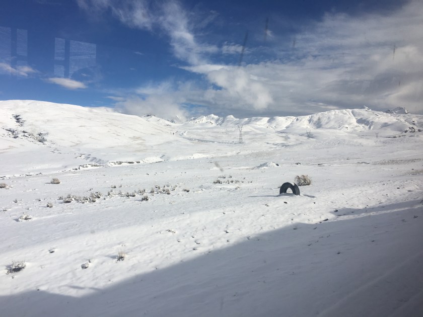
Heading out of the densely-packed, busy La Paz towards Cochabamba**, the road soon turned into wide open spaces, with a mix of adobe and brick houses, often many kilometers apart. The landscapes were reminiscent of the Peruvian Andes highlands (sierra), from plains to red rock mountains, and then winding through the hills above a valley, with short little bushes dotting the yellow brown hills.


Torotoro is at an altitude of 2,800 meters (9,000 ft) with a rocky mountainous landscape, but also has a very unique look and feel. The colorful and pointy, oddly shaped hills and rock formations may remind an American of the Southwest, especially South Texas, New Mexico, and Arizona, and also parts of the Rocky Mountains. While the temperature is cool, the days were mostly sunny, and it is noticeably 1,000 meters lower than La Paz, giving one a relief from the cold and altitude of La Paz.

In the tiny town of Torotoro, most people wear the typical rural Bolivian dress- women in colorful skirts, and men in pants and a vest. Most people wear brimmed hats (sombreros), though there are different types between the men and women. But there are two unique things I see here that I haven’t seen in other parts of Bolivia (or Peru):

First, a good proportion of people have official work vests, signaling that many people are employed in the tourism industry, working either for the government or a tourism business.

The other, which I absolutely love, is that there are many guys (mostly older men) that wear the typical Andean “chullo” hat with ear flaps, but these chullos have a long pointy top, like an elf hat…and they wear the pointy part standing up! (Sorry, I don’t have photos of the local dress styles.)

Torotoro is such a tiny town, that even though the tourists stay in hotels around the middle of town, integrated with the houses of the locals, tourist activities feel very separate from local activities, and so it has a bit of a tourist town feel.

The locals have a kind of wary-ness towards me, surely from having had many a varying experience with tourists, and it takes a few minutes of conversation for them to relax and feel more comfortable conversing. I tried to chat with a street food vendor who was also serving some locals, and she was really hesitant to talk. Finally, remembering that I was in a Quechua-speaking region, I tried to speak with the little bit of Quechua I had learned in the northern Lake Titicaca island Amantani. “Soma pollo,” (delicious chicken), I told her. “Yosparasunki,” (thank you)! When she realized I was trying to speak Quechua she smiled (half laughing at me) and then taught me to say “Reposa” (bye).

Torotoro is also a national park, and due to the efforts to protect it, they have recently implemented a strict system for visiting the park, where you always have to go with a guide. (You pay 100 Bolivian Pesos for a park entry fee and then you pay separately for each guided tour.)

The system of contracting a guide is interesting because there is a set cost for each guide and you can have up to 6 people in a group with a guide. That means that most people come just before the office opens in the morning and afternoon to look for other people that want to do the same tour so they can form a group of six to split the cost. Sometimes it works out beautifully and sometimes no one shows up to do the tour you want to do. (But for the two most popular tours, even in low season, there were always people in the early morning looking to form a group. The afternoons had fewer people, though I did get lucky my first day and found a couple late in the afternoon to go see dinosaur tracks and the canyon.)

That’s right…dinosaur tracks! Who knew that in the middle of Bolivia, there are dinosaur tracks!???!?

Many businesses use the dinosaur tracks for their marketing strategy

The area used to be swampy area and over the millennia it dried up and turned to rock, preserving tracks of those massive herbivores and vicious carnivores that roamed the area thousands of years ago.

All in one tour (“El Vergal”), you pass dinosaur tracks  and walk along an historic river with amazing geologic formations, leading to the majestic Chiflón canyon.

Just when we were about to leave the rim to begin our descent into the canyon, we caught sight of a graceful condor soaring above the canyon…and then another…and then another. They had emerged just in time to paint the already amazing landscape with their graceful flight paths.

We then climbed down into the canyon, passing a lemon-mint smell of the bodje tree, and later transversing the boulder-filled base for about a kilometer until we arrived at some beautiful waterfall cascades with green-blue pools below.

What a refreshing swim in that beautiful canyon pool!

The next day I successfully formed a group of 6 with my two French neighbors and a group of 3 other French tourists wanting to do a full day tour of the “Ciudad de Itas” and the Umajalanta Caverns.

We first took a 4×4 out to the grand rock formations of the City of Itas, and on the 40-minute drive climbing into the mountains, there were four different languages buzzing about in the vehicle – the guides speaking Quechua in the front, the three tourists in the back speaking French, my French neighbors and I speaking in Spanish in the middle, and the tourists in the back speaking to me in English.

The “Ciudad de Itas” was a hike through incredible rock formations and mountains.

Among many cool highlights were an almost completely dark cave-like space with just a tiny slot of light filtering through from above called “cueva del diablo”, and ancient drawings of llamas and the sun and earth goddess/god preserved in the rock in some cave-like spaces.

Do you see the llama?

We were also led through a maze of rock to a secret hiding place that was a kind of hidden canyon between rocks where the natives would hide stolen cattle during the 18th and 19th centuries, before the land reform times. This was when the Spanish had taken over large swaths of land, and a wealthy, well-connected Spanish “patron” would run an agricultural businesses on “haciendas” (large farms), often practically enslaving the locals while making profits exporting products across the country or abroad. (Again I was grateful for having read Isabel Allende’s “House of Spirits” to have a sense of the history around this time period.)

Another point of interest amidst the rocks was a large opening in a cave-live space in the rocks called the “cathedral” where the locals during Incan times held a gathering to celebrate the gods and goddesses of the earth (Pachamama) and the sun (Tatainti). They would have a type of pot-luck called “A’tapi”, and they would give an offering to Pachamama called  “Tcha’lla”.

We also saw photo-luminescent bacteria that glows this green color from one angle but up close it just looks like brown slime on the rocks.

After having climbed to the highest part of the Torotoro area, we then descended below the surface of the earth, to explore the Umajalanta Caverns. While not the most beautiful cave I’ve ever seen, it was definitely the most fun!

Hiking, climbing, repelling, crawling, and scootching through this cave was a fun adventure (and led by an experienced guide and plenty of ropes, it was not as hard or scary as it sounds.) Unfortunately, many of the beautiful formations had been damaged in the decades before it became a protected part of the national park, (due mostly to people not knowing that touching the formations would damage them but also due to some vandalism).

This image is on the 10-boliviano bill

However, there were also signs of hope where the stalagmites and stalactites had started growing again since the cave has been protected for two decades now (since 1989).

I was so happy to have found this little gem in the middle of Bolivia, to explore such a beautiful place, and to support the protection of some natural areas.***


Famous Footnotes

*While I arrived smoothly from La Paz to Cochabamba (other than a hot bus), I had bad luck catching a ride to Torotoro. The buses go “colectivo” style which means they wait until enough passengers come to fill them and then they leave. I waited 3 hours and then it was getting dark and no more passengers were coming so the company passed me off to another company that was supposedly leaving soon but still didn’t actually leave for another hour. I arrived at midnight in Torotoro and needed the next morning to recover from travels.

** Many people told me to “be careful” in Cochabamba. Luckily I had nothing but good experiences with the people there. When I asked at the terminal how to get to the vans for Torotoro, the woman didn’t know so asked a coworker who not only told me which car to take, he flagged down the car and ran the half block to where it stopped to explain to the driver where I was going and to ask him to let me know when we arrived!

***While I would definitely call this an “eco-tourism” experience, the jury is still out on whether it counts as “community-based tourism”. While on the surface it seems to bring some income to many locals, there were rumors that the government actually gets most of the proceeds and that there was a wealthy and foreign family somehow making most of the profits. I wasn’t there long enough to find out to what extent these were true, but even if the government was making profit, they were also employing quite a few people (remember all the vests?)

Side note: There were a few other short tours that I didn’t make it to (like a huge fossilized turtle), so while you can see the biggest attractions in 2 days, it is definitely a place one could stay 3-4 days, especially just to relax in a calm and quiet little village in a beautiful place with a great climate, (though there aren’t tourist attractions outside of the guided tours).

Coroico – Biking to the Yungus

Since I wasn’t able to hike to the Yungas (the lower altitude, subtropical side of the Bolivian Andes) from the mountains, I decided to bike there. In bicycle you can really see the scenery, feel the change in climate, and really experience each moment along the way with all your senses. Sometimes you can even see the change in wildlife along the way.

Since I didn’t know where and how to rent a bike, the easiest and quickest way was to go along with one of the touristy tours that rent you the bike, gear, guide, support van, and transportation to a starting point and back and that advertise the route as Death Road or “the world’s most dangerous road”. Actually called “North Yungus Road” or “Coroico Road”, the route is a windy, steep downhill dirt road that used to be the primary route to Coroico, before they built a new paved route that is supposed to be a little less windy and steep and therefore has fewer incidences of cars going too fast and finding themselves flying off the cliff. (An estimated 300 travelers were killed annually when this was the primary route to Coroico).

As a mountain bike route, it’s not too dangerous since it was designed for cars and so is actually fairly wide. That said, it would be dangerous for someone that isn’t used to biking and tried to ride like a crazy person. I found it to be a challenging but not too unlike many rides I did regularly in Oxapampa. Going with the tour had its pros and cons*, but overall it was awesome, and definitely a great way to get to the lower jungle town of Coroico where I wanted to go.

To get to Coroico from La Paz, you first have to pass over the mountains, so the van drove us a few hours to the starting point in the mountains at 4,700 meters (15,400 ft) above sea level. We would then ride down to 1,100 meters (3,600 ft) above sealevel. It had snowed the night before which complicated our arrival to the starting point but made for a beautiful, of very cold, starting point.

From white mountains, freezing fingers, and multiple layers, we quickly descended to green hills, greeted by the smell of the moisture and vegetation characteristic of the tropical jungle, (and making me nostalgic for Oxapampa). The views of the hills and valleys, and the river cutting through the valley below (way below), were indescribable. (Sorry, don’t have photos.)

Arriving in the valley, one perk of going with the tour is that we had access to a beautiful little resort with an all-you-can-eat buffet, rustic showers, and even a pool.

The two guides were also cool. One guy was a medical student and was explaining that to be a doctor in Bolivia, one has to study for 5 years, then do a one year internship in a hospital where they don’t pay you anything, and then ANOTHER one-year unpaid “rural internship” where you work in a rural site in “provincia”. (Ok, so this one’s not completely unpaid – the interns receive 15 pesos bolivianos ($2) per day.) Just when I thought the US doctor training program was not ideal…

As the van then continued back to La Paz, I caught a car for a 15-minute ride to the little city of Coroico. I arrived just as it started to rain, so I spent the evening resting and cooking myself a meal in the hostel.

Coroico is a small town with the streets buzzing with activity. There are many little stores (tiendas) and restaurants on every street, vendors selling vegetables and fruits in the street during the mornings, and kids running to and from school in the mornings and afternoons. At night, kiosks open up selling fried chicken and fries – which seems to be the Bolivian evening meal choice, second only to Silpancho – rice, potatoes, carrots, beets, tomato, chicken fried steak, with a fried egg on top. (To avoid an early heart attack and to be able to sleep at night, I cooked a stir fry of vegetables and quinoa for my evening meals, with the bonus of spending less than I would have eating out.)

The town was small enough that I quickly felt at home there. People weren’t immediately warm – everyone was busy living their lives and didn’t even notice a random tourist walking the streets, which I kind of liked. Often they didn’t even hear me greet them, (or were so surprised at a tourist greeting them that they didn’t know what to do.) But when I did get a chance to chat with someone (like the woman who sold me juice or the guy managing the hotel), they were super nice, chill, and helpful.

I read that there were three main sights to see in Coroico – the stations of the cross that lead up to a chapel on a hill with a nice view, and then from the chapel there are two 4-ish-hour roundtrip hikes – one to a hill that overlooks the city and the other to three waterfalls.

I packed my bag with swim gear, asked a couple of people how to get to the waterfalls, and then headed off, running, following a trail that wound around the side of a few massive hills. I was pretty disappointed when I arrived about an hour later and only saw a tiny fall with nowhere to swim, and it seemed that it was just a water capture point for the city. Maybe an appropriate thing to find, since I’m a water engineer, but disappointing.

So I ran back to the chapel, arrived at 4pm and decided to try to climb the overlook hill. The hill started as an open, desert-like hill covered with rocks, dry grasses, and only short bushes.

After about 30 minutes I was surprised to suddenly enter what was like jungle – thick trees blocking the sky and the smell of moist soil and vegetation. After a few minutes, I emerged again from the jungle and the trail opened up again to less dense vegetation and dried grass, only to turn into jungle again a few minutes later.

When the vegetation cleared, there were incredible views of the valley and the towns down below, including the little city of Coroico, which appeared much bigger from above than it seemed being in the city.

Towards the top, the hill turned into pure jungle, and I was sweating even though it was getting chilly as the sun started going down. Jogging uphill, I was thankful for the extra lung power I had gained being at altitude for almost two weeks. I didn’t want to get caught in the night in the jungle, so I decided I would turn around at 5:45 even if I didn’t make it to the top. I kept thinking I was near the top but would find that there was still more climb. I was pretty sure I wasn’t going to make it to the top, and then magically, at exactly 5:45 I arrived to the clearing at the top of the hill! Win!

The next day, I was just about to leave Coroico and I learned that the waterfall I went to was definitely not the waterfall that everyone goes to. I decided that I couldn’t leave without going to the waterfalls, so I started walking (this time the right direction), and then found a car to take me the rest of the way. When I got to the waterfall, I decided it had definitely been worth it! There was not much water in the cascade because I arrived just at the end of dry season, but there was a beautiful pool under the falls calling my name, (and two guys swimming there also calling me to join them).

The guys were from La Paz and had come out for the weekend just to enjoy this specific spot. With little hesitation, I was soon splashing around in the pool beneath the waterfall with them. Within a few minutes, another guy from La Paz showed up – he was showing around a friend from Quito, Ecuador who had come to visit Bolivia for a few weeks. We all became friends for the afternoon and I even ended up catching a bus back with the Ecuadorian woman and her Paceño friend.

Turns out that Coroico, and specifically the falls, are a nice little weekend escape for Paceños. With its warm climate and green hills, it’s a nice escape from the cold, altitude, and busy, tree-less city. I’m so glad I went off the beaten path to find this little gem (and to make a few more friends along the way)!


Ignore the jacket…it was actually warm in Coroico, but after swimming in the cold falls I needed to warm up

Famous Footnotes/Bonus Content

* The pros of going with the mountain bike tour were the sag wagon and the food included, but the cons were the cost (it was outside of my low budget but I gifted myself that day), and that it was so touristy that the group had to stop every few minutes so the guides could take photos of each person to later send us.

**I somehow lost my water bottle in the car that I took to the waterfalls, and I was pretty bummed, but then the driver showed up at the falls within 5 minutes, having noticed that I left it. Good, kind people in Coroico!

***Often when I mentioned that I went to Coroico, Bolivians asked me if I saw any black people. Actually, I didn’t. But Coroico is apparently part of the area where many African slaves were brought to work on haciendas and so many Afro-Bolivians live in the surrounding areas.

Bolivian Andes (Part II)- Glacier Lake and Spanish Gold Trail, Sorata

After a ridiculously cold and uncomfortable night (the first night camping is always the hardest), I was happy for day break so we could start hiking to go find the glacier lake.

If the first day was pure climbing, the second day was pure rock scramble – my favorite way to hike (and I’m not being sarcastic).

Add the fact that there was snow on the ground, and I was in heaven! Actually, it was more like hail or frozen rain because it was tiny little white ice balls, like I’d never seen before. But whatever it was, it was white and beautiful and made that wonderful crunching sound beneath our feet.

We climbed up and down (mostly up), over about 4 ridges on the side of a mountain, crossing a few landslides, literally climbing on the face of the mountain much of the time, and it was exhilarating. I fell once but I caught myself and didn’t die! Win!

We didn’t talk much because we needed all the air for breathing, as the air was getting thinner and thinner as we gained altitude. We both were chewing coca leaf to keep from getting altitude sickness.

As we crossed over the side of the great peak Illampu, the view suddenly opened up to reveal the beautiful glacier lake.

The grand Illampu rises over the left of the lake, while Ancouma rose over the right side (though Ancouma was hiding in clouds).

At the far end of the lake, the snowy side of a mountain seemed to be constantly feeding the lake with a glacier and avalanches.

The lake created an optical illusion such that it was actually much larger than it seemed; after 20 minutes of hiking I still hadn’t arrived to the far side where the snow and ice was falling into the lake, so I headed back since my guide was a little anxious to get back.

Every few minutes I would hear the distant sound of avalanches, but I could never find them when I looked up into the mountains.

The next day, we headed across the mountain pass to see some ruins, a couple of overlook points, and the Spanish Gold trail. We were walking in the clouds the whole way down, so unfortunately I didn’t get to see some of the amazing views. Despite the fog, I still loved it!

We normally would have hiked about 5-6 hours and camped one more night, with a campfire at a mirador, but with all the fog and my stomach acting up, I convinced Eduardo to to do an 8-hour hike that would bring us all the way back to Sorata in one day. Turns out we would have gotten rained on in the night if we had camped, and I didn’t have the most waterproof tent. Win #2!

The day was long and challenged my glutes again, but I enjoyed it just the same.

We hiked along the Spanish trail or the Gold trail, which is the trail that was used by the Spanish colonial rule to deliver gold from a mine in the mountains down to Sorata, carried by the locals who were used as slaves in the gold mining business. (My first night in Sorata I had stayed in a hostel that seemed like a really old house, and I later learned that it used to be the place where the slaves (indigenous people) delivered the gold to the Spanish.)

Walking along the Gold Trail, glutes screaming, sore shoulders, I thought about how this would be torture if someone was forcing me to do it, (especially for their own profit and not for me). But since I had chosen to do it, and I could go at my own pace and enjoy the scenery, and I was not doing it every day, it was something I actually paid to do. Privilege.

Eduardo continued to tell me the history of Sorata while walking this trail. He explained how the Spanish enslaved the locals not only for mining but they also set up the big haciendas, where the Spanish “patron” treated the locals like slaves to work the land and produce crops as efficiently as possible while the patron then got rich from selling the products, sometimes on the international markets that he had access to. The conversation invoked memories or reading Isabel Allende’s “House of Spirits”.

Eduardo went on to say that there came a time when the young rebelled and received a few more rights so they weren’t so much like slaves, but it wasn’t until later with the big land reform policies that the patrons left and locals could own their own land and reap the benefits from it.

Since then, he said, the community has organized itself so that each person owns their land where they live, and then the land in the hills above the community is common land so that anyone in the community can farm it. They meet once a month to resolve community issues and they rotate the leader of the community every year. Anyone with land in the community is registered on the “roster” and therefore has rights to farm the community land and also has the responsibility to serve their rotation as leader of the community for one year.

As I arrived back to Sorata, I could not believe that we had walked that entire distance. I had left behind the busy world of getting everywhere fast, and I had reunited with the age-old tradition of walking. I was just stunned at how two legs, two feet, could take me across massive hills and high up into the mountains, across distances and through terrain that seemed impossible, or difficult at best, to cross. It was a reminder how much I appreciate my feet and also the power of the human spirit and body.

Bonus Content: What do the kids do in the evenings in Sorata? As I made my way back to my hostel, all along the way, kids were playing with the same top-like toy in the streets, so I stopped at one group of kids and asked an older kid to show me what they were playing. He was super shy at first but I finally got him to show me on camera, and he let me try a few times too.

(Unfortunately I am having technical difficulties uploading videos here, but you can find the video on Facebook).