Heading south from Mendoza along “La Ruta 40”, one passes through Malargüe, which is a small, enchanting little town, where I met some really wonderful people.
Guillermo is an agricultural engineer that lives in Malargüe and runs a farm that grows potatoes and garlic. He is involved in the Workaway program and hosts travelers from all over the world that help out on the farm and stay for free at his place. He also happens to teach at one of the rural schools and is doing a project with his students where they make potable water by evaporating water in a green-house-like system, capturing and condensing the vapor.
Headed south towards Malargüe, we travel parallel to the cordillera (mountain range) that divides Argentina and Chile, with an amazing view of those majestic mountains out the passenger side window.
For some reason, the movie “Alive” about the rugby team whose airplane crashed into the snowy mountains came to mind. Moments later, Guillermo pointed to one of the peaks saying that it was the mountain where the Uruguay rugby team crashed! (I have no idea how my brain made that association; the subconscious is a powerful thing!) He went on to explain that if they had walked towards the Argentine side of the mountain, it would have actually been a shorter and easier hike to salvation, but they had no idea from where they were and they hiked through the toughest and longest part towards Chile.
That afternoon, I came across this great little spot along the highway, kind of in the middle of nowhere, called Manqui Malal. I went to investigate and found that it was a privately-owned conservation area. There was a restaurant, a campsite, and a few cabins, and they offered guided tours of the surrounding canyon-like area. And there were dogs, sheep, and chickens wandering around. Exactly the type of place where I wanted to stay! #eco-tourism!
Luckily, I had arrived just in time for the afternoon guided tour! I didn’t have time to store my things in the cabin, but they assured me it was safe to just leave them there in the restaurant. It may seem like a crazy thing to do – to trust strangers in the middle of place where you’ve never been before. But I got such a good vibe from the staff and the family eating there in the restaurant, and having had such good experiences in all the small, rural towns I’d been through, I actually felt completely comfortable trusting people here.
The guide was a young woman who did an awesome job explaining the different rock formations we saw – how they were formed and where they fit into the history of the Earth.
I was not the only participant on the tour – there was a woman and a man about my age and three kids between 5 and 10 years old. I could not believe it when I learned that the woman was an American from Minnesota! She had lived in Argentina for about 7 years, married an Argentine man and they were currently living in MN but visiting Argentina for about a month. I could not believe that I had run into another American in this tiny little spot on the side of the highway (not even a major tourist attraction) in the middle of Argentina!
As we explored the area and hiked to a waterfall, I chatted with the American woman. Her kids were growing up speaking Spanish and English and they were doing homeschool. (In retrospect, I realize that the social distancing measures must not be impacting their lessons!) She explained that she really loved the experience of home schooling so far, especially because they found that they had quite a lot of free time to do more active things after the lessons – which both she and the kids liked. She was really proud that her kids had scored really well on the state tests they take every year, and her 10-ish year-old daughter interjected, explaining that she had scored really well in math and science and less in English, and then continued to talk about her lessons. It was pretty cute to see her interest in her education and her ability to talk easily and confidently with adults.
After enjoying the refreshing waterfall, I hiked through the canyon where I met a couple my age from Buenos Aires sitting on a large boulder and drinking mate.
The sky had clouded up and the guide had warned me that if it started raining I should immediately start heading back because the canyon is prone to flash floods. So I headed quickly to the end of the canyon, and as it started to drizzle I hurried back, leaping from boulder to boulder, until I arrived at the base camp.
Having arrived here after spending a few days in the city (Mendoza), I was amazed by the absolute, complete silence (except for once every hour when a car passed on the highway). I had one of the best night’s sleep of my whole journey that night – which was much-needed to prepare me for my long journey ahead.
I woke up early that morning in “Baldecitos”*, not really sure where I would be sleeping that night.
The French couple I had met, Silvia and Michel, were going to pick me up at 8am to tour the famous Parque Ischigualasto together, so I was pretty excited about that! (I would get a chance to get to know them, and I had overcome the challenge of seeing the park without my own car!)
But after that, my future was uncertain. I was learning to get comfortable with taking things day by day. Sometimes even hour by hour.
(In my travels, I keep a spreadsheet of dates and locations, transportation times and costs, etc., but it is more like a rough guide than a fixed plan. And the last few days I had really be improvising, especially as I’d discovered cute small towns and these national parks! Squirrel!)
A few minutes before 8am, I headed outside and found a car parked out front where we’d agreed to meet. As I approached, I was greeted by the bright smiling faces of Silvia and Michel, and I was happy to join the excited energy of heading off for a new adventure.
When we arrived at the park we were instructed that we would be joining a caravan of about 5 other vehicles, with the guide at the helm, and we would be stopping at certain spots along the way where we would get out, walk a short way, and the guide would share information with us.
Silvia and Michel, my French friends, in front of a large “mushroom” formation, a common formation seen in Parque Ischigualasto.
At the first stop, we parked behind a white van with Texas plates. I rubbed my eyes and looked again, but it was true that I wasn’t dreaming.
After checking out the landscapes of the “valle de la luna”, I heard a couple my age speaking in English and heading towards the van. Too shy to talk to them, I never learned if they were really from Texas.
Just kidding. If you believed that, you haven’t been reading my blogs enough to know that I’m rarely too shy to talk to someone.
So, it was there in the middle of Argentina, where I met Danika and Brady, a couple that had been living in El Paso, Texas and had been planning to travel through South America. A little over a year ago, their plans started coming together and they decided to do the journey by land from Texas to the southern tip of South America. They bought a van and turned the back part of it into a mini-apartment – equipped with a bed, shelves, cabinets, a stove, and even with walls decorated with photos – and then began their journey south. And now, we had been lucky enough to cross paths here in Parque Ischigualasto!
Parque Ischigualasto was quite a gem, with fossils from as far back as the Triassic Period – 250 MILLION years ago – when Pangea existed! (Remember Pangea? Back when the majority of the continents were united as one continent.)
So the parks (Ischigualasto and Talamapaya) are UNESCO World Heritage sites because they help tell the story of the evolution of land and life on Earth across time.
With so much time on its hands, the Earth had done some pretty creative things. Like creating these perfectly-shaped spherical rocks.
Precariously balanced towers of rock.
That sometimes do topple over.
I saw where the ancient Egyptians got their idea for the Sphynx. (The natural world had already created it!)
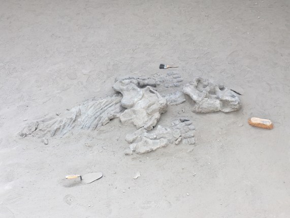
One stop included a museum where they told us about the dinosaurs and fossils that have been found in the area (many dinosaurs have been found in Argentina!) They explained how they carefully excavate fossils and determine their age (carbon dating), how they determine where they should dig to look for interesting things, and how they try to understand the geological processes that cause changes across the millennia.
The final stop was a showcase of the rock formations in their different stages of evolution, so you could essentially see the process that leads to the creation of the mushroom formations, as it happens over thousands of years.
We promised to come back to see these formations when they are mushrooms in a few thousand years.
Loving my time with Michel and Silvia and having also made two new friends, Danika and Brady, I realized that as a group of 5, we could do the tour of “cañon arco iris” and “ciudad perdida” (Rainbow Canyon and Lost City). (This is the tour that leaves from the southern entrance of Parque Talampaya and leaves only if a group forms.) They were all interested in the idea, so instead of trying to head to San Juan, I continued on with them, back towards Parque Talamapaya.
On the way, Silvia, Michel, and I shared travel stories and talked about everything under the sun. I learned that Michel had actually been to Talampaya before, more than a decade ago, before it was a national park. At that time, he had been able to drive his vehicle through the park to see the sights. Now only the tour companies are permitted to drive in the park, to minimize the human impact.
Michel had a project collecting photos of all the different animal crossing signs they saw along the way, so I took advantage and joined in the game – which also included trying to spot all the animals from the signs.
From top left, clockwise: Ostrich, Guanaco, Liebre, Fox
We arrived at the ArcoIris entrance to Talampaya just in time to be able to do an afternoon tour, and we even picked up an extra for the group – Alicia, a woman from Mar de Plata (a city in Argentina) that was on vacation traveling by motorcycle. (We also greeted a French cyclist passing through, brave or crazy enough to be cycling through the desert.)
The hike through Cañon Arco Iris and Ciudad Perdida was time travel through millions of years. We started with the red “youngest” rock formations and as we walked along we passed through tens of millions of years, finally arriving at the grey oldest rock formations, named “Ciudad Perdida” because of their shapes.
Leaping across tens of million of years, into Ciudad Perdida
Along the way, we could see how the seismic activity that created the Andes had lifted parts of earth’s crust out of the ground, exposing different layers of rock.
And we could see how the sun, wind, and rain changes the rock over millions of years, turning it into sand and reshaping it.
We also saw where the Incas might have gotten their idea for using rectangular stones for building walls that could withstand seismic activity…right there from nature herself.
You know when you meet someone that is so passionate about something that even if you never were interested in the topic before, they transmit their energy and enthusiasm to you and ignite an interest in you? (I’ve had some really good teachers with this talent, for example.) Well, our guide was like that. He was an easy-going and soft-spoken person, and when he talked about the the rocks and plants in the park and the history and science around it all, you could tell that he was really passionate about sharing this beautiful place with others (in his easy-going, soft-spoken kind-of-way).
Our guide Camilo lives in Pagancillo and the company that offers this tour is actually a co-op of independent guides, separate from the larger company at the main entrance of the park.
We finished the tour in the evening, and luckily, Silvia and Michel also loved staying in small towns, so I was happy to have already scouted out Pagancillo, the small town near the park. And I was really happy to be returning there to be able to see the friends I had made there, Dario and Marisel, once again.
That night, sharing wine and grapes (from their grape vine) with the family, the stars were shining brightly and it was a perfect opportunity to bust out the stargazing app and look at the stars. They were fascinated, as they hadn’t had the constellations pointed out to them before. So even though I was exhausted from a long day (that started in Baldecitos and had the surprise ending of being back here in Pagancillo), we walked down to the river where there were no lights to see the night sky in all its glory.**
Famous Footnotes:
*Baldecitos is the small town of about 10 houses, that is about 15km from the entrance to Parque Ischigualasto.
**While I was impressed by the centaur, whose hind leg is made up of the southern cross (only visible in the southern hemisphere), they were more impressed by the dog Sirius and Virgo.
After a long (9-hour) drive, I arrived in Jujuy, Argentina, without local currency nor a local phone chip (so unable to contact the person I would be staying with). While I wasn’t too worried – (I’m getting used to navigating without those basic things we take for granted like money and cell phone service – for a short amount of time) – those moments are still somewhat humbling and uncertain.
Yet I felt like I was greeted in Jujuy by a welcoming committee!
First was David from the grocery store. I asked him about phone cards, money exchange, wifi, how to get around the city, and not only was he super friendly and helpful, he made me feel really welcome and we ended up chatting for 15-20 minutes about life in general.
My first experience in Argentina was a warm welcome from David from the grocery store
Then there was Pablo from the internet store. He lent me wifi for free, told me about his favorite things to do in the city and we exchanged travel stories and ended up chatting for nearly an hour!
A serendipitous trip to the internet store led me to another welcoming and fun soul who made me feel right at home (and gave me free wifi). (Don’t judge my appearance – I had been traveling through the desert for 9 hours!)
Then I arrived at the house where I was couchsurfing, and my host invited me to the dinner he had cooked, introduced me to his cat, the washing machine (it’s a real treat to have access to a washing machine when traveling!), and made me feel right at home. Over the course of my stay there, we ended up becoming friends – he even invited me to a birthday party where I made friends with his friends, and even vacationed later with some of his friends! (Unfortunately, we forgot to take a photo together.)
I crossed this beautiful city park to arrive at the house where I would stay.
Given the friendliness of everyone I met, I was surprised to hear that a famous tv personality from Buenos Aires visited Jujuy and noted that the locals complained a lot. A friend I met from Jujuy agreed that it was a fair stereotype. (As a traveler passing through, I didn’t experience any complaining while I was there, and actually had nothing but wonderful experiences with all the locals I met!) To be fair, “Porteños” from Buenos Aires also have a reputation among other Argentines to be snobby and less friendly, and so the stereotyping across regions continues, just like we do for east-coasters and west-coasters, New Yorkers, and southerners in the US.
To be clear, I am in San Salvador de Jujuy – the capital of the province of Jujuy. For those who live in other parts of the province, the city is usually called “San Salvador” to distinguish it from the rest of the province, whereas by outsiders, it is often referred to as Jujuy.
San Salvador de Jujuy is a pretty big small city, with wide roads and a fair share of traffic. It is clean and seems well organized, with nice parks, good infrastructure, good public transportation, and I was surprised how many people had personal vehicles.
My first impression was that Argentina is a bit more well-off than Bolivia and Peru, especially because a local informed me that the province of Jujuy is one of the poorer provinces of Argentina. To me it seemed a bit more put-together than similar cities in other parts of South America, though it also has a clear wealth gap, with neighborhoods of what seem like makeshift houses, where people are just making ends meet, according to one local.
Argentina has a history of an economy that fluctuates drastically, and they are in a period of inflation, with the currency devaluing monthly. At the bank, I learn that it’s very difficult if a foreigner wants to sell Argentine pesos, and they only permit it one day per month.
One friend I met is earning half of what he earned three years ago, but the cost of living hasn’t changed. For him, he can still get by, but he points out that there are a lot of people who struggle to get by because of it. Throughout his life the economy has been in drastic fluctuation – growing at insane rates, like 8%, with everyone doing really well economically, then inflation getting out of hand and things falling like they are now. While it’s not ideal, he kind of casually said. “We just have to wait a few years for the economy to improve again. And the cycle continues.”*
I was planning to run some errands in the early afternoon, and luckily my friend stopped me. Siesta is a thing here,** and most places close at 1pm and don’t open again until 5 or 6 pm. Restaurants typically don’t open again until 7:30 or 8. When things do open again, downtown “el centro” is a bustling place, people hurrying from one shop to another, people passing out flyers, reading your blood pressure for a small donation to the Red Cross, and even a huge protest with a marching band (protesting a raise in some type of tax) passed by when I was walking around downtown.
Most of the locals and transplants (the majority of people I met were actually transplants) agreed that the best thing about Jujuy was the outdoors. The city is surrounded by forested hills, has some great parks, and it’s fairly easy to go out and immerse yourself in beautiful nature for a day trip, for the weekend, or anytime.
There are a ton of great hikes and also many sites to see in the towns outside of the city, the most famous being Purmamarca, Tilcara, and Quebrada de Humahuaca. In addition to being home to great hikes and outdoors activities, these towns are also the heart of Carnaval.
I just so happened to arrive in Jujuy during its annual Carnaval, which is similar to Louisiana’s Mardi Gras or Rio’s Carnaval, but with its own unique flavor. It was both a blessing and a curse to be there at this time; on one hand, I had the opportunity to get a taste of Carnaval, but on the other hand I wasn’t able to take advantage of the beautiful hikes and outdoors activities because of traffic and logistics.
I was told that the best places to experience Carnaval are “in the north”, in Tilcara or Quebrada de Humahuaca, (though Pumamarca, and many other small towns throughout the province of Jujuy and nearby provinces have insane celebrations too)…BUT, then I heard horror stories of the traffic and that there wouldn’t be a place to stay.*** In the end, I opted to participate in a celebration in the city put on by the local government, which I would call “Carnaval Light”, though it did have a live performance by the regionally famous Carnaval band “Los Tekis”.
While each town does it a little differently, the main aspects of Carnaval are the “desentierro” and “entierro” of “el diablo”. That’s the unearthing of the devil to kick off the festival, and the burying of the devil to end the festival a few days later. The idea is that after unearthing the devil, people are free to do whatever they want that would normally be considered immoral (what happens in carnaval stays in carnaval), and then once the devil is buried again at the end of carnaval, life goes back to normal.
Each town has their own unique way to exhume the devil, but it usually involves a bunch of people dressed in devil costumes appearing from some special spot. This “desentierro” is the main event and that is why traffic is so bad as crowds of people try to arrive to witness the desentierro.
Before, after, and during the desentierro, people drink (especially box wine, often mixed with any number of other drinks – soda or alcoholic), people paint themselves and throw paint on everyone else, people throw powder and flour on each other, and spray cans of foam at anyone passing by.
Luckily, my friend had warned me not to wear any nice clothes. If you enter clean, you don’t stay clean for long. Random strangers do you the favor of painting you or spraying you with foam, like a little sibling trying to annoy an older sibling. (It would normally be a situation that would lead to a fist fight, but it’s expected at Carnaval and people who don’t like to be randomly attacked by foam in the face or paint thrown at them don’t go.)
All the while, the music is playing and people dance and drink and party all day and all night long, some for multiple days. I enjoyed Carnaval “light” for a few hours Saturday night, and when I arrived in a small town in the south (Amaicha) two days later their celebrations were still in full swing.)
Soon after arriving (still clean), with the Basil of CarnavalAbout an hour after arriving (still very mild paint and foam coverage – and no flour still)
The atmosphere in Jujuy in general and also during Carnaval was super friendly. I met multiple people who offered to help me in one way or another – a group of women my age invited me into their group to dance and hang out at the event, a group of older women offered me basil to put behind my ear, which is supposedly a thing you do during carnaval (right ear if you’re married, left ear if you’re single), and a family of three offered me a place to stay in their home if I ever visited Santiago de Estero in the next province over.
Carnaval friendsThey hooked me up with basil so I could be legitI gifted my hat to the woman and she invited me to stay at her house if I ever visited her city.
My first impressions of northern Argentina have been highlighted by the friendliness and generosity of the people; I don’t think I’ve ever been in an environment where I felt such generosity everywhere I went!
Famous Footnotes
*Just one perspective on the economy from one person of upper middle class.
**Siesta is not unique to Jujuy, as it seems to be the norm for all the places I’ve been in northern Argentina so far. It is so hot at mid-day in some places, that it makes a lot of sense to be at home resting.
***For future reference: If you want a place to stay in one of the towns in “the north” during Carnaval, you either need to know someone that lives there or reserve a year to 6 months in advance.
Another option is to arrive early the morning of the desentierro and then not sleep the night – just party all through the night and catch a car early in the morning back to Jujuy (I shared a car south to Salta the next day with some people who had done this.)
You would need to leave the city before noon, otherwise you might not make it before the “desentierro.” The normally 2-hour drive often takes up to 6-8 hours the days of Carnaval desentierro.
The Atacama desert in northern Chile is known for the best stargazing in the world – and that’s why I HAD to come here. Ironically, I came during the two weeks of the year when it was cloudy and I didn’t get to do proper stargazing (other than a few minutes before the sunrise one morning.)
But, the sunsets!!! Even if I didn’t get to see the other suns of the universe, I got to see OUR sun in all its glory!
The dry desert air makes the incredible landscapes look exceptionally majestic and brilliant, and with a setting sun sending gold in all directions and casting deep blue shadows while tinting the clouds in pink, one will stop whatever she or he’s doing and run to catch the sunset every evening.
All the sunsets were awesome, but the most incredible was definitely in Laguna Tebinquinche*, where the sun set over the white, salt-covered lake and a rainbow emerged in the dark blue rainclouds opposite the sun.
Like many lakes here, the water appears to be covered in a layer of ice but is actually encrusted with a layer of white salt. The lakeshore is filled with “living rocks,” which are salty rocks made up of minerals and microorganisms that can survive some of the harshest environments on the planet. These microorganisms are some of the first living things that came into existence on Earth!
Contemplating the first life on earth, a flamingo flies across the sunset. And with friends made along the journey, we marvel at the beauty of life, the richness of the moment. We all just met each other, and yet we’re all family, born from Mother Earth, who is amazing us with her beauty.
But I digress. Being immersed in this vast desert, looking out across immense spaces and also out into the vast sky, makes one reflect on the grandness of the Earth, the universe, and the beauty of life.
While access to sensitive spots is limited to protect them, there was one salt lake that people can swim in. If you have never swam in a salt lake before, it’s definitely worth adding to the bucket list. Because salt water is more dense than fresh water, the saltier the water the more we float. I noticed the difference swimming in the Pacific Ocean in Lima, but it still didn’t compare to the unique sensation of floating in the salt lake in Atacama!
Look Ma! No hands!
When a large moist area of salty land has dried up, a salt flat (“salar”) is left behind. I saw many salt flats, with the the Salar de Atacama being the 3rd largest salt flat in the world (after those in Uyuni and Argentina). It is so large it can be seen from space.
I was lucky enough to see a few other marvels of the desert during my stay in Atacama, the most grandiose being the National Reserve of the Flamingos (Reserva Nacional de los Flamencos). At 4,200 meters (13,800 ft) above sea level, we saw two beautiful mountain lakes that used to be one great lake until seismic activity of the Nazca and South American tectonic plates created some hills that divided the lake in two.
Another breath-taking desert lake is the laguna aguas calientes. Here, the diversity of the landscapes was overwhelming. There were huge dune-like mountains of black lava rock, a lake of hot water fed by an aquifer that sits on top of a volcanic magma layer, and red hills rich in iron minerals. All accented by the pink flamingos looking for food in the lake below.
Finally, the bike ride through the Valle de la Luna was a challenging adventure through the desert heat, where we met friends along the way, saw incredible rock formations, and watched rain develop across the flat desert plains – the same rain that cooled us off a few hours later.
One final fun fact. The Atacama desert is located on the tropic of capricorn. I’m pretty sure I learned about the tropic of Capricorn at some point in my life, but I didn’t really remember what it was. The tropic lines are the points where the sun shines directly overhead, due to the tilt in the Earth. The regions of land between the two tropic lines are considered “tropical” areas since they receive the most direct sun, typically creating warmer year-round climates than the rest of the globe.
Our guide explains the tropic lines with a drawing in the desert sand. The sign marks where the tropic of capricorn passes, which also happens to be a part of the Inca Trail.
Famous Footnotes
Unless you rent (or have) a car to go see the sites (which would be a great way to explore Atacama), the way to see things is through the tours offered by the various tour companies in San Pedro de Atacama. The tours I took were:
-Tour 1: Laguna Cejar, Laguna Piedra (the salt lake where you can swim and float), Ojos del Salar, and Laguna Tebinquinche (the salt lake with the amazing sunset).*If you take the tour of Laguna Cejar in the afternoon, it usually ends at Laguna Tebinquinche so you can see the incredible sunset here.
-Tour 2: Reserva Nacional de los Flamencos (Laguna Miscanti and Laguna Miñiques), Laguna Talar, and Salar and Laguna Aguas Calientes with overlook to Piedras Rojas
-Observatory ALMA tour (free but you have to get to the meeting point early to get on the list, as I described in my blog post.)
-I rented a bike and rode through “Valle de la Luna” all day (about 6 hours), and another afternoon I rode through “Valle de Marte” and watched the sunset from an overlook point nearby.
**I didn’t get to do a stargazing tour because of weather, but would definitely recommend one!
**I didn’t get to do the geyser tour because rain had washed out the road, but would also recommend that!
The Atacama desert is the driest and highest in the world, and that’s one of the main reasons that we built “ALMA,”* the largest radio telescope in the world here! I say “we” because it was an international collaboration – an example of us humans working together to better understand the universe in which we live.
“The purpose of ALMA is to study star formation, molecular clouds and the early Universe, closing in on its main objective: discovering our cosmic origins.”
To most of us, a telescope is an apparatus of lenses pointed at the sky to see stars, (or far away visible light in the sky). But the ALMA telescope is not one, but 66 antenas pointed at the sky! Just like we have 2 eyes that give us a single image of the world, the telescope has 66 eyes to give us a single image – it’s like a mom that has eyes in the back of its head. Or like a fisheye camera.
The other unique thing about the ALMA telescope is that it isn’t viewing light in space like an optical telescope, it’s looking at the dark and cold part of space, capturing radio waves* emitted by stars and planets.
One of the antenas undergoing maintenance
That doesn’t mean that stars and planets are broadcasting songs. Radio waves are emitted by the cold and cool matter in the universe that doesn’t give off light and so can’t be seen with our eyes (or with optical telescopes). But the ALMA telescope can receive these signals and tell us about that matter out there in space.
For example, the ALMA telescope was able to detect sugar molecules around a young sun, indicating a good possibility for a life-supporting planet to develop in that solar system.**
In some cases, scientists can combine the information from an optical telescope and ALMA (and x-ray and infrared telescopes)* to give a fuller picture of a solar system or galaxy, and to “see” what’s happening in the dark spots of the sky.
Also, since it’s not optic, ALMA can point at the sun and study the sun’s atmosphere without burning.
For me, one of the most interesting abilities it has is to study the early universe – it has found evidence of the earliest known solar system – suns that formed just 250 million years after the Big Bang. (Sounds like a long time, but it’s only 2% of the universe’s current age, which is about 13.8 billion years.)
I know, this is a lot of high tech modern science stuff. But according to our guide, the basic principle behind the antena design is actually something that was used hundreds of years ago by the pre-Incan culture, the Tihuanacu.
Just outside of La Paz, you can visit an archeological site of the Tijuanacu. Then you can head a thousand miles south to the ALMA observatory in northern Chile to see the modern day use of this technology studying the origins of the universe!
While the tour to the observatory is free, it takes a bit of luck to get there. To be on the official list you have to reserve online, usually 6 months to a year in advance. If you don’t make the official list, you might be able to get on the online waitlist. But since the list fills up so far in advance, a lot of people on the list end up not making it on the dates they reserved. So you still have a chance to get on the “hope list” the day of the tour. The bus leaves at 9am, but people show up sometimes 2 hours early to wait in line to be on the “hope list”. If there are any empty spaces from people who didn’t show up from online reservations, next priority goes to the wait list and then to the hope list, in order of arrival. It makes it that much more exciting to get chosen from the hope list! It’s like winning the lottery!
Famous Footnotes
*The ALMA – Atacama Large Millimeter/submillimeter Array – captures electromagnetic radiation with wavelengths in the range of milimeter wavelenths in the electromagnetic spectrum.
(There are also other non optical telescopes that exist- infrared and X-ray telescopes that capture information from other non visible light parts of the electromagnetic spectrum.)
The diversity of landscapes in Colombia is amazing, and one of those unique gems is the Tatacoa Desert, not too far from Bogotá, in Huila.
All within 32,000 hectares, the desert-like landscapes are filled with more than 100 varieties of cactus, petrified wood, and other-worldly rock formations.
While the majority of the area is dominated by grey-ish colored rock formations, the Tatacoa makes a sudden drastic change to red rock formations, and so is referred to by its two parts – the red desert and the grey desert.
The intense sun and extreme heat is something that the locals try to avoid by relaxing in the shade at mid day, and with long sleeves and brimmed hats the rest of the day.
Fun fact: Despite it’s heat, sand, and cactus, the Tatacoa Desert isn’t actually categorized as a desert; it’s technically a “dry forest” climate zone. (Though it’s what a lay person would call a “desert”.)
It was here in the Tatacoa desert that I discovered my favorite berry in the world – the Chichatop. I have never tasted a more delicious fruit (and I LOVE strawberries and blueberries… but this one topped them all!) Sorry, I didn’t get a photo of my favorite berry, but I did get a photo of this edible fruit that grows in a cactus.
The desert is just a few minutes drive from the nice little town of Villavieja.* You can stay in the town and do a day trip to the desert, or you can spend the night at one of the hospedajes in the desert.
Many of them have pools (and even if you don’t stay in the desert, you an always pay to enter one of the pools for a much-needed cool-off).
On clear days you can see the faraway snow-capped mountains near Manizales, but these days you can’t see the white peaks. Due to global warming, the size of the snow caps has been diminishing over the years and they are too small to see now.
While a guide isn’t necessary to appreciate the desert, it is quite helpful to not get lost in the heat and to maximize your time seeing some of the highlights. I would recommend it especially in support of eco-tourism…it supports the local economy in a positive way, giving value to the preservation of the land and creating green jobs for the locals. Our guide specifically mentioned that he really loved the training he received to be a guide, learning about the landscapes and the history, and he hoped that he could continue to learn more to continue getting better at his job.
The Tatacoa is home to two observatories and they give viewing sessions every night where you can learn a few night sky fun facts and see a few highlights through a telescope and binoculars. I was super impressed to learn that the half moon is a C or a D shape in the US, but it’s more like a smile or frown shape here. (In other words, the we see the lit-up side from different angles so it seems to be rotated between the two hemispheres). Similarly, Casiopia is a “W” in the US but an “M” here (something I had noticed but just thought it was related to the time of the year I was looking at it!)
We looked at stars being born (in the Orion Nebula). And looking at the cloud of the andromeda galaxy, we saw more stars at one time than one sees in the entire sky. With a basic high powered telescope, binoculars, and a really knowledgeable star guide, it was interesting and entertaining, and I loved it! It was a perfect way to appreciate the desert night.
Famous Footnotes/Bonus Content:
*On the way back to Neiva, the largest city near Villavieja, I took a colectivo, which is like a taxi van that waits until all the seats are filled to leave. (I got lucky and was the last one so didn’t have to wait.) In the colectivo there was a couple from Bogotá, another backpacker from Europe, and two women from Villavieja. The women were quiet at first, but as we started chatting, they each had a fun sense of humor, and were very chill and friendly. They confirmed that the town is a pretty quiet and relaxed town, that lives off tourism and some farming and raising animals. That weekend was going to be less quiet than usual – the town was going to have a big celebration all weekend with a concert sponsored by the mayor.
If there was one thing I wanted to see in Colombia, (besides my good friends Adam and Adrienne), it was la Ciudad Perdida (“the lost city”). To describe the impact and significance of this archaeological site, many call it the Machu Picchu of Colombia. But unlike Machu Picchu, the only way to arrive to la Ciudad Perdida is a multi-day (4-7 days) hike through the hot, humid jungle of the Sierra Nevada, Colombia.
Translated as “The Lost City”, it was found overgrown by the jungle and being looted for precious stones (like most archeological sites in the world). In the 1970s, the Colombian government and archeologists were able to protect it and begin “recovering” it, (cutting the jungle back). This revealed the historic city – neighborhoods (terraces where houses once stood and walking paths that connected the at least 500 houses of the city) and ceremonial areas overlooking the surrounding mountainside.
In the 1980’s it was opened for visitors, and now you can access this unique site by trekking through the jungle with one of the 7 authorized tour companies. (And you can ONLY access it by trekking with one of these authorized companies). During the trek, you pass through two national park reserves (parques nacionales naturales), which are protected areas.
Since all the companies by law have to charge the same price, I chose to go with Wiwa Tours, which hires guides from the four native communities whose ancestors founded Ciudad Perdida and who still live there and in the surrounding lands, still practicing many of their traditional customs.
Our guide, Juan Daza, in Ciudad Perdida, explains a traditional process of making pots
Our guide explained that the site of Ciudad Perdida was home to the Tayrona (also “Tairuna” or “Teyuna”) culture, the ancestral culture of the four present-day, distinct but connected communities of the Sierra Nevada – the Arhuaco, Kogui, Wiwa, and Kankuamo. Each has their own language, customs and leaders, but they share this sacred site.
Ciudad Perdida was as interesting and mystical as Machu Picchu was for me, though in different ways. One of the most fascinating aspects was its connection to the present – the “mamo” and “saga”, or male and female community leaders from one of the four communities still lives on the grounds of Ciudad Perdida.
Mamo’s or Saga’s house in Ciudad Perdida
The communities still live in and around the surrounding lands and are involved in management of the tourism that comes through, receiving some of the financial benefits from it.* Each September, the four communities still gather at the sacred site of Ciudad Perdida to perform ceremonies (and clean the site of any bad juju that tourists might have brought to the sacred site in their visit). (Yes, I said “juju”. Don’t hate.)
The vistas are also breath-taking. The site is on a high point in the hills, surrounded by 180 degrees of beautiful green mountains and valleys, and even a waterfall cascading down a mountain in the distance.
To arrive at this amazing site, we hiked for about a day and a half up and down through the hills of the jungle, crossing streams and the river. The jungle humidity kept me drenched in sweat the entire day, every day of hiking, and we got rained on twice – which was actually quiet refreshing! (Having done my research I knew to prepare my bag as light as possible and to water-proof it to be able to hike in the rain and cross rivers, and still have dry clothes to wear in the night and the next days.)**
I was surprised to find that these tours and their accommodations are actually a pretty well-functioning machine – they get hundreds of tourists to and from Ciudad Perdida every day of the year! First, the accommodations were surprising. There were well-equipped camp sites along the way, prepared to accommodate multiple groups at a time, some seeming to accommodate up to a hundred through-hikers each day. They had bunk beds with mosquito nets, showers, and flush toilets in every camp where we stayed. There was also a huge kitchen area where the different guide companies prepared meals for their groups – and the meals were delicious and nutritious! Since they provided all the lodging and meals, we only had to carry clothes and a few basic personal items.**
I was impressed by how they’ve scaled up a multi-day trek through the jungle, making it accessible for a wide range of ages and fitness types (there was an 80-year-old man in one of the groups) and also making it accessible for a lot of people at once. On the other hand, I might have been slightly disappointed that the crowds and accommodations did make it less exotic, mystical, and hard-core. But I was also happy to have a shower and delicious meal each night and to meet people from all over the world.
Our group had 19 people from Europe, Colombia, Chile and me, two tour guides (one Wiwa, one Kogui), and an English translator (Venezuelan).
This was actually one of the first guided hikes that I’ve done in South America where there was a good percentage of locals on the tour – nearly half of the group were Colombians, with a group of 3 Chilean women (a few years older than me), and the rest Europeans.
Almost as if to prove our worthiness, the morning of the third day we had to cross a rushing river and then climb a few hundred meters to arrive at the Ciudad Perdida.
There, we learned about some of the current and ancient customs of the Tayrona culture and the current-day communities. Interestingly, there is still disagreement between some archeologists and the current-day communities about the meaning of some of the ruins and artifacts.
One of my favorites of the artifacts were the maps etched in stone – always with the 2 snow-capped peaks of the Sierra Nevada as a reference. (These two peaks of the Sierra Nevada are very important in the culture and show up in many artifacts, artwork, and architecture of the Tayrona culture.)
“You are here”
While a little more “touristy” and expensive than I typically go for, I wouldn’t have missed this grand adventure. An incredible mix of history, culture, adventure, nature, and incredible landscapes, it embodied what I am seeking in my travels – an opportunity to invest in cultural and natural conservation, while learning and experiencing a great adventure!
Bonus Content
A peek into some traditions of the modern-day indigenous communities of the Sierra Nevada:
Throughout the 4-day hike, our guides constantly chewed coca leaves and carried a gourd-like thing, always “painting” it with a stick.
Note the bulge in the cheek where he chews his coca leaf, and the gourd and stick he is always wielding.
Finally, after arriving to the Ciudad Perdida, our guides (one Wiwa and one Kogui) explained that gourd for them was a kind of journal or a work of art. They chew the coca leaf and then spit it into the gourd “popora” where they mix it with crushed seashells. They then paint the outside of the popora with this mixture of calcium, coca leaf, and saliva, building up layers of a coating on the outside of the gourd. This coating carries all their thoughts, hopes and ponderings, and so functions as a kind of journal for them.
A tradition that probably dates back centuries before the Spanish arrived (according to archeological evidence of poporas), when men become of age, they go through a ceremony to become official members of the community, and this includes receiving their first “poporo”. When it reaches a certain size, they take it to the mamo (leader) for consultation and then receive another to start on.
The women have a similar tradition in which they weave circular bags using the fibers of the fique plant. (The fique plant is the same plant used to make the coffee sacks I mentioned in a previous blog about a coffee farm in Salento.) The bag contains all of their thoughts and stories and ponderings while making the bag, so that when the gift the bag to someone, they are also gifting them all of their thoughts during the creation of the bag. The circular design is to keep the positive energy in the bag because the energy “runs into the corners and escapes”. This circular style of bag is typically referred to as a “mochila”, or backpack, and is actually fashionable all through Colombia, used by men and women alike throughout the country.
The coca leaf is, and has been, an important part of the indigenous cultures of South America for centuries. One of the most interesting uses I saw was in the greeting. When one person (male) of the Tayrona culture greets another person, each offers the other a handful of coca leaves.
Exchanging coca leaves
Footnotes
*A person that grows up in an indigenous community in the “modern age” inevitably experiences an identity conflict. The person has to reconcile adapting to the modern world without losing key aspects of their cultural identity. That means defining what parts of each world define them – which customs from each culture (traditional and modern) they will adhere to and maintain in their daily life. With the “modern” culture dominating in cultural and economic power, many traditional customs are abandoned in order to be able to survive or to gain more opportunities in the modern world. In my opinion, the “cultural tourism” aspect of visiting Ciudad Perdida was a way to invest in promoting cultural conservation of these traditions. By sharing their traditions with us, the guides were able to keep their cultural memories alive, and they could be inspired to do so both by the interest we have in learning as well as the financial incentive – the fact that they can earn a living through keeping their culture alive.
**Packing for Ciudad Perdida, I recommend: quick-dry towel, flip flops for the evenings, newspapers to stuff in shoes so they will dry at night, carabiners to hang things from your backpack to dry during the day, water-proof backpack cover, multiple plastic bags to store everything you want to keep dry and to line the inside of your backpack, a ziplock to keep your phone dry, just enough shampoo and soap, 1L water bottle, money to buy gatorade or snacks along the way.
I kept hearing and reading that Salento and the Cocora Valley are “the place(s) to go” in the Eje Cafetero, (coffee region) of Colombia. Was Salento in the Cocora valley? Or nearby? I wasn’t really sure so I headed there to find out.
The bus trip to Salento from Manizales was captivating as we wound through the beautiful green mountains. Nearing the other major city of the “eje cafetera”, Pereira, I took in the spectacular view looking down on the highway carved along the side of the majestic verdant mountains, leading to the city below. While to some extent it reminded me of traveling to Oxapampa, (Peru) it had a slightly different feel because of the shapes of the hills. (Sorry couldn’t get a good photo op!)
From Pereira I caught a van to Salento, which turns out to be a cute, tiny town (Colombia is full of them!) that has the steepest streets I’ve ever seen – more so than Manizales or La Paz! Or was it an optical illusion because Salento is so small – only about 10 blocks long in either direction? Like Guatapé, almost every house was painted a beautiful combination of two or three colors.
I learned that Cocora is another town – even smaller and more rural than Salento, located about 13km from Salento – and it is the starting point for exploring the Cocora valley. I decided to bike from Salento to Cocora and then hike around when I got there.
One can hike in (a multi-hour hike) and spend the night in the valley, or one can explore parts of the valley on horse-back or hiking during a day trip. Chatting with a local woman selling artisan goods (and access to bathrooms), I learned that the “palmera de cera” (wax palm) – a tall, skinny palm that rises so tall it stands out among all the other trees in the landscape – is unique to the region and one of the main reasons the area is a (mixed use) protected area.
Though you can see from the landscapes, that the land is also used for grazing, (for milk and cheese production),** the main economic activity in Cocora is tourism (which has been big for about 30 years!) The town sees more international tourists than Colombians (probably because many tourist companies sell packages for tours through Colombia including a stop in Cocora.) Most of the guides and vendors are from Cocora, with a few from Salento, and the woman I was chatting with opined that while tourism helped the economy in some ways, it wasn’t a magic bullet making everyone wealthy because it also caused the price of land and goods to rise.
I didn’t hike in to spend the night in the Cocora Valley and I also didn’t stay in the town of Salento. Instead, I stayed a 20-minute walk from Salento for a countryside experience in a chill hostel called Yambolombio that I had found on the interwebs. I arrived at night and was greeted by a family home-like atmosphere, with travelers from Europe and Australia chatting in the living room, eating at the dining room table, and the owner preparing his dinner in the kitchen. I was introduced to the finca’s two dogs and the horse while I was shown to the shared dorm space out back.
The property was on the side of a tall, steep hill, and the only flat space was found climbing up to the top of the hill, where there was a fire ring for campfires and perfect small, open space for doing yoga. Every night I fell asleep to the sounds of night insects on the background of a peaceful silence, and every morning I climbed to the top of the hill to greet the sunrise while doing yoga and listening to the river in the valley below. I can see why this is a popular stop for both international tourists and Bogatanos looking to escape city life.
Famous Footnotes:
*There are actually a ton of cute little towns around the area, and any one of them is worth checking out or staying in.
**The local woman explained to me that they don’t produce a lot of cheese there in Cocora, rather the surrounding areas produce more. There are some cheeses that they can only buy once a month because the producers live so deep in the hills that it takes a whole day by mule on dirt paths to get into Cocora to sell their products.
I never would have thought that my travels through South America would include going to a theme park! But the best part about traveling is the surprises!
Parque Nacional Chicamocha (Panachi) is a theme park in Santander, Colombia built above the Chicamocha river valley and probably has the best views of any theme park I’ve ever been to.
One of its main highlights is the teleférico (elevated cable car) that takes you down into the river valley, floating above the river, and then back up to a mountainside across the river. (If you know how much I love teleféricos, you know I couldn’t pass this up!)
When you arrive on the mountain on the other side, there are restaurants with typical food from the Santander region, snacks, souvenirs, and you could even do a virtual reality session.
I ordered the mute (pronounced “mootay”)
Another highlight is the water park literally on the side of a mountain, with an amazing view overlooking the valley, with a mountain backdrop in the distance. (If you know how much I love swimming, you know I couldn’t pass that up either!)
There were a couple of water slides, a lazy river, different pools, and a few water park areas for kids.
Panachi also has different “xtreme” experiences like a bungee-jump type experience, swings that swing you over the side of a cliff, zip-lines, etc. all paid for separately.
It was really cool to see how some Colombian families spend vacation, and to see people out having fun! (And it was also cool that there weren’t a ton of people because I went during low season!)
Like many of my experiences here in Colombia, the park has a funky schedule (closed Monday and Tuesday during low season), and the teleférico also has its own schedule. I was surprised when they had told us we’d return from the teleférico in 2 hours; I thought it was just a really long ride … until they dropped us off on the other mountain after a 30-minute ride and left us there for an hour until it fired back up again to deliver us back to the park.*
Overall, it was a fun day, and highly recommended, for anyone, but especially as a family outing!
Famous Footnotes:
Still, 3+ years in Latin America and I still get surprised at things done differently. Some things get lost in translation, and some things just aren’t explained well or in a context that I understand, and I forget that sometimes one has to ask a lot of questions to clarify things. But, I have learned to appreciate surprises, go with the flow, and not stress (or stress less) when things don’t go as I planned or as I expected. And that is a gift that I value more than gold!
Turns out that Colombia is full of tiny adorable towns, and I might have to revise my statement from my previous blog that Guatapé is the cutest small town, especially because it turns out that BARICHARA is popularly known as the cutest town in Colombia (“el pueblo más lindo de Colombia”). (Also it’s a UNESCO world heritage site.)
Upon hearing that, I revised my travel plans and went to investigate.
I would have to say that Barichara certainly deserves the title, though I would not change my statement about Guatapé, which is cute in a different (colorful) kind of way.
I am so glad I had the pleasure of visiting the small town of Barichara and neighboring Guane, where, with the natural landscapes, tranquility, and friendliness of the people, you feel relaxed from just breathing in the air of the countryside. It’s no surprise that so many city-dwellers come here for vacations to decompress and take a break from the noise and rush of city life.
Heading north from Bogota in a bus, I watched the city landscapes transform into rolling green hills. My seat-mate lives in bogota but does construction projects in a rural area a couple hours outside of the city, so he takes on the role of tour guide and points out all the interesting things along the way.
As I see more and more cows grazing, he points out milking stations and informs me that we are in dairy country. We pass a town statue indicating that we are in the self-proclaimed milk capital of Colombia where you can get fresh dairy products like milk, cheese, and yogurt.
In between the cute, small, rural towns were grazing pastures, houses of brick or adobe, kilns with tall chimneys for making bricks, and I was completely surprised when we passed a series of coal mines.
About 7 hours later, when I arrived in San Gil, the air was filled with that familiar smell of burning wood or vegetation that I encountered when stepping off the airplane in El Salvador and in Cairo. From the busy little city of San Gil, I hopped on another bus that takes me to the small, quiet town of Barichara in about 30 minutes.
With its cobblestone streets, adobe buildings and colonial Spanish style balconies and flower pots, it almost seems like the town hasn’t changed much since it was a Spanish colonial hub in the 18th century.
And the views! Located in the hills above a river valley, there are multiple overlook points where you feel tiny as you stand in awe looking out over the the Suarez river far below and the mountain backdrop in the far distnce.
The town is connected to the nearby tiny town of Guane by “the Camino Real”, a stone path through the countryside that takes about 1.5-2 hours to hike. It used to be an Inca trail and more recently was a rehabilitated by a German engineer in the mid 1900s.
The hike to Guane was divine. The sun shone down, birds and insects were singing and chirping, there was a cool breeze, and while it was extremely hot in the sun, it was cool in the shade (and the path was mostly shaded by trees).
This is going to sound weird, but it was kind of welcoming to arrive to the village and be greeted by the light smell of smoke in the air and cow or horse poop. I guess those smells of rural areas grow on you after a while. ?
Guane was a kind of magical place for me.
The mirador provided an incredible view of the river valley with the river rushing through, and I spent some time there taking it all in, and later chatting with a Venezuelan artisan.
In the middle of Colombia, in this tiny little town of Guane, there is a hidden gem – a fascinating little museum that recounts the site’s history from millions of years ago to the present. (I wasn’t allowed to take photos inside, sorry!)
There are incredible fossils of fish and shells and plants from when the site was under the ocean. There are artifacts, some writing in pictographs, and even a mummy from the pre-Colombian Guane (the town is named after a group of indigenous people that lived in the region).
There are paintings from Spain that had been brought over during the colonial times. And there were coins – from the original “patacones”, (imperfectly round, made of silver from the colonial mines), to the perfectly formed colonial coins fabricated after mints were built, to the current coins in circulation in Colombia.
Unfortunately, the artifacts from the Guane people are pretty much all that remain because they were forced to stop speaking their language and practicing their customs many generations back. In fact, present-day Guane is where those indigenous Guanes that survived the epidemics were sent to be forced to forget their language and culture and be educated in the Spanish colonial language and culture in the 1700s.
Ironically, this incredible museum exists largely thanks to a dedicated priest who worked tirelessly to compile the fossils and artifacts in the late 1900s.
Barichara and Guane are located in the department (state) of Santander, which has its own little sub culture, for which it is very proud. In addition to beautiful landscapes and fascinating history, I got a taste of the Santandereana food and music (specifically “bambuco”), and I felt very welcome thanks to the incredibly friendly Santandereanos.
In a very embarrassing moment in Guane I found I didn’t have enough cash to pay for my lunch. Thinking quickly I asked if I could leave the rest of the payment with someone in Barichara and without flinching the woman said it was not a problem and gave me the name of a store where I could leave it. I was much more worried about the situation than she was.
Finally, I have to note that the hotel where I stayed (“Quédate Aquí”) is run by the nicest woman EVER. She made me feel so at home, cooked delicious food, and emanated a really loving and caring spirit.
I wish I could have stayed a few more days here, but I was intrigued to check out a theme park nearby…which I’ll tell you about next!


 I learned that Cocora is another town – even smaller and more rural than Salento, located about 13km from Salento – and it is the starting point for exploring the Cocora valley. I decided to bike from Salento to Cocora and then hike around when I got there.
One can hike in (a multi-hour hike) and spend the night in the valley, or one can explore parts of the valley on horse-back or hiking during a day trip. Chatting with a local woman selling artisan goods (and access to bathrooms), I learned that the “palmera de cera” (wax palm) – a tall, skinny palm that rises so tall it stands out among all the other trees in the landscape – is unique to the region and one of the main reasons the area is a (mixed use) protected area.
I learned that Cocora is another town – even smaller and more rural than Salento, located about 13km from Salento – and it is the starting point for exploring the Cocora valley. I decided to bike from Salento to Cocora and then hike around when I got there.
One can hike in (a multi-hour hike) and spend the night in the valley, or one can explore parts of the valley on horse-back or hiking during a day trip. Chatting with a local woman selling artisan goods (and access to bathrooms), I learned that the “palmera de cera” (wax palm) – a tall, skinny palm that rises so tall it stands out among all the other trees in the landscape – is unique to the region and one of the main reasons the area is a (mixed use) protected area.

 Though you can see from the landscapes, that the land is also used for grazing, (for milk and cheese production),** the main economic activity in Cocora is tourism (which has been big for about 30 years!) The town sees more international tourists than Colombians (probably because many tourist companies sell packages for tours through Colombia including a stop in Cocora.) Most of the guides and vendors are from Cocora, with a few from Salento, and the woman I was chatting with opined that while tourism helped the economy in some ways, it wasn’t a magic bullet making everyone wealthy because it also caused the price of land and goods to rise.
 I didn’t hike in to spend the night in the Cocora Valley and I also didn’t stay in the town of Salento. Instead, I stayed a 20-minute walk from Salento for a countryside experience in a chill hostel called Yambolombio that I had found on the interwebs. I arrived at night and was greeted by a family home-like atmosphere, with travelers from Europe and Australia chatting in the living room, eating at the dining room table, and the owner preparing his dinner in the kitchen. I was introduced to the finca’s two dogs and the horse while I was shown to the shared dorm space out back.
The property was on the side of a tall, steep hill, and the only flat space was found climbing up to the top of the hill, where there was a fire ring for campfires and perfect small, open space for doing yoga. Every night I fell asleep to the sounds of night insects on the background of a peaceful silence, and every morning I climbed to the top of the hill to greet the sunrise while doing yoga and listening to the river in the valley below. I can see why this is a popular stop for both international tourists and Bogatanos looking to escape city life.
I didn’t hike in to spend the night in the Cocora Valley and I also didn’t stay in the town of Salento. Instead, I stayed a 20-minute walk from Salento for a countryside experience in a chill hostel called Yambolombio that I had found on the interwebs. I arrived at night and was greeted by a family home-like atmosphere, with travelers from Europe and Australia chatting in the living room, eating at the dining room table, and the owner preparing his dinner in the kitchen. I was introduced to the finca’s two dogs and the horse while I was shown to the shared dorm space out back.
The property was on the side of a tall, steep hill, and the only flat space was found climbing up to the top of the hill, where there was a fire ring for campfires and perfect small, open space for doing yoga. Every night I fell asleep to the sounds of night insects on the background of a peaceful silence, and every morning I climbed to the top of the hill to greet the sunrise while doing yoga and listening to the river in the valley below. I can see why this is a popular stop for both international tourists and Bogatanos looking to escape city life.


