Bolivian Andes (Part II)- Glacier Lake and Spanish Gold Trail, Sorata

After a ridiculously cold and uncomfortable night (the first night camping is always the hardest), I was happy for day break so we could start hiking to go find the glacier lake.

If the first day was pure climbing, the second day was pure rock scramble – my favorite way to hike (and I’m not being sarcastic).

Add the fact that there was snow on the ground, and I was in heaven! Actually, it was more like hail or frozen rain because it was tiny little white ice balls, like I’d never seen before. But whatever it was, it was white and beautiful and made that wonderful crunching sound beneath our feet.

We climbed up and down (mostly up), over about 4 ridges on the side of a mountain, crossing a few landslides, literally climbing on the face of the mountain much of the time, and it was exhilarating. I fell once but I caught myself and didn’t die! Win!

We didn’t talk much because we needed all the air for breathing, as the air was getting thinner and thinner as we gained altitude. We both were chewing coca leaf to keep from getting altitude sickness.

As we crossed over the side of the great peak Illampu, the view suddenly opened up to reveal the beautiful glacier lake.

The grand Illampu rises over the left of the lake, while Ancouma rose over the right side (though Ancouma was hiding in clouds).

At the far end of the lake, the snowy side of a mountain seemed to be constantly feeding the lake with a glacier and avalanches.

The lake created an optical illusion such that it was actually much larger than it seemed; after 20 minutes of hiking I still hadn’t arrived to the far side where the snow and ice was falling into the lake, so I headed back since my guide was a little anxious to get back.

Every few minutes I would hear the distant sound of avalanches, but I could never find them when I looked up into the mountains.

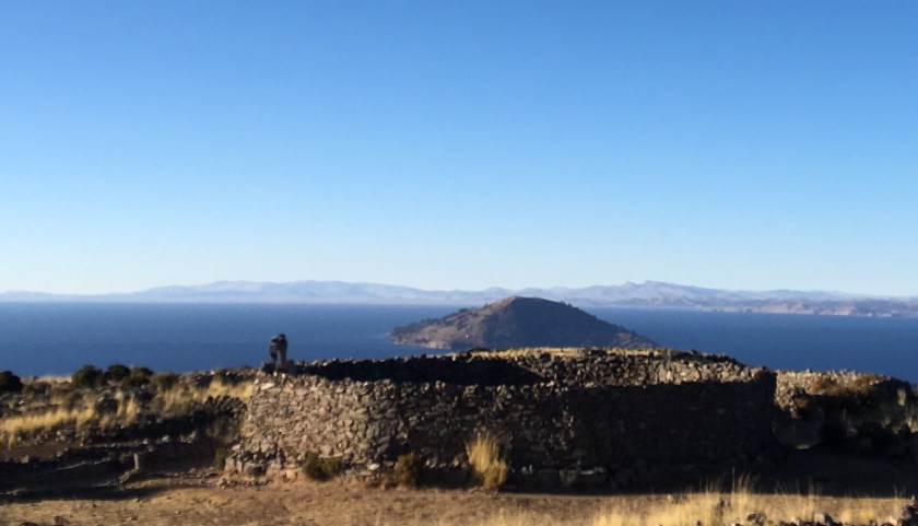
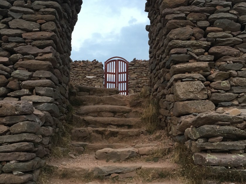
The next day, we headed across the mountain pass to see some ruins, a couple of overlook points, and the Spanish Gold trail. We were walking in the clouds the whole way down, so unfortunately I didn’t get to see some of the amazing views. Despite the fog, I still loved it!

We normally would have hiked about 5-6 hours and camped one more night, with a campfire at a mirador, but with all the fog and my stomach acting up, I convinced Eduardo to to do an 8-hour hike that would bring us all the way back to Sorata in one day. Turns out we would have gotten rained on in the night if we had camped, and I didn’t have the most waterproof tent. Win #2!

The day was long and challenged my glutes again, but I enjoyed it just the same.

We hiked along the Spanish trail or the Gold trail, which is the trail that was used by the Spanish colonial rule to deliver gold from a mine in the mountains down to Sorata, carried by the locals who were used as slaves in the gold mining business. (My first night in Sorata I had stayed in a hostel that seemed like a really old house, and I later learned that it used to be the place where the slaves (indigenous people) delivered the gold to the Spanish.)

Walking along the Gold Trail, glutes screaming, sore shoulders, I thought about how this would be torture if someone was forcing me to do it, (especially for their own profit and not for me). But since I had chosen to do it, and I could go at my own pace and enjoy the scenery, and I was not doing it every day, it was something I actually paid to do. Privilege.

Eduardo continued to tell me the history of Sorata while walking this trail. He explained how the Spanish enslaved the locals not only for mining but they also set up the big haciendas, where the Spanish “patron” treated the locals like slaves to work the land and produce crops as efficiently as possible while the patron then got rich from selling the products, sometimes on the international markets that he had access to. The conversation invoked memories or reading Isabel Allende’s “House of Spirits”.

Eduardo went on to say that there came a time when the young rebelled and received a few more rights so they weren’t so much like slaves, but it wasn’t until later with the big land reform policies that the patrons left and locals could own their own land and reap the benefits from it.

Since then, he said, the community has organized itself so that each person owns their land where they live, and then the land in the hills above the community is common land so that anyone in the community can farm it. They meet once a month to resolve community issues and they rotate the leader of the community every year. Anyone with land in the community is registered on the “roster” and therefore has rights to farm the community land and also has the responsibility to serve their rotation as leader of the community for one year.

As I arrived back to Sorata, I could not believe that we had walked that entire distance. I had left behind the busy world of getting everywhere fast, and I had reunited with the age-old tradition of walking. I was just stunned at how two legs, two feet, could take me across massive hills and high up into the mountains, across distances and through terrain that seemed impossible, or difficult at best, to cross. It was a reminder how much I appreciate my feet and also the power of the human spirit and body.

Bonus Content: What do the kids do in the evenings in Sorata? As I made my way back to my hostel, all along the way, kids were playing with the same top-like toy in the streets, so I stopped at one group of kids and asked an older kid to show me what they were playing. He was super shy at first but I finally got him to show me on camera, and he let me try a few times too.

(Unfortunately I am having technical difficulties uploading videos here, but you can find the video on Facebook).

Sorata to Lago Chillata – Adventures in the Bolivian Andes

As I was walking on Isla de la Luna in Lake Titicaca, I caught my breath as I looked across the lake and saw grand white peaks rising out of the horizon.

If you know me, you know that I have a love affair with mountains, and especially those majestic white, snow-covered mountains (“nevadas”). The mountains seductively said to me “You’ve hiked in the Peruvian Andes, are you up for the Bolivian Andes?”

So after leaving Copacabana, instead of taking the usual route to La Paz, I got off the bus early and caught a few cars to get to Sorata, a small mining town of about 4,000 people about 3 hours from La Paz and a starting and ending point for a few different treks through the Bolivian Andes.

I had heard that Sorata was a mining town, but I was still blown away when I saw a sign in a store off the main plaza that said “I buy gold. I sell mercury.”

I had laughed when my uncle heard I was going to Bolivia and told me to take a metal detector and to look for gold…but turns out he knew what he was talking about!

Other than the sign about gold, the town reminded me of any small mountain town in Peru. With a nice plaza in the center,* the main church and municipality building off the plaza, and shops filling the streets around the plaza. And because the town is on the side of a mountain, the streets off of one side of the plaza were an incredibly steep climb up, while the streets off the other side were a steep descent.

I arrived on Sunday when they had their “feria”, or market day, when people from the surrounding areas bring their products to sell – potatoes, acacha (a long, skinny, knobby potato), habas (a big, protein-filled bean), snap peas, herbs, carrots, green beans. Similar to Peru, they would bring their big colorful “manta”, spread it out on the ground and neatly arrange their products to sell. Common to all markets I’ve ever seen in Peru and Bolivia, there were many different vendors, all selling the same things.

I had sought out a local, Sorata-based guide association and “Eduardo”, a local guide met me in the plaza when I arrived and introduced me to his wife and daughter who were enjoying a Sunday walking in the plaza.

I was fascinated with the option of doing an 11-day trek through the Andes that included climbing a snow-capped peak and ending in the “Yungus” (the lower altitude, warm climate of the jungle on the other side (east) of the Andes, but I wasn’t able to pull together a group to do it with. Since it would be just me and the guide, I decided to do a 3-4-day trek to a glacier lake between two snow-capped peaks, “Illampu” (Aymará for “fat of the llama”) and “Ancouma” (Aymará for “white snow”).

 That evening we bought food and supplies and the next morning we started off from the town’s center, which is located low in the hills at 2,600 meters above sea level (8,500 ft). Eduardo pointed to the mountains in the far distance. I could not believe that we were going to arrive all the way there walking, (and with 15-20 kilos in my backpack) within a day. But he confirmed that we would do it. So I just put one foot in front of the other and waited to see what would happen.

It happened to be “Día del peatón”, or “Pedestrian Day”, the one day of the year in Bolivia where cars weren’t permitted to drive, which was lucky for us because our hike started along a dirt road, and when cars (illegally driving that day) did pass by, they kicked up a ton of dust which didn’t help breathing through the uphill climb.

Finally we got off the road and the smell of eucalyptus (one of my favorite smells of all time) filled the air and I realized we were walking through a eucalyptus forest.

Fun fact: Eucalyptus is an invasive from Australia that sucks the water and nutrients out of the soil…. But it produces wood quickly so people keep it around.

Later, the climb got steeper and the smell changed to muña. Another smell that I love, and this time there’s no worry about it being an invasive species. Muña is native here, it’s used in tea and is helpful preventing and alleviating the effects of altitude.

The first day was pure steep, uphill climb, like climbing stairs for 6 hours, without any flat parts to rest, so we took breaks every 30 minutes or so. It reminded me of the constant climb up Volcán Misti in Arequipa, including the burning glutes with every step (yep, for 6 hours).

My guide is a really nice guy who’s been a guide since 1993. He started as the front desk staff at a hostel that did tours. Trekking tourism started to boom in Sorata and one day they needed a guide so he went out with a group, and he loved it, and they loved him. He knew his way through the mountains because as a kid he used to take sheep out to graze through the mountains to make cash and as a curious spirit, he would go exploring new parts every time.

As more and more tourists flooded to Sorata to do treks, he formed the Association of Guides in Sorata, which ultimately had 30 guides and 20 arrieros (donkey handlers), all professionally trained. He loved meeting people from all over the world, learning from them, and exploring with them. He especially loved learning about new foods and ways to cook in the mountains. He picked up English and even a little French and Hebrew.

Everything was great until 2003. That’s when the Bolivian gas conflict exploded, with the country divided between plans to build a gas pipeline to export gas to the US and Mexico and a growing movement calling for Bolivia to build a local processing plant to get more value from their product and to meet internal gas needs before exporting. Between internal protests and international relationship problems, the booming tourism suddenly halted.

Since then, tourism in Sorata is starting to pick back up, but now most of the tours are dominated by agencies out of La Paz that charge double or more and often contract local guides anyway. When Eduardo goes out with big groups, his wife sometimes comes along to help, and his sons had come along a few times too, (but they didn’t enjoy it as much).

We ate lunch at 3,800 meters (12,500 ft), (the same altura as lago Titicaca), and then after about 3 more hours of climbing, we arrived at our campsite at at 4,200 meters (13,800 ft), a mountain lake “Lago Chillata”.

“Chillata” is Aymará for “the sacred lake where people go to pray, sobbing for help from the divine”). Or, to the Incas before Catholicism, the lake was called “Kotaato” – Aymará for “the lake in the middle of the rocks”.

Here, the clouds roll in thick around 4pm every afternoon and the fog hangs around until the middle of the night, where it clears up and the temperature drops below freezing.

As the clouds are rolling past, visibility sometimes would clear for just a few seconds, leaving an incredible view of the sun setting on the great white peaks of Illampu and Ancouma. (Many times I ran to a high point to get a photo, and within 10 seconds it was already covered in fog again by the time I got there.)


Tomorrow we’ll be able to leave the heavy stuff at the campsite as we head towards the great peaks to find the glacier lake that is tucked between them.

*Famous Footnote/Bonus content:

While wandering around the plaza the night before the trek, I saw a group of people speaking English in the plaza. I approached them and learned they were a chapter of Engineers Without Borders doing an Eco-bathroom project in a nearby rural town! I find my people all over the world!

Isla del Sol

La Isla del Sol is the biggest Lake Titicaca island, and it is also the most visited by tourists, due to its convenient location just a 2-hour boat ride from Copacabana, the popular tourist stop between Bolivia and Peru.

It is apparent that the island has developed around tourism – there is an abundance of lodging (hospedajes) and restaurant options, and even signs pointing the way to tourist points of interest like overlook points.

You know international tourists come through a place in Bolivia if you find a pizza restaurant, and there are a ton of pizza restaurants on Isla del Sol.

I was really struck by the beautiful architecture and especially the facades of many of the hospedajes, most of which incorporated rock or pebble to adorn traditional adobe construction.

It is also close enough to the mainland peninsula (with a tiny tree-covered island in between), that it is connected to the electric grid of the mainland, unlike Isla de la Luna, which relies on solar panels.

Isla del Sol has three different communities and is less densely populated than Amantaní, with approximately the same population but spread throughout the 14-square-kilometer island (compared to Amantaní’s 9-square-km). (But both much larger than the tiny 1-square kilometer Isla de la Luna with just one community of 27 families).

Just like the other two islands I visited, the geography is that of a mountain rising out of the sea…er, lake. (It is very easy to forget that I am on a lake and not the sea!)

The point is that everything is uphill from the shore. And even walking around from place to place on the island is like hiking in the mountains – a lot of up and down (which always feels like there’s more up than down) at 3,800 meters of altitude.

The boat I came in arrived at the port Pilko Kaina with Incan ruins to explore.

From there to the rest of the island was a surprisingly long climb up.

I really wondered if I was going the right way and if all this climbing was going to be worth it in the end. But I persevered, meeting some friends and some awesome views along the way.

I eventually wandered upon two other lost tourists and soon we came to a house which turned out to also be a fancy restaurant on the edge of Yumani, the community most frequented in Isla del Sol and full of restaurants and hospedajes.

They stayed to enjoy some gourmet food while I continued along in search of a place to stay the night and a cheaper lunch since I was on a really tight budget, and running low on cash at this point.

The site where I did eat lunch was indescribably beautiful. The view of the lake was breathtaking (literally and figuratively at 4000 meters above sea level)… so blue, and so immense, stretching as far as the eye could see. The only sounds were a few birds and a distant conversation in Aymará, with the light sea, er, lake breeze whispering past my ears. Ultimate peace.

And it was the best meal I’d had since Amantaní – fresh trout from the lake with some fresh veggies.

Later, heading to the lookout point to catch the sunset I met and chatted with a local woman selling souvenirs who appeared slightly younger than me and who had curious and rowdy 2- and 4-year-olds. She had lived in São Paulo, Brazil and so not only spoke Aymará (the local language on the island) and Spanish, but also Portugués from her time in Brazil. She had returned to Bolivia because she said they had been treated like second class citizens, her husband robbed at gunpoint a few times, and other Bolivian migrant friends injured or killed…she said her experience was that there was no justice as the government didn’t really value their lives, safety, and rights as immigrant workers. (USA, can we please not be like that???? Pretty please.)

After doing yoga and watching the sunset with her and her kids, I headed to another overlook point.

There I met a super sweet couple – a Spanish woman and an Argentine who ended up staying two extra nights and exploring the whole island (even the northern part which we had been told could be dangerous because of an inter-community conflict that started two years ago), and they said it was incredibly beautiful!

Unfortunately I was running low on cash and had to return to Copacabana the next morning to change money and continue my journey. So, after a delicious dinner of trout from the lake (yes, again!) I headed to my hospedaje and had my last peaceful, Lake Titicaca island sleep.

The next morning, after watching the sunrise and eating breakfast, I headed down to the dock, past the Fuente del Inca and saw the grand island entrance to the Yumani community.

I had the pleasure of chatting with a few local women while waiting for my boat. This might have been one of the highlights of my stay here. Using my handy language chart, I practiced my Aymará with them, and we were all highly entertained (even if they were laughing AT me not WITH me at times!) Similar to Isla de la Luna, most people have their farms where they grow the typical sierra (highland) crops- quinoa, wheat, corn, and a variety of potatoes, and animals (mostly sheep), while the income from tourism helps provide something extra.

With a farewell photo, I said “juspara” (thank you) “jakisiñkama” (goodbye)! and boarded the boat for my last ride across the majestic Lake Titicaca.

Isla de la Luna

Every morning at 8:30am, boats full of tourists leave Copacabana heading to Isla del Sol, with an option of stopping for an hour at Isla de la Luna. Planning just to go to Isla del Sol and stay the night, I boarded a boat and met up with the two traveler friends from London and Italy that I had met in my hostel.

It was a beautiful 2 hour boat ride and I even saw some little fish swimming along side of the boat. Instead of getting off at the first stop at the Isla del Sol, I stayed on with my new friends to go to the Isla de la Luna.

The boat only stops for an hour at Isla de la Luna and the guide on the boat says there’s not much to see there and you can do it in an hour…and they only give you an hour before the boat leaves to go to the Isla del Sol. And if the boat leaves without you, you’re stuck in the island until the next day because the boats only come once a day for an hour.*

Entering the island the smell of muña caught me by surprise and reminded me of my stay in Amantaní, the island in the north part of the lake. As I was walking up the stairs to enter the island with the other tourists, I passed a little 4-year-old boy who, without prompting, greeted me saying “Hi, my name is Miguel Ángel”! It was so adorable!

I started exploring late because I chatted for about 10 minutes with the guy who was charging for bathroom use, geeking out about the water and electricity access on the island. (Islands have always fascinated me because they present unique infrastructure challenges ripe for alternative energies and exploring the idea of sustainability.)

Geek out about the island’s infrastructure:

They used to not have power but now they use solar panels (“because the kids want their cell phones. And also tv.”) He said the panels are great but the batteries only last a couple of years and they have to be careful not to let them drain to zero or they stop working well. They use what look like basic car batteries that charge during the day.

They also have solar hot water heaters in most of the houses.

They use water from the lake but have to buy gas to power the pumps that pump the water up from the lake. (They charge for the bathroom in part to cover costs of the gas).

End Geek-out.

Finally, I headed up the hill to the ruins of the “temple of the virgins”, which was supposedly a type of boarding school for young women to learn to do womenly things in the Incan times.

There, I met an older woman from the island who explained that life living on Isla de la Luna is really calm and peaceful, and she liked it much better than the city (La Paz) where she lived for a few years. Here they grow their food, have a few animals- (llamas, pigs, chickens, sheep), they have fish farms within the lake, they and buy what they don’t have on the island from Copacabana. There’s a primary school and a church and a football field – everything they need, she said.

As I started to hike the hill from the temple to see what was on the other side of the island, I passed a woman knitting in the shade who asked if I was going to stay the night in the island.

“That’s an option?” I asked her.

Part of my travel purpose is to go off the beaten path and get to know some places and the people that live there… so when she said that her mother owned a hospedaje, I negotiated a price to include my meals, and I decided to stay the night instead of going back with the boat to Isla del Sol.

The boat companies from copacabana don’t promote the fact that there are hospedajes on the island, (maybe because it’s a tiny island and most tourists want more entertainment and conveniences? I don’t know.)

But if you are looking for a quiet and incredibly beautiful place to pass 24 hours (or more), where you can chat with one (or a few) of the 27 families that live on the island, learn about their daily lives, and walk along the perimeter of the 1-square-km island in the afternoon sun…then it’s worth the stay.

The tourists only come one hour per day, at the same time every day, and the community rotates selling things, collecting the entrance fee, collecting bathroom fees, and helping/keeping an eye on the tourists.

On the other side of the hill, and down the length of the island are the houses where the community (called Coati) lives…So the tourists only see the ruins and a view of both sides of the island from the top of the hill, but don’t see or go into the community, unless they stay the night.

The community of Coati, Isla de la Luna

The hospedaje where I stayed overlooks the lake, with a little pier extending into the lake. In the patio between the rooms are beautiful plants with flowers and the constant buzz of bees that I even hear from inside he room.

The quiet lapping of the waves on the shore can also be heard from inside if you listen closely.

This half of the island, the opposite side from where the tourists land, smells of muña for parts and eucalyptus for other parts.

I loved chatting with the woman who owned the hospedaje. It challenged my conversation skills a little because she wasn’t super talkative, but every time I asked her a question I saw her face light up a little and I felt her open up a little more, like she viewed me with a little less skepticism each time.

She commented that the president/government built part of the hospedaje last year (or at least convinced them that he did so they’ll vote for him at the end of this year), and the alcalde bought the water pump. The entrance fee to the island goes towards paying the locals to do restoration of the ruins or other community-based things.

The woman has 5 kids, one still living here on the island, a few in Copacabana and a few in other cities, but she’s content because they talk on the phone. When she first moved here with her husband (who is from here), there wasn’t running water or electricity so it was a rough adjustment for her, but she adapted, and now it is much easier with the solar power and pumped water. She feels at home now and likes that it’s quieter with less people than where she grew up, (in a community on the peninsula).

We chatted as the sun set over the pier, and she told me that tomorrow would be her turn to sell her artesanías in the temple so I would see her there when I leave.

In the morning, heading back over the hill to the other side of the island, I saw the little boy from the previous day, Miguel Ángel, walking with his mother, taking their sheep out to graze. She had a few of them on a leash, and the similarity to people walking their dogs in the morning made me smile. A few loose sheep stopped to eat and wouldn’t follow her so she sent Miguel Ángel to collect them, and I went to help herd sheep, while the talkative, friendly boy told me stories of his sheep.

This visit had a different feel than my stays on Ccotos and Amantaní, mostly because the business arrangement is different. Here, they are following a more traditional hotel-type tourism model, where the host is simply providing a space to stay, and doesn’t even live in the same area where the guest rooms are. Whereas in Amantaní and Ccotos they are following a homestay model where the tourist is a little more integrated into the daily life with the host – through sharing meals and sometimes community events, in addition to the guest rooms being more physically close to where the family lives and considered part of the family’s house.

While I personally preferred the homestay model and the culture-sharing atmosphere it fosters, I still greatly enjoyed my stay here. There aren’t many words to describe the peacefulness and beauty of this place, but hopefully you can catch a glimpse of it through the photos!

As I left the island in the morning for Isla del Sol, I saw the snow-covered peaks of the Cordillera Real in the distance, a reminder that I was on a lake in the middle of the Andes, not the ocean, and a foreshadowing of my future travels through Bolivia.

Famous Footnotes

*If you really needed to leave the island, you could pay a local a very high price to take you in a private boat to Isla del Sol or the mainland.

Copacabana…Bolivia

Copacabana, Bolivia is a tiny little border town on the coast of Lake Titicaca, just 30 minutes from the Peruvian border. It’s a popular tourist stop between the two countries, and that is evident by the fancier and pricier restaurants and hotels geared towards international travelers on two of the streets running from the plaza to the port, where the boats take off to visit Isla del Sol and Isla de la Luna.

Walking down these streets you hear people calling out insistently, “Isla del Sol! Isla del Sol!” “La Paz!” trying to sell tickets, competing with the 20 other people on the street doing the same (even though there seems to actually only be about 3-4 different actual companies. It’s an interesting system that I never fully understood.)

Copacabana had quite a few attractions but I only took advantage of really checking out three.

Trying to adjust to the altitude, just before sunset I ran along the coast of the lake and (ran-walked) up the famous Calavario hill, which is the hill overlooking the town and the lake with the

stations of the cross at the top. Watching the sun set over the lake while doing yoga was … indescribable. Like looking at a beautiful painting while doing yoga, only better. It was the most beautiful moment in Copacabana.

Copacabana is also famous for its Cathedral, and for blessing cars. Yep, you read that right. People bring their cars to Copacabana to get them blessed, a service offered every morning by the local priest.

But the cars have to look good for their baptism so there’s a whole series of tents set up to sell flowers and decorations for the cars in front of te cathedral every morning.

I happened to be there during a Peruvian holiday so I actually saw more Peruvian plates than Bolivian plates, as Peruvians took advantage of the 4-day weekend to cross the border and visit Bolivia.

I was staying at a really cozy hospedaje that I would recommend for people on a low budget: Hostal Sonia. I got quite a bit of writing done in one of the great common areas with natural light and a view of the lake.

I was surprised to hear the garbage truck drive by playing the same “reduce, reuse, recycle” song that the garbage truck in Oxapampa, Peru plays! (The garbage trucks play music so you know when they’re coming and can run out to put out your trash if you haven’t already.)

While I heard about a few other cool things to do in Copacabana, (like Hora del Inca, a pre-Incan astronomical observatory(!), Baño del Inca, and the nearby Kusijata with archeological stuff), I didn’t get a chance to check them out…next time. But I did hop in a boat full of international tourists to go visit Isla del Sol and Isla de la Luna.

On the many different boat rides over the next few days, I met some really great fellow travelers, who gave me great tips on logistics and trip planning, including another lone woman traveler from France, a brother and sister from Italy, a couple from France, three university students from Spain, two older women from Spain, and a couple from La Paz who were also chemical engineers working in the environmental field! (Needless to say, we geeked out, and they also showed me a good, cheap spot to eat they had found in Copacabana).

While Copacabana was much more touristy with little to none of the tranquil, community experiences I had come from in Peru, it was a good experience, and I loved connecting with other travelers!Next up…I will get a taste of the islands in the southern, Bolivian side of Lake Titicaca: Isla del Sol and Isla de la Luna.

Crossing the Border

As much as I would have loved to stay longer in the paradise of Amantaní, my visa had expired and I had to flee the country (Peru charges a fee for every day you overstay your visa.)

While not unsurprising, crossing the border between Peru and Bolivia was not a smooth process for me because of my expired visa, my very flexible backpackers itinerary, and my US citizenship.

At Peruvian immigration I had to had to jump through a whole series of hoops (including taking a taxi to the bank in a nearby town to pay the fee for overstaying my visa). But they didn’t put me in a detention center or deport me back to the US, so instead of complaining about the inconveniences I’m just thankful that Peru Immigrations is more humane than the US when it comes to visas and immigration.

Bolivian immigrations also gave me a hard time, but that was kind of expected. As a fellow traveler pointed out to me, the American passport is one of the most powerful , or widely accepted, passports in the world. Almost all countries will let us visit with few problems. Meanwhile, if you happen to be born in a North African country, like my traveler friend, she was only able to travel to a handful of countries with her passport (until she moved to France and got a French passport).

Whole US citizens enjoy this travel freedom, the US is one of the countries that restricts entry simply for a person’s country of origin.

Bolivia is one of the countries in the world that has a reciprocity policy for US citizens – since the US makes Bolivians (and most South Americans) pay a high visa application fee and puts strict (and sometimes arbitrarily interpreted) requirements that many people don’t meet so they end up not getting the visa and losing the application fee, without obtaining a visa to travel to the US…Bolivia puts a high fee for US citizens wanting to enter Bolivia. (Unfortunate because many US travelers disagree with the US immigration policy and they are the ones that bear the cost, but I would do the same if I was Bolivia.)

So after paying my fee, changing money, and finally passing Peruvian immigration, I walked down the road to Bolivian immigration, thinking I had my paperwork in order but finding out I was wrong. They hassled me about my itinerary and made me retype it, mostly because I didn’t have hotels reserved in advance since I was on a backpackers plan where I would find a hostal in each place I went. Actually, the real real reason was that they were just following policy…the US hassles Bolivians about entering the US, looking for any reason not to let them in, so they were doing the same.

Interestingly, their attitude towards me changed when I heard them speaking Aymará so I tried to joke with them and throw in some words in Aymará from the cheat sheet that Romulo (my host from Amantaní) had given me.

Maybe it’s that when I tried to connect with them and their culture they realized I wasn’t a stuck up and racist American. Or, maybe an American trying to pronounce words in Aymará was more entertaining than a frustrated and tired American being hassled about being let into the country. Either way, they loosened up, joked with me, accepted my paperwork without further hassle, and let me in the country.

This was a perfect example of how my travels have been like a video game – something I picked up along the way helped me pass to the next level.

When I was staying in the island Amantaní, I enjoyed great conversations with the couple with whom I stayed, including conversations about politics. From Romulo (the husband), I learned about the divide in culture and language between the different sides of the lake Titicaca – the part north of Puno is Quechua-speaking, and south of Puno and into Bolivia is Aymará-speaking.

The day that I had planned to leave the island Amantaní, we got word from a teacher who lives in Puno and travels to the island for the weekdays to teach, that there was going to be a huge protest that would block the main roads between Puno and Bolivia.

The regional governor for the whole region of Puno had just been charged and put in jail for leading protests that destroyed state property a few years back. As the region of Puno is culturally divided between people who speak Quechua and those who speak Aymará, this was the first regional governor that was from the Aymará culture (almost always a Quechua-speaking governor had been elected).

Because of this, many Aymará people were upset with the ruling, believing that it was a political move to oust their leader, and so they would be protesting by blocking the roads hoping to release the governor. (This type of protest, in which the roads are blocked is somewhat common in Peru, and the good thing is that it is usually planned a few days in advance so that  people get word and know not to travel those days.)

So along with this history and culture lesson about the Puno region, Romulo showed me a chart that translated a few basic words between Quechua, Aymará, Spanish, and even English, and he told me me take a photo of it.

Little did I know, he was the wizard giving me the magic wand that I would later need to open the door to taking me to the next level of my video game Odyssey – from Peru to Bolivia.

Bonus Round: After finally arriving to the plaza in Copacabana, I was struggling with google maps trying to find my airbnb because there were no street signs. Suddenly, someone calls my name, and it’s one of the guys who worked in the immigration office. A little creepy, yes. I asked myself if he was following me, and I was kind of cautious answering him. But it turned out that he happened to live nearby (it’s a really small town), and he was just being nice and helpful. When we found the place, he wished me a safe journey and left me feeling like that magic wand of connecting with people through their own language had turned obstacles into friends helping me along the way.

Bienvenida a Bolivia! The Bolivian adventure begins! ??

Island Life (Amantaní)

Sometimes we travel long and hard to arrive at our destination. And then sometimes the journey itself is so beautiful and interesting that it is part of the destination.

Getting to Amantaní is one of the latter. The hour-long motorboat ride through the lake was was both fascinating and relaxing at the same time. A vast expanse like the ocean, but calm, with only minuscule waves, passing islands along the way that I had seen from the shore just a day before…and passing the shore that I had been on just the day before, staring out to where I now was in a boat!

When I arrived at the dock, I was greeted by a smiley and warm, short and round woman who introduced herself as Silveria, the wife of Romulo, with whom I had organized the stay. She led me up a steep sidewalk with many stairs along the way, and after just 5 minutes I was huffing and puffing with my 15 kilos of backpacks and just my second day in the altitude. But luckily, we had already arrived!

Their house is located close to the dock, and my room had big windows with an incredible view of the lake!

Just like in Ccotos, in the shade it’s cold and I need my 2-3 layers, but sitting in the sun for a few minutes I could wear just a long-sleeve or sometimes short sleeve t-shirt, so I sat in the sun while Silveria prepared lunch.

Chatting over a delicious lunch of local varieties of potatoes, an assortment of vegetables, and local bread, I learned that Silveria had run from one side of the island to the other in the morning, first helping her step-mom on her farm, then working on her own farm on the other side of the island, and then running to the dock to meet me. She said it took her about 30-45 minutes to run from each side of the island to the other.

Over lunch, we shared stories, getting along so well that we even began sharing about our childhoods and a summary version of our life stories! After a rough childhood, she was very happy to have a peaceful life with a nice house and a nice husband, living a good life without want. She reminded me of a sweet and hospitable southern woman, someone who had grown up in a machista culture and had a rough childhood but had made a better adult life for herself and lived constantly thankful for what she has now, moving and speaking in a manner that was both self conscious and humble, yet confident in its own way.

In Amantaní, similar to Ccotos and the surrounding areas, people’s first language is Quechua because that is what is spoken in the home. I asked if Quechua was taught in school, and the response I got was, “No, everyone knows Quechua so they don’t need to study it in school.” I was told that typically children speak only Quechua until age 5 when they begin going to school, where they start learning Spanish and school is pure Spanish.

It was interesting to me that, while speaking to Silveria, she was quite self conscious of her Spanish, even commenting that my Spanish was better than hers (though as we talked more and became more comfortable talking, her Spanish flowed more and more fluidly.)

In the late afternoon, Silveria walked me up to the path that led to the highest points on the island-two hills close together, each with a sanctuary to Pachamama* and Pachatata, respectively.

She left me and I continued to climb, slowly, step by step…up to 4,200 meters, my lungs wondering where all the oxygen went, and the temperature dropping rapidly. I was surprised as the land and hills began to give way to water on either side (apparently I had forgotten I was on an island).

My plan was to watch the sunset from there, but the clouds rolled in cutting it short. What I did find as I got closer to the sanctuaries was a ton of tourists! (And a ton of local women selling chullos* and sweaters and crafts and souvenirs all along the paths)! The tourists had all come out from hiding wherever they were staying on the island, and everyone had come to watch the sunset up here.

I got a little confused getting back to the house, and as I asked an older man who was walking with a child, he sent the little girl to walk me to the corner where I needed to turn. I found this simple reaction to be so strange and so kind – but very different from most places where everyone is in a hurry and busy with their own things and also worried about sending kids off alone, even for a few blocks.

That night over dinner, speaking with Romulo, I learned that the island is actually quite organized around the home-stay tourism and they usually partner with tour companies who bring in large groups of tourists at a time. The community is divided into 10 communities, and each community rotates being the host of a group of tourists, with each family in the community offering space in their house and meals to the visitors. Each community also has a community center where they perform traditional dances and have a party with the group of tourists. (I had bypassed this system, contacting Romulo directly, and he said this was a much better deal because he directly receives the payment, and they even have a problem with one tour company that never paid the island for hosting a group.)

I was really impressed by how organized the island of 500 families was. They meet every Sunday, first the whole island, and then they break into meetings just for each community. Romulo explained that it was their only way to get news since there wasn’t a radio station on the island just for news about the island (though they do get regional radio stations from Puno and Juliaca).

They also coordinate which communities plant which crops when, and they rotate, making sure the land has time to rest. Because of the population and limited amount of land, the island is not self-sustainable and the crops produced are not enough to feed everyone so they do have to buy food from the mainland in addition to what they produce. Because of this, the money brought by tourism is crucial for the residents.

The night was so quiet and peaceful and the stars so incredible!! And it was cold. I didn’t dare shower and I slept under about 6 heavy blankets. Before going to bed, they told me if I had to use the restroom to use the “pee bucket” under my bed instead of trying to brave the cold and go to the bathroom. I had heard of these “pee buckets” from other Peace Corps volunteers that lived in the mountains, but I had never seen them for myself. (Turns out it was just a plastic tub.)

The next morning I took a stroll along the shore…

And then we all had a crepe-like “pancake” breakfast, learning about each other’s families.

Later, Silveria walked me to another spot on the island that the tourists often like to visit, the Inca’s chair. To walk there, I noticed that she took time to put on a nice shawl, and she also brought along her knitting…and continued to knit as we walked there! (I was highly impressed.)

Everything on the island is somewhat of a climb…at this point I realized that as an island, it’s really just a big hill or mountain jutting out of the middle of the lake, with the middle of the island being the high points and the shore the low points, so you really have to climb to get anywhere unless you are literally just walking along the water.

I really fell in love with the island, with its stone paths connecting the 10 different communities. I saw the island to be filled with with trees, houses and farm plots. There are no vehicles – everyone walks. (Though I did see one motorcycle in the two days I was there.)

The Inca’s chair was a beautiful spot on the beach and I camped out there until lunch, writing, and then returned after lunch to watch the sunset.

placeholder://

Dinner was delicious and a really great conversation, including Romulo showing me a photo of Silveria and complimenting her to me (with her sitting there in the kitchen) saying what a beautiful wife he had and what a great cook she was. I practiced a few of the Quechua words they had taught me, commenting that the food was delicious and thanking them for it:

“Sumaq micqvi” – delicious food!
“Yoshparasonki” – Thank you!

(My Quechua spelling is surely not correct, but that’s how I remembered to pronounce it.)

Muña- the minty-smelling herb that helps with the altitude and stomach problems. We had fresh muña tea every meal!

Before daylight broke the next morning, I left the warmth of the 6 heavy blankets and headed out to run/walk up to the highest point of the island, the sanctuaries to Pachamama and Pachatata, to watch the sun rise and start the day with some yoga and meditation at 4,000 meters (13,000 feet).

Starting at 3,800m, and climbing to 4,200m (13,000 feet) was not a walk in the park and I had to stop to breathe a few times and also take off some layers, but in about 45 minutes I reached the sanctuary and did a few sun salutations because, well, for obvious reasons.

While I was meditating I heard what sounded like a fan motor off to my left. Then I suddenly heard it in my my right ear, I opened my eyes and was amazed to see a hummingbird (“luli”) floating just one foot from my face, checking me out and whispering (quite loudly) in my ear, with its thousands-of-beats-per-minute wing-flapping motor. After 3 seconds it flew away, but left me feeling like I had just received a message from Pachamama delivered by a Chaski* in the form of a hummingbird.

After breakfast, I had to say goodbye, and I mentioned that I was sad to be leaving because I really felt at home with them and was so thankful for their hospitality, and as I saw their faces light up with genuine happiness, I was really touched to have met such kind people that opened their homes and lives to me for a couple of days!

When I had arrived, I had greeted them with the handshake, hug and air kiss that I was used to in Peru, but awkwardly found that they were expecting only the handshake. Out of habit I accidentally made that mistake twice! But upon leaving, they each reached out for a hug, and I felt a special connection to this family and this beautiful island in the middle of the highest navigable lake in the world.

Famous Footnotes:

*Pachamama – the Incan word for mother earth, which is revered with a god-like respect and reverence

*Chaskis were the Incan messengers that traveled the Incan roads delivering messages throughout the Incan Empire

*Luli – what Silveria called the hummingbird – maybe the Quechua or a local word for the hummingbird. She said it was a sign of good luck for my journey

*Chullo – the warm hat with ear flaps commonly used in the mountains of Peru and Bolivia. I learned from Romulo that if your ear flaps have dangly balls like mine, you can tie the earflaps back when you are eating so they don’t get in the way!

Off to an Amazing Start (Ccotos)

And so my South American travel odyssey begins in…

(drumroll)…

(try to guess from the photo…)

Nope, it’s not the ocean…

The birthplace of the sun, according to Incan legend and the highest navigable lake in the world, at 3,800 meters (12,500 ft) above sea level.

Lake Titicaca is divided between Peru (northwest) and Bolivia (southeast), and I am staying with a family in a little pueblo called Ccotos, which is located on a northern peninsula on the lake, on the Peruvian side.*

This is a homestay, a beautiful form of community-based tourism, where I eat 3 meals a day with the family, I stay in an extra room they have built specifically for this purpose. They treat me like a visiting friend, sharing meals and conversing, recommending things I can explore in the community during the day, and helping me plan the next part of my journey. When they met me at the terminal, the mother of the family even chastised the mototaxi driver for charging me a few more soles than the normal going price.

My room and the family dog

My stay started perfectly…I woke up in the morning to do yoga looking out over the lake (the house backs up to the lake). I asked the mother if she wanted to join me and she sent her two kids to join me – a smiley, shy 16-year-old girl, Judith, and a witty, talkative 6-year-old boy, Ronnie. Together we did yoga watching the lake, while the donkey and calf watched us.

After yoga we had breakfast of hot tea (fresh coca leaf to help me adjust to the altitude), bread specific to the sierra region, and a hot quinoa drink. The father, Alfonso, told me about the points of interest I could go explore, and the kids headed off to school.

Chatting with him, I learned that they are mostly farmers, planting quinoa, potatoes, corn, wheat, and barley. They had a few cows and a few sheep and they also sometimes caught fish from the lake. The quinoa drink we had that morning was from the harvest earlier in the year. And for lunch they bought fish from a neighbor that had gone fishing in the morning.

After breakfast, I decided that I wanted to follow the main (dirt) road to the very tip of the peninsula… which means I got to see most of the community since there is basically only one main road that goes down the middle of the little peninsula. But in my way out, I saw the family doing a curious thing…

They explained that they were taking advantage of the  wind blowing to separate the grains from the husks. The wind carried the husk away, and the grain fell in a pile.

A few women were working in their fields, and almost every property had a few sheep! I have never seen so many sheep in my life.

The 45-minute walk through the community to the tip was so incredibly peaceful, only one car passed and just a handful of people walked by. The women wore these great brimmed hats with two colorful balls on top. Almost all the land was divided into small plots of farmland with crops planted and sheep grazing and an adobe house (or a few) on each property. I also saw a woman taking water from a hand pump well. While the community has a central well-based water system, water is only available every other day. (I never clarified if that was due to pumping costs or lack of sufficient water in the well, but the community was interested in engineering help to have water on a daily basis. Note to self – another reason to return. And note to all you Engineers Without Borders out there.)

The beach at the tip of the peninsula was incredible. A peaceful silence- there was literally no one and nothing around, other than the occasional bird. As I climbed down to the shore I heard the waves lapping at the shore; it could have been easily mistaken for the ocean. A very calm ocean with small waves – nothing like the (poorly named) Pacific Ocean, but a very ocean feel.

Looking out I could see a few fishing boats and a few islands – one larger one with terraced land, that I guessed might be Amantaní, the island I was thinking of visiting next.

I returned to the house for lunch and saw that, like Alfonso had mentioned in the morning, 2 other tourists, young Italian guys, had arrived. We all had lunch together – that fresh fish from the morning catch, quinoa and potatoes from their farm and vegetables bought from the nearby market.

Later, with the Italians, we climbed to the mirador (scenic overlook point) and I was really feeling the altitude as I huffed and puffed to the top, my first day at 3,800 meters (12,500 ft).

After wading around in the lake, we returned to the nice surprise that Alfonso agreed to take us out in the boat to fish. That meant bundling up (because it gets really cold when the sun goes down), and paddling out to leave nets out that we would then go out and gather in the morning.

Over dinner I helped Judy (the 16-year-old daughter) with her English homework, which was way too hard for a non-native speaker and reminded me that in American English we don’t pronounce our words clearly, we let words run together, and we speak very differently from written English. Anyway, her homework was to understand this video of street interviews in the US, which I found hilarious and interesting, so I’ll share it here. https://www.youtube.com/watch?v=wL3CFtW8WE0&t=2s

After dinner we started kicking the soccer ball around, laughing hilariously with Ronnie and coincidentally continuing my Friday soccer tradition, making me both miss Oxapampa and still feel connected at the same time.

The next morning I did yoga with Judith and the donkey while the guys brought in a few little fish from the nets they had left out. After breakfast, Judy dressed us up in the traditional clothing for celebrations and events…so finally I have a photo of those great brimmed hats with puff balls that the women wear!

Sad to leave new friends and happy and thankful to have been invited into their lives for a brief moment, and given the opportunity to enjoy the tranquility of the beautiful lakeshore on their land, I headed away from Ccotos feeling like this tiny farming peninsula on the lake has a very special place in my heart.

  Famous Footnote

*Yes, I should have been rushing to get out of the country to not overstay my visa. But I couldn’t pass up this opportunity! Hopefully they won’t arrest me and throw me in a detention center and deport me back to the US. Privilege noted.

Viajera Mochilera – Join my South American Odyssey

On August 21st I officially completed my Peace Corps service, and with my visa expiring within two days, I had to quickly head to the border.

(Which border? Stay tuned in future posts to find out!)

I love traveling, meeting new people, discovering new places, volunteering, (and apparently not making any money) so much that I decided to take this opportunity to make traveling and sharing my experiences with you my job for a few months. You’re welcome.

(Yes, this goes against every workaholic and opportunistic grain in my soul due to my American upbringing, but I hope that it will bring us all joy and be well worth it.)

What do you know about South America? From my experience growing up in the US, the majority of what I knew was from the show “Where in the World is Carmen Sandiego” (read singing the song).  Now there’s what we hear in the news… The Amazon Rainforest is being threatened every day…(and now it’s being burned to a crisp!) Then there’s the FARC and drug trafficking in Colombia. The inflation and mass exodus in Venezuela. Maybe you have heard stories of high poverty rates or places where people barely have enough to eat, high levels of malnutrition, no clean drinking water. Or maybe you think of Machu Picchu, Carnival, or Patagonia.

While these are things that make the headlines or call attention to the tourist passing through for a week, they are not what define the people or the place, and they certainly don’t tell even half the story of what life is like living here.

So, in the next few months, I’ll be exploring a few corners of South America, meeting people, getting a taste of the lifestyles, the culture, the landscapes, politics, and the general vibe of the places where I land in my journey. While I’ll certainly be landing in some common tourist spots simply because they tend to be more accessible and able to receive an outsider, I will definitely see what I can do to go off the beaten path or at least explore places less commonly explored.

I have often thought that travel after Peace Corps would be pretty unfulfilling because I will never be able to really get to know a place, the people, the culture, like I did in my service. I went through a whole process of trying to fit in, trying to be more of a local and trying really, really hard to NOT be anything like a tourist. I didn’t want to be looking in from the outside, I wanted to be part of the place, experiencing it from the inside, understanding the reality of the people who live there and how they define the place. And after three years, I really felt like I became a part of my site Oxapampa, as it became a part of me.

So the idea of traveling to a place for just a few days or traveling to places geared for tourists seems kind of superficial. Window shopping. Peeking in from the outside and only seeing a tiny part of a reflection of reality and not getting a chance to see the human part of a place. I certainly don’t like the idea of being seen as a tourist…the foreign, often white person that doesn’t (often can’t) connect with the people because of a language barrier or because they are rushing through a packed schedule to see a bunch of places in a short amount of time. This creates the archetype of the tourist that the locals see – a kind of alien that comes to visit and has money, brings a stimulus to the economy, and will often pay more than the going price for things. Just like the locals rarely see tourists as individuals, the tourists rarely see the locals as individuals but rather as interestingly-dressed humans that are part of another world.

I know that through my travels I will not have the opportunity to get to know a place like I did Oxapampa and parts of Peru, but because I can now speak Spanish and have some experience living in Latin America, I have a few more tools to help me connect on a deeper level with people. I’m going to try to stay in places longer and take more time to get to know people and learn about their lives. I’ll be focusing on finding places where I can do:

  • Community-based Tourism
  • Eco-tourism, visiting National Parks and Reserves
  • Multi-day treks to immerse myself in the different geographies of a place
  • Voluntourism*

I know I’m still just scratching the surface, but with a few months, a flexible schedule, and the right mindset, I hope to experience the people and places of South America on a deeper level, and share that odyssey with you – and you won’t have to leave the comfort of your home!


Always the Famous Footnote…

*Voluntourism can be controversial for many because there are many accounts of how trying to volunteer for short periods of time in a place have actually created more negative impacts than positive impacts. Conscious of this, I will be choosing the way in which I volunteer very carefully, and I’ll tell you about it!