I never would have thought that my travels through South America would include going to a theme park! But the best part about traveling is the surprises!
Parque Nacional Chicamocha (Panachi) is a theme park in Santander, Colombia built above the Chicamocha river valley and probably has the best views of any theme park I’ve ever been to.
One of its main highlights is the teleférico (elevated cable car) that takes you down into the river valley, floating above the river, and then back up to a mountainside across the river. (If you know how much I love teleféricos, you know I couldn’t pass this up!)
When you arrive on the mountain on the other side, there are restaurants with typical food from the Santander region, snacks, souvenirs, and you could even do a virtual reality session.
I ordered the mute (pronounced “mootay”)
Another highlight is the water park literally on the side of a mountain, with an amazing view overlooking the valley, with a mountain backdrop in the distance. (If you know how much I love swimming, you know I couldn’t pass that up either!)
There were a couple of water slides, a lazy river, different pools, and a few water park areas for kids.
Panachi also has different “xtreme” experiences like a bungee-jump type experience, swings that swing you over the side of a cliff, zip-lines, etc. all paid for separately.
It was really cool to see how some Colombian families spend vacation, and to see people out having fun! (And it was also cool that there weren’t a ton of people because I went during low season!)
Like many of my experiences here in Colombia, the park has a funky schedule (closed Monday and Tuesday during low season), and the teleférico also has its own schedule. I was surprised when they had told us we’d return from the teleférico in 2 hours; I thought it was just a really long ride … until they dropped us off on the other mountain after a 30-minute ride and left us there for an hour until it fired back up again to deliver us back to the park.*
Overall, it was a fun day, and highly recommended, for anyone, but especially as a family outing!
Famous Footnotes:
Still, 3+ years in Latin America and I still get surprised at things done differently. Some things get lost in translation, and some things just aren’t explained well or in a context that I understand, and I forget that sometimes one has to ask a lot of questions to clarify things. But, I have learned to appreciate surprises, go with the flow, and not stress (or stress less) when things don’t go as I planned or as I expected. And that is a gift that I value more than gold!
Turns out that Colombia is full of tiny adorable towns, and I might have to revise my statement from my previous blog that Guatapé is the cutest small town, especially because it turns out that BARICHARA is popularly known as the cutest town in Colombia (“el pueblo más lindo de Colombia”). (Also it’s a UNESCO world heritage site.)
Upon hearing that, I revised my travel plans and went to investigate.
I would have to say that Barichara certainly deserves the title, though I would not change my statement about Guatapé, which is cute in a different (colorful) kind of way.
I am so glad I had the pleasure of visiting the small town of Barichara and neighboring Guane, where, with the natural landscapes, tranquility, and friendliness of the people, you feel relaxed from just breathing in the air of the countryside. It’s no surprise that so many city-dwellers come here for vacations to decompress and take a break from the noise and rush of city life.
Heading north from Bogota in a bus, I watched the city landscapes transform into rolling green hills. My seat-mate lives in bogota but does construction projects in a rural area a couple hours outside of the city, so he takes on the role of tour guide and points out all the interesting things along the way.
As I see more and more cows grazing, he points out milking stations and informs me that we are in dairy country. We pass a town statue indicating that we are in the self-proclaimed milk capital of Colombia where you can get fresh dairy products like milk, cheese, and yogurt.
In between the cute, small, rural towns were grazing pastures, houses of brick or adobe, kilns with tall chimneys for making bricks, and I was completely surprised when we passed a series of coal mines.
About 7 hours later, when I arrived in San Gil, the air was filled with that familiar smell of burning wood or vegetation that I encountered when stepping off the airplane in El Salvador and in Cairo. From the busy little city of San Gil, I hopped on another bus that takes me to the small, quiet town of Barichara in about 30 minutes.
With its cobblestone streets, adobe buildings and colonial Spanish style balconies and flower pots, it almost seems like the town hasn’t changed much since it was a Spanish colonial hub in the 18th century.
And the views! Located in the hills above a river valley, there are multiple overlook points where you feel tiny as you stand in awe looking out over the the Suarez river far below and the mountain backdrop in the far distnce.
The town is connected to the nearby tiny town of Guane by “the Camino Real”, a stone path through the countryside that takes about 1.5-2 hours to hike. It used to be an Inca trail and more recently was a rehabilitated by a German engineer in the mid 1900s.
The hike to Guane was divine. The sun shone down, birds and insects were singing and chirping, there was a cool breeze, and while it was extremely hot in the sun, it was cool in the shade (and the path was mostly shaded by trees).
This is going to sound weird, but it was kind of welcoming to arrive to the village and be greeted by the light smell of smoke in the air and cow or horse poop. I guess those smells of rural areas grow on you after a while. ?
Guane was a kind of magical place for me.
The mirador provided an incredible view of the river valley with the river rushing through, and I spent some time there taking it all in, and later chatting with a Venezuelan artisan.
In the middle of Colombia, in this tiny little town of Guane, there is a hidden gem – a fascinating little museum that recounts the site’s history from millions of years ago to the present. (I wasn’t allowed to take photos inside, sorry!)
There are incredible fossils of fish and shells and plants from when the site was under the ocean. There are artifacts, some writing in pictographs, and even a mummy from the pre-Colombian Guane (the town is named after a group of indigenous people that lived in the region).
There are paintings from Spain that had been brought over during the colonial times. And there were coins – from the original “patacones”, (imperfectly round, made of silver from the colonial mines), to the perfectly formed colonial coins fabricated after mints were built, to the current coins in circulation in Colombia.
Unfortunately, the artifacts from the Guane people are pretty much all that remain because they were forced to stop speaking their language and practicing their customs many generations back. In fact, present-day Guane is where those indigenous Guanes that survived the epidemics were sent to be forced to forget their language and culture and be educated in the Spanish colonial language and culture in the 1700s.
Ironically, this incredible museum exists largely thanks to a dedicated priest who worked tirelessly to compile the fossils and artifacts in the late 1900s.
Barichara and Guane are located in the department (state) of Santander, which has its own little sub culture, for which it is very proud. In addition to beautiful landscapes and fascinating history, I got a taste of the Santandereana food and music (specifically “bambuco”), and I felt very welcome thanks to the incredibly friendly Santandereanos.
In a very embarrassing moment in Guane I found I didn’t have enough cash to pay for my lunch. Thinking quickly I asked if I could leave the rest of the payment with someone in Barichara and without flinching the woman said it was not a problem and gave me the name of a store where I could leave it. I was much more worried about the situation than she was.
Finally, I have to note that the hotel where I stayed (“Quédate Aquí”) is run by the nicest woman EVER. She made me feel so at home, cooked delicious food, and emanated a really loving and caring spirit.
I wish I could have stayed a few more days here, but I was intrigued to check out a theme park nearby…which I’ll tell you about next!
Little did I know when I arrived in Colombia, that I would be here just in time to witness a historic moment in history.
Maybe you recently read something in the news about protests in Colombia?
If you haven’t, I don’t recommend that you go looking for it because all the news sources I have read in English have presented the situation in very uninformed ways, some even comparing the protests in Colombia to those in Chile or even the mass exodus happening in Venezuela, which is just plain irresponsible journalism.* While the protests in Chile, Bolivia, and Ecuador might have helped empower and mobilize Colombians, each situation is different. The scale, duration, and violence and vandalism around each one are also very different, and news sources greatly exaggerated the security situation in Colombia by comparing the situation to recent protests in other Latin American countries. But I digress.
On Thursday, the 21 of November, for the first time in decades, Colombians held a huge “paro” or strike, and masses of people came together to protest in many cities across the country, to march in the streets, peacefully voicing that they were fed up with corruption and that they wanted to see government money invested back into the people instead of filling the pockets of politicians and the wealthy.
Sign comparing the salary of a member of congress to the minimum wage, then asking if it seems fair.
Planned for a Thursday, the paro ended up going through the weekend. While the protests were peaceful, there were a few isolated incidents of casualties* and some criminals took advantage of the situation, looting and a hijacking a bus.
But it was clear that the protesters didn’t want violence, and cities put in measures to prevent looting and violence. When I arrived back in Bogotá, big shopping centers were still closing a few hours early and the public transit system was just starting to operate at full service again, and the curfew had been lifted.
The president organized meetings with the protest leaders, but they still haven’t come to any agreements and so the protests continue with one or two big marches per week – organized, peaceful, and legal, with all the necessary permits, and causing major road closures with advance notice.
Left: I march because the government doesn’t march (forward). Right: a parody of the current president’s political slogan.
Everyone I’ve talked to (taxi drivers, random people sitting next to me on the bus) support the marches, (as long as they remain peaceful and not too disruptive). One taxi driver said, “Colombians are happy people, but dumb – we’ve just been letting the politicians rob us without doing anything about it. Finally people are speaking up.”
I asked a guy in his 50s sitting next to me on the bus if he supported the strikes and he said “Yeah, I marched in the strike on the 22nd. The politicians need to do what’s best for the people not what’s best for their pocket.” (This was a guy who did construction in rural areas a few hours outside of Bogotá and definitely didn’t strike me as someone who would have been out marching in the streets.)
The most recent march included Colombian music artists who support the strike performing concerts during the march. There were 3 stationary stages at the start, middle, and finish, and one mobile stage that moved along with the march. (I think you have to understand how integral music is to Colombian culture to not be surprised by this.)
Official protest/concert route, circulated on Instagram
It had started raining at the final stage when I went to scope it out, and there were hundreds of umbrellas and people in ponchos chanting, “Llueva o truene, el paro se mantiene!” (“Rain or thunder, the strike continues!”)
Music rose from a small stage on the street, keeping everyone singing and moving to the music in between chants.
One of my favorite chants was “A parar para avanzar!” Which is really fun to say but not as fun to translate and basically means we are stopping in order to advance (like stopping traffic and daily life in order to advance as a society, or advance the cause).
What do people hope the outcome of the strike will be? I wanted to know. So I asked.
One young man and his mother were out there in the rain without ponchos or umbrellas, getting soaked but they didn’t seem bothered by the rain. The young man told me that there was a group of corrupt leaders running the public universities, and they were striking until those corrupt leaders left. He noted that he actually attended a private university so wasn’t affected by it but that he was marching in solidarity with public university students.
His mother added that she was hoping for pension (social security) reform because there would be no funds left for her son and young people his age by the time they needed it.
Then there was a young family with two kids holding hand-written signs. The mother (maybe in her early 30s) said, “Never in my life have I seen Colombians come together to unite their voices and believe in change. Instead of being in their warm houses watching tv, for the first time people have come out into the streets to call for change, finally believing they could make a difference.”
She didn’t know if it would result in any actual policy changes, but she hoped it would advance women’s rights (she and her husband were both wearing green bandanas to support a woman’s right to choose, decriminalizing abortion), and she hoped the current tax code proposal would be denied.
Finally, I spoke to a group of three older women, maybe in their 60s-70s, who were super fired up and in detail, explained all the issues they were hoping would be addressed, which included not approving the proposed tax reform and could maybe be summarized as addressing the gap between the wealthy and the poor, especially improving living conditions for those with lower incomes.**
The local news reported (accurately, according to what I saw), a festive and peaceful air of music and chanting, especially for these most recent rallies. My heart goes out to Colombians and I hope they are able to make some strides against corruption and take steps to close the wealth gap (as I hope the same for my own country.)
Famous Footnotes:
*In the first weekend of protests, there were many injured, with one death in Bogotá and two in Cali.
**Specifically, she stated that there was a tax code reform proposal that she hoped would not be approved because it would only benefit the wealthy. She also wanted the minimum wage raised since so many people struggled to meet ends meet. And she wanted the government to recognize that unemployment, which was reported at 10%, was actually around 40% because such a large percent of employment was in the informal sector. Additionally, she saw the need for recognizing and legalizing indigenous people’s rights and improving the lives of people who live and work in the rural areas (farmers, indigenous people).
The prize for the cutest, most beautiful, quietest-without-being-boring, small town goes to … Guatapé, a small town two hours from Medellín.
When I stepped off the bus, I was greeted by a few colorful buildings and thought “how cute”. But then I began walking through the streets in search of lodging, and I realized this was a city like no other. There weren’t just a few cute and colorful buildings, but looking down every single street my eyes were rewarded with a burst of color – and not tacky colorful houses but really cute, orderly and coordinated colors that made the atmosphere of the whole town feel pleasant.
Turns out, this Colombian lakeside town of 5,000 people is known as “la ciudad de zócalos”, because of the colorful, artistic baseboard decoration on the outside of each house.
The decorative band of designs typically depicts an aspect of daily life, history, or the homeowner’s or artist’s interests.
Though sometimes they are just colorful designs accenting the colors of the house.
The town reinvented itself in the 1980’s after the construction of a dam protected it from future flooding, and the town came together with the idea to adopt this signature style throughout the whole town. The result of their unified efforts is astounding.
This quiet town, 2 hours from Medellín is a popular weekend getaway for Paisas and a common stop for international travelers.
It is quiet most days of the year, except during the approximately 12 holidays of the year – during a holiday, the population explodes from 5 thousand to up to 15 or 20 thousand as visitors flood in from Medellín or other parts of the country. On the busiest days, there isn’t enough lodging and people have to return to Medellín for the night.*
I am not at all surprised at the popularity of Guatapé as a relaxing weekend escape.
First, it is most famous for “la piedra”, which is a tall rock rising above the landscape, offering an incredible view of this interesting lake-filled region.
The town has built stairways of 659 stairs up to the top of the rock and charges an entrance fee. While the touristy part at the entrance and the top didn’t appeal to me much, many would appreciate the opportunity to buy a cold drink or souvenirs, especially those who just do a day trip to the area. Either way, the view at the top is well worth the climb. It was really unlike anything I’d ever seen.
Back down on the ground, you could do lake activities like paddle boats, kayaking, going out in big boats, or renting jet skis.
You could walk or bike to the monasteries (one for women and one for men, though only the one for men was active).
You could rent a bike and do a loop around Guatapé, which of course is something I chose to do.
And this is where I really got a sense of how chill this town is. The bike rental place rented me a bike with zero collateral. I just wrote my name on a paper and said I’d bring the bike back before 6pm and they gave me a bike and helmet and said I could pay when I got back.
I got another feel for the small town life the day I walked around town and got my haircut. In the salon, I was greeted by a mestizo guy who informed me that the stylist was finishing lunch, and as we chatted I realized he was a neighbor just hanging out there. He was proud to be a Paisa, and enjoyed explaining to me how friendly they were.
While the woman was cutting my hair, two black teenagers came in and the woman greeted them enthusiastically. Turns out they were from Guatapé, but one was visiting from Medellin where he had gone to study. The woman had an aunt-like manner with the young neighbor boys, highlighting for me that small-town feel where everyone knows everyone and looks out for everyone.
In addition to the mix of mestizos and blacks (seen all over Colombia not just in Guatapé), the majority of people tending the restaurants (and those managing my hostel) were Venezuelan – also a common occurrence throughout Colombia right now.**
Turns out that I was in Guatapé at just the right time too … I was safely enjoying small-town life during the planned protests in Colombia this past weekend (21 Nov). While some of the bigger cities experienced cases of looting or disturbances that led to curfews, things in Guatapé were calm and quiet.
I am so lucky to have experienced this little gem in the middle of Colombia! Hopefully you will one day too!
Famous Footnotes:
*Oxapampa, twice as large as Guatapé with an urban population of 10,000, experiences a similar phenomenon during holidays as Limeños flee to the rural city looking for a quiet, nature-filled, relaxing holiday. Ironically, in both Oxapampa and in Guatapé, this surge of tourism turns the quiet town into a busier and noisier city – though still much quieter and relaxing than Lima or Medellín.
**As a neighbor to Venezuela, Colombia has received around 1 million Venezuelan immigrants in the last two years due to the economic crisis there.
I almost skipped visiting Medellin, and that would have been a major fail on my part, as it has actually been one of my favorite places! Not only is it a beautiful city, it has an incredibly rich and inspiring history.
Unfortunately, Medellin (and Colombia in general) is more commonly known internationally for parts of its tragic history when it was the home of the drug lord Pablo Escobar (romanticized by certain tv series) and was the most dangerous city in the world.
But today, part of the beauty of the city is that has transformed itself into a much safer city, visited by hundreds of thousands of tourists each year, with beautiful public spaces enjoyed by its citizens.
Medellin has a lot going for it – it has a beautifully warm climate (akin to southern California), is surrounded by beautiful mountains, and is a perfect climate for producing the cash crops of coffee, cocoa, and of course the other stimulant for which it became infamous, coca.)
It originally became a wealthy region for its railroad and illegal smuggling routes of cheap goods INTO the country. Those same smuggling routes later were used in the opposite direction to export coca by mafia-type groups that got richer and more powerful each year, fueled by the growing demand from North America. Add into the mix the armed extreme leftists and rights, and you have the molotov coctail for creating the most dangerous city in the world.
Through a complicated history that I will oversimplify by saying that through peace accords and urban revitalization, neighborhoods became safer and a beautiful culture began to emerge into public spaces. Once dangerous squares filled with drug addicts and homeless people, many parks are now filled with statues by the famous Paisa artist Botero and people strolling along enjoying the nice weather.
Services became available for those previously occupying those public spaces and the spaces themselves were transformed to be more hospitable. Buildings were transformed into libraries – designed as cool and interesting places to hang out, and they provided access social programs. And the metro was built, not only helping people get around, but as a symbol of pride for Paisas (people from the Medellin region).
The city is divided into large communities called Comunas, and Comuna 13 was a war zone between the different factions in the 80s, 90s and early 2000s. Our guide through Comuna 13 lived there through the violence. Her neighbors were armed members of the guerrilla groups, who used intimidation to get what they wanted. The area was notorious for drug trafficking and it was common to hear shots and helicopters passing above. One couldn’t freely leave and enter the neighborhood.
Then there was a hugely controversial government siege in 2002 to oust the guerrilla groups. For our guide, this marked a turning point, where within 2 years, the neighborhood started to turn itself around – it started to be safe to walk in the streets, and the beginnings of a transformation could be felt. (It was controversial because it also resulted in the disappearance and death of many people’s family members.)
Now, what were provisional shack/like houses have been transformed especially by the street art decorating their walls. As Lina guided us through the streets, she explained the meaning behind each work of graffiti, most of which depict this transformation – the suffering, the death, the injustice, the pain of a few decades ago, as well as the hope, the strength of the people, and the power of love to transform.
As a resident, Lina knew each artist and she explained that the neighborhood gets together to decide what areas will be painted and to assign areas to each of the artists that would like to do a piece.
Another big impact for the revitalization was the installation of outdoors, covered escalators in the neighborhood (sorry, I don’t have a photo). It may seem strange, but since the neighborhood is built on the side of a mountain, these escalators first helped people (especially the elderly) be able to get around better, and now are an added tourist attraction too.
For me, it was unbelievable that this sweet, humble, intelligent person standing before me had lived her young adulthood in the middle of a conflict zone, with neighbors as armed guerrilla members. For her, she said, it was unbelievable that she now not only walks freely in the streets, but that tourists from all over the world come to visit her neighborhood. It is something she never could have even imagined before; it is like a dream, she said.
Our guide, standing below the house she lived in for decades.
Standing in the street corner, waiting for the bus to leave Comuna 13, a restaurant had the music loud (nothing unusual there for Colombia), and I noticed that 2 couples got up and started dancing salsa in the tiny space between tables on the sidewalk. Along with the break dancers and rappers we had passed earlier, I was moved by this casual, appreciation for life, a celebration of self-expression and the simple joy of being able to safely be out in the streets in their communities, something they didn’t enjoy a few decades ago here.
A statue destroyed by a bomb remains to remind Paisas of the history, but stands next to a new and in-tact statue symbolizing a new era for Medellín.
Sucre is a colorful city, full of signs of its colonial history and teeming with life. A UNESCO World Heritage site, the capital of Bolivia, and the seat of the judicial power*, to me it felt strangely like a big city with a small town feel.
People from Sucre call themselves Chuquisaqueños because Sucre used to be called Chuquisaca and is the capital of the department Chuquisaca. During colonial times, the Spanish called the city “la plata” and it was the center of the region of Spanish rule called Los Charcas.
It bears the nickname “ciudad blanca” because of the traditional Spanish style white houses (not to be confused with Arequipa, Peru which has the same nickname but for the white stone of the region used in construction there.)
I only barely scratched the surface of this little gem (multiple other tourists had told me they had planned to stay only 2 days and had ended up staying a week or more), but I was just there a couple of days.
The best way to bring the city to life is to visit the “casa de la libertad” in the main plaza de armas, which is one of the best museums I’ve been to, and where you can see the original Declaration of Independence and get an excellent primer on the colonial history of the city…actually of all of Bolivia – and most of South America!
The guided tour of the museum explained the history of Spanish colonial rule, from the robbery of precious metals and the brutal treatment of the natives and African slaves, to the fight for freedom from Spanish rule – a history that is shared by the majority of South American countries, with heroes such as Sucre, Simon Bolivar, and Juana Azurduy.
Later I wandered into an art museum that gave a modern history lesson, told through alasitas – miniatures of everything. One day every year in Bolivia, vendors in the street sell everything in miniature, and this miniature version of things are called alasitas. I know, I didn’t get it either. But it’s a real thing. One day a year you can buy a doll-house sized version of just about every normal thing you might buy (toilet paper, detergent, clothes, everything!)
This little exhibit in the museum had collected alasitas throughout the years and told the history of the 70s, 80s, and 90s in Bolivia (mostly La Paz) through alasitas.
To my surprise, everyone I talked to told me I had to visit the cemetery. Finally, a French friend I made convinced me, and I have to say it was quite an experience. Not a Halloween-type experience. More like visiting a huge, beautiful, sacred park.
The entrance was as grand as the entrance to a palace, and it opened up to a huge manicured park with walkways lined with trees. It was so expansive it would have literally taken hours to walk all the different walkways to see all the different graves and mausoleums.
The walkways were lined with trees, and the air was filled with the sound of birds chirping on top of a very peaceful silence, the smell of flowers and cypress, and a mix of warmth from the sun and cool air in the shade. Workers were tending the grounds and planting flowers, and a few visitors were trending to their loved ones’ graves. At one point, in the distance I heard a woman sobbing loudly (wailing, really), and I felt the sadness of her loss, reminding me of the solemnity of the place.
The main walkway was lined with massive family mausoleums, and the other paths led to walls and walls of graves with locker-sized boxes decorated with memorabilia.
Interspersed were a few grave plots, and a few more large family mausoleums. There were large buildings dedicated to specific groups like rural teachers, union workers or people who had constructed certain roads.
The differences between the family mausoleums and the walls of hundreds of graves was both artistically interesting and also a distinct reminder of the huge class, power, and wealth divisions put in place by Spanish colonialism. (Not to say that previous societies didn’t have class divisions, just saying that in this particular place those divisions created by colonial rule are what are evident.)
I couldn’t have visited Sucre without some kind of outdoors adventure, so I went looking for the “7 cascadas” that the military guy in the taxi had told me about. It was an hour bus ride leaving the city, and from there I asked the locals to point me in the right direction. “It’s straight ahead, just follow the path”, they all said. And that’s when I realized I’m not as outdoors-expert as I thought I was, even after living in a rural place for three years, because I kept losing what they claimed was a clear path. Some young teenage girls trending a flock of sheep helped me find my way (after first laughing at me).
But I did eventually find all 7 of the waterfalls and was rewarded with a delightful swim in a pool beneath a waterfall.
On the way back (after getting lost one or twice), I ran into a group of Spanish, Germans, and Argentines also coming back from the falls, and we made our way back together, just catching the last bus back to the city and then exploring one of the markets together. This is why traveling alone never really feels like traveling alone.
Famous Footnotes
*La Paz holds the seat of the executive and legislative powers, which is why many call La Paz the capital, though Sucre is the constitutional capital of Bolivia
**The hostel I stayed in, Villa Oropeza, had a lovely garden area, good WiFi, and a super friendly staff, definitely one of my favorites so far!
Today I woke up in Torotoro (the rural, mountainous, Jurassic Park of Bolivia) and I am going to sleep in Sucre – the bustling capital city of Bolivia that somehow also has a kind of small town feel.
By direct travel, Sucre would be just 3-4 hours from Torotoro, but there is not a developed direct route, so I had 10 hours of travel – going north to Cochabamba and then south again, to Sucre, passing Torotoro on the other side of the mountains.
On the way from Cochabamba to Sucre, the guy in the seat next to me kept falling asleep half on top of me (I’m used to that now after 3 years of colectivo rides in Peru), but he very kindly happened to wake up just when we passed a key landmark and he told me, “hey we’re about to pass the bridge and the famous road that Simon Bolivar took in the fight for independence for Bolivia!” Then he went back to sleep. (Unfortunately we passed it so quick I couldn’t snap a photo.)
Later, he woke up and we chatted and I found out he was in the military, from La Paz but living in Sucre, which he said he fell in love with because it is much “nicer, smaller, quieter, and safer than La Paz”*. In the military he travels most of the time, so only has short bouts of time with his family. He commented that his daughter likes to dress like “people like you” (I was in dry-fit, outdoorsy clothes), and that she loves learning English and wants to study in the US or England.
Since elections were coming up, we talked a while about it but I noticed he was trying to be very neutral, so I finally asked him directly if he wanted Evo Morales to win again. He said he hoped not because under Evo’s isolationist policies his daughter would likely not have the opportunities to study abroad and travel.
Evo Morales was re-elected in October and there were a lot of demonstrations in the country, many people claiming corruption in the election process and calling for a change of government. My super simplistic understanding based on the conversations I’ve had traveling through Bolivia is that Evo has done some good things for the country, including promoting recognition and rights of indigenous people and trying to keep benefits and profits from natural resources in the country, but his government is also know for corruption, and he changed the constitution to allow himself to be re-elected indefinitely.
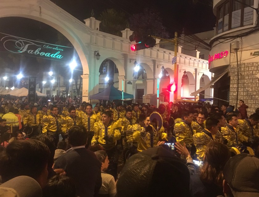
I paid extra to arrive in Sucre in one day and not have to sleep on a bus, and I was rewarded with the biggest fiesta of the city – the celebration of the Virgin of Guadalupe – which happened to be closing that night with a huge parade through the town – They said it had been going since 11am!
The best way to describe it would be “it’s not done till it’s overdone”.
Just when I thought I’d seen the craziest costumes and best music, something crazier came next.
By 10:30pm many of the people marching were so tired and/or drunk they could barely walk and hold their eyes open.
I found anticuchos and, for the first time in South America, street pizza made in a portable oven.
The bands played and as they came closer and got louder it became impossible to not dance and join the fun.
People from the crowd hopped into the middle of the parade to take selfies with the marchers. The marching band played a pop song and the crowd went wild. If the US marching band kids got to lead the town’s parties like this, they would be more popular than the football players.
(Shout out to Megan Eileen-this reminded me of your wedding, proof that you really did it right!)
The partying here is insane. It goes into the night and once you are tired the band just plays louder and they drink more and it just keeps going. Work hard play hard.
The best way to see a city is to do a run or bike ride through it, so in the morning I put on my running shoes (the only pair of shoes I brought this trip) to do a run through Sucre. The predominant style was houses with tiny balconies and hanging plants.
Between the paved main roads were cobblestone streets and lots of public green spaces. Having heard that Sucre was small, I found it much bigger than I had imagined, with many major thoroughfares throughout the city.
I ate lunch in the “Mercado Central” where there were about 20 food stations all serving the same options and each yelling the popular dishes they served trying to convince visitors to come to their restaurant (despite the fact they all were serving the same thing.)
I randomly chose one and say at a table with a young couple with a baby. We chatted and I asked if they attended the parade fiesta the previous night. Being from Sucre, they had attended the fiestas when they were younger but now they tried to avoid the crowds. They explained that students from different organizations in the universities from different parts of the country typically were the ones that dressed up and marched. Before leaving, they asked the server/cook/owner for an extra cup and then poured me a drink of their soda, generously leaving me with a parting gift.
The next day for lunch, I chose a different restaurant and sat at the table with an older, expressionless man that didn’t smile. I wondered if I should even try to talk to him… but of course I did. And after chatting a while he opened up and I learned that he has a daughter and a son in the US. In the end, he gave me a really sweet and very warm smile wishing me well as I left.
Next up, sight-seeing around Sucre…stay tuned!
Famous Footnote:
*As my friend from the taxi said… “Sucre is incredibly safe. With the fiesta you have to be careful – it is less safe because of pick pockets taking advantage of crowds, like in any place, and also drunk people can do stupid things. But Sucre is generally a safe place, and while there is the possibility of pick-pocketing, you won’t be robbed, you won’t crime of force.”
One of the cool things about traveling is meeting other travelers. I have met people from so many different countries, each with their own itinerary, their own purpose of traveling, their own way of traveling, and their unique perspective on the people and places they are seeing.
Many people have some artistic and/or social goal as their vessel carrying them through their travels and guiding them along the way, like me and my blog-writing project.
Like Lucas, the photographer from Denver who was trying to capture photos of people who still maintain some practices from their indigenous ancestors and who hopes to be able to portray their culture in cool ways so that it is enticing to youth to learn and preserve their culture. (He was just the second other American I have met so far traveling!)
And like Noel from Switzerland who is traveling volunteering. She hasn’t seen all the tourist sites in Peru but rather has spent more than a month in two sites, volunteering and getting to know the place and the people on a deeper level. First she did a volunteer program in Trujillo that she paid quite a bit for but didn’t actually receive much help from the organization she paid, and finally towards the end of her 5-week stay she started to get a feel for how she could actually be of service to the community. Here in Iquitos she did a 19-day boat ride with 9th wave along the Napo river border with Ecuador where they stopped at communities along the way. There she connected with one community and decided to stay for about 5 weeks to teach English, now that she would be able to use what she learned from her first experience to make this one more impactful.
Then there are the parapenters. This couple from France worked on a farm in California to raise money to be able to travel and with that money has been traveling for about 8 months. They are traveling with an extra backpack that has their parapenting gear because everywhere they go, they look for spots to go paragliding. Since there’s a whole community of people who paraglide, It’s also a great way that they are able to meet locals in each place they go as well as meeting other travelers from around the world who paraglide.
And recently I met a 26-year-old Swiss woman who looked suspiciously Latina… and it turns out that she was born in Colombia and adopted by a Swiss family when she was 6 years old. She doesn’t remember her life before adoption, including didn’t remember any Spanish, so she had come to Colombia to attend a Spanish school in Cartegena. Having finished classes, I met her when she was speaking Spanish quite well! She is a nurse and had taken a month off to volunteer at a clinic in Peru and then travel a little around Colombia to know her homeland a little more.
These are only a few snapshots of some of the different people I have met along the way and the motives that drive them in their journeys.
Torotoro was an unplanned surprise adventure that I stumbled across in Bolivia and now I can’t imagine my journey without it.
I had never heard of Torotoro until I arrived in La Paz, where two different people recommend it to me within my first day there. My friend Gabriela said I HAD to see because, as a person that likes outdoors adventures, it was a must-see while in Bolivia.
I decided to do the 2-bus journey from La Paz in one day, leaving at 7am and arriving around midnight (due to some bad luck in my layover).*
Heading out of the densely-packed, busy La Paz towards Cochabamba**, the road soon turned into wide open spaces, with a mix of adobe and brick houses, often many kilometers apart. The landscapes were reminiscent of the Peruvian Andes highlands (sierra), from plains to red rock mountains, and then winding through the hills above a valley, with short little bushes dotting the yellow brown hills.
Torotoro is at an altitude of 2,800 meters (9,000 ft) with a rocky mountainous landscape, but also has a very unique look and feel. The colorful and pointy, oddly shaped hills and rock formations may remind an American of the Southwest, especially South Texas, New Mexico, and Arizona, and also parts of the Rocky Mountains. While the temperature is cool, the days were mostly sunny, and it is noticeably 1,000 meters lower than La Paz, giving one a relief from the cold and altitude of La Paz.
In the tiny town of Torotoro, most people wear the typical rural Bolivian dress- women in colorful skirts, and men in pants and a vest. Most people wear brimmed hats (sombreros), though there are different types between the men and women. But there are two unique things I see here that I haven’t seen in other parts of Bolivia (or Peru):
First, a good proportion of people have official work vests, signaling that many people are employed in the tourism industry, working either for the government or a tourism business.
The other, which I absolutely love, is that there are many guys (mostly older men) that wear the typical Andean “chullo” hat with ear flaps, but these chullos have a long pointy top, like an elf hat…and they wear the pointy part standing up! (Sorry, I don’t have photos of the local dress styles.)
Torotoro is such a tiny town, that even though the tourists stay in hotels around the middle of town, integrated with the houses of the locals, tourist activities feel very separate from local activities, and so it has a bit of a tourist town feel.
The locals have a kind of wary-ness towards me, surely from having had many a varying experience with tourists, and it takes a few minutes of conversation for them to relax and feel more comfortable conversing. I tried to chat with a street food vendor who was also serving some locals, and she was really hesitant to talk. Finally, remembering that I was in a Quechua-speaking region, I tried to speak with the little bit of Quechua I had learned in the northern Lake Titicaca island Amantani. “Soma pollo,” (delicious chicken), I told her. “Yosparasunki,” (thank you)! When she realized I was trying to speak Quechua she smiled (half laughing at me) and then taught me to say “Reposa” (bye).
Torotoro is also a national park, and due to the efforts to protect it, they have recently implemented a strict system for visiting the park, where you always have to go with a guide. (You pay 100 Bolivian Pesos for a park entry fee and then you pay separately for each guided tour.)
The system of contracting a guide is interesting because there is a set cost for each guide and you can have up to 6 people in a group with a guide. That means that most people come just before the office opens in the morning and afternoon to look for other people that want to do the same tour so they can form a group of six to split the cost. Sometimes it works out beautifully and sometimes no one shows up to do the tour you want to do. (But for the two most popular tours, even in low season, there were always people in the early morning looking to form a group. The afternoons had fewer people, though I did get lucky my first day and found a couple late in the afternoon to go see dinosaur tracks and the canyon.)
That’s right…dinosaur tracks! Who knew that in the middle of Bolivia, there are dinosaur tracks!???!?
Many businesses use the dinosaur tracks for their marketing strategy
The area used to be swampy area and over the millennia it dried up and turned to rock, preserving tracks of those massive herbivores and vicious carnivores that roamed the area thousands of years ago.
All in one tour (“El Vergal”), you pass dinosaur tracks and walk along an historic river with amazing geologic formations, leading to the majestic Chiflón canyon.
Just when we were about to leave the rim to begin our descent into the canyon, we caught sight of a graceful condor soaring above the canyon…and then another…and then another. They had emerged just in time to paint the already amazing landscape with their graceful flight paths.
We then climbed down into the canyon, passing a lemon-mint smell of the bodje tree, and later transversing the boulder-filled base for about a kilometer until we arrived at some beautiful waterfall cascades with green-blue pools below.
What a refreshing swim in that beautiful canyon pool!
The next day I successfully formed a group of 6 with my two French neighbors and a group of 3 other French tourists wanting to do a full day tour of the “Ciudad de Itas” and the Umajalanta Caverns.
We first took a 4×4 out to the grand rock formations of the City of Itas, and on the 40-minute drive climbing into the mountains, there were four different languages buzzing about in the vehicle – the guides speaking Quechua in the front, the three tourists in the back speaking French, my French neighbors and I speaking in Spanish in the middle, and the tourists in the back speaking to me in English.
The “Ciudad de Itas” was a hike through incredible rock formations and mountains.
Among many cool highlights were an almost completely dark cave-like space with just a tiny slot of light filtering through from above called “cueva del diablo”, and ancient drawings of llamas and the sun and earth goddess/god preserved in the rock in some cave-like spaces.
Do you see the llama?
We were also led through a maze of rock to a secret hiding place that was a kind of hidden canyon between rocks where the natives would hide stolen cattle during the 18th and 19th centuries, before the land reform times. This was when the Spanish had taken over large swaths of land, and a wealthy, well-connected Spanish “patron” would run an agricultural businesses on “haciendas” (large farms), often practically enslaving the locals while making profits exporting products across the country or abroad. (Again I was grateful for having read Isabel Allende’s “House of Spirits” to have a sense of the history around this time period.)
Another point of interest amidst the rocks was a large opening in a cave-live space in the rocks called the “cathedral” where the locals during Incan times held a gathering to celebrate the gods and goddesses of the earth (Pachamama) and the sun (Tatainti). They would have a type of pot-luck called “A’tapi”, and they would give an offering to Pachamama called “Tcha’lla”.
We also saw photo-luminescent bacteria that glows this green color from one angle but up close it just looks like brown slime on the rocks.
After having climbed to the highest part of the Torotoro area, we then descended below the surface of the earth, to explore the Umajalanta Caverns. While not the most beautiful cave I’ve ever seen, it was definitely the most fun!
Hiking, climbing, repelling, crawling, and scootching through this cave was a fun adventure (and led by an experienced guide and plenty of ropes, it was not as hard or scary as it sounds.) Unfortunately, many of the beautiful formations had been damaged in the decades before it became a protected part of the national park, (due mostly to people not knowing that touching the formations would damage them but also due to some vandalism).
This image is on the 10-boliviano bill
However, there were also signs of hope where the stalagmites and stalactites had started growing again since the cave has been protected for two decades now (since 1989).
I was so happy to have found this little gem in the middle of Bolivia, to explore such a beautiful place, and to support the protection of some natural areas.***
Famous Footnotes
*While I arrived smoothly from La Paz to Cochabamba (other than a hot bus), I had bad luck catching a ride to Torotoro. The buses go “colectivo” style which means they wait until enough passengers come to fill them and then they leave. I waited 3 hours and then it was getting dark and no more passengers were coming so the company passed me off to another company that was supposedly leaving soon but still didn’t actually leave for another hour. I arrived at midnight in Torotoro and needed the next morning to recover from travels.
** Many people told me to “be careful” in Cochabamba. Luckily I had nothing but good experiences with the people there. When I asked at the terminal how to get to the vans for Torotoro, the woman didn’t know so asked a coworker who not only told me which car to take, he flagged down the car and ran the half block to where it stopped to explain to the driver where I was going and to ask him to let me know when we arrived!
***While I would definitely call this an “eco-tourism” experience, the jury is still out on whether it counts as “community-based tourism”. While on the surface it seems to bring some income to many locals, there were rumors that the government actually gets most of the proceeds and that there was a wealthy and foreign family somehow making most of the profits. I wasn’t there long enough to find out to what extent these were true, but even if the government was making profit, they were also employing quite a few people (remember all the vests?)
Side note: There were a few other short tours that I didn’t make it to (like a huge fossilized turtle), so while you can see the biggest attractions in 2 days, it is definitely a place one could stay 3-4 days, especially just to relax in a calm and quiet little village in a beautiful place with a great climate, (though there aren’t tourist attractions outside of the guided tours).
Since I wasn’t able to hike to the Yungas (the lower altitude, subtropical side of the Bolivian Andes) from the mountains, I decided to bike there. In bicycle you can really see the scenery, feel the change in climate, and really experience each moment along the way with all your senses. Sometimes you can even see the change in wildlife along the way.
Since I didn’t know where and how to rent a bike, the easiest and quickest way was to go along with one of the touristy tours that rent you the bike, gear, guide, support van, and transportation to a starting point and back and that advertise the route as Death Road or “the world’s most dangerous road”. Actually called “North Yungus Road” or “Coroico Road”, the route is a windy, steep downhill dirt road that used to be the primary route to Coroico, before they built a new paved route that is supposed to be a little less windy and steep and therefore has fewer incidences of cars going too fast and finding themselves flying off the cliff. (An estimated 300 travelers were killed annually when this was the primary route to Coroico).
As a mountain bike route, it’s not too dangerous since it was designed for cars and so is actually fairly wide. That said, it would be dangerous for someone that isn’t used to biking and tried to ride like a crazy person. I found it to be a challenging but not too unlike many rides I did regularly in Oxapampa. Going with the tour had its pros and cons*, but overall it was awesome, and definitely a great way to get to the lower jungle town of Coroico where I wanted to go.
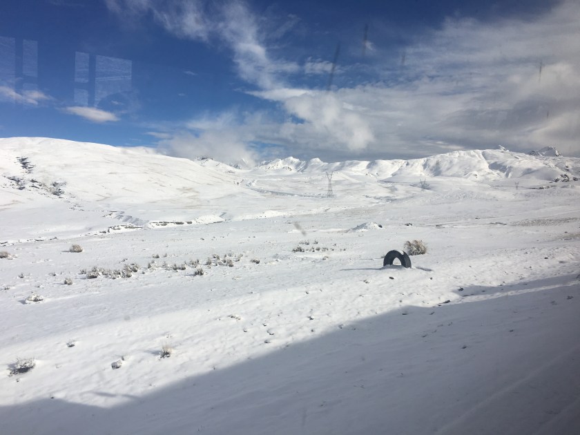
To get to Coroico from La Paz, you first have to pass over the mountains, so the van drove us a few hours to the starting point in the mountains at 4,700 meters (15,400 ft) above sea level. We would then ride down to 1,100 meters (3,600 ft) above sealevel. It had snowed the night before which complicated our arrival to the starting point but made for a beautiful, of very cold, starting point.
From white mountains, freezing fingers, and multiple layers, we quickly descended to green hills, greeted by the smell of the moisture and vegetation characteristic of the tropical jungle, (and making me nostalgic for Oxapampa). The views of the hills and valleys, and the river cutting through the valley below (way below), were indescribable. (Sorry, don’t have photos.)
Arriving in the valley, one perk of going with the tour is that we had access to a beautiful little resort with an all-you-can-eat buffet, rustic showers, and even a pool.
The two guides were also cool. One guy was a medical student and was explaining that to be a doctor in Bolivia, one has to study for 5 years, then do a one year internship in a hospital where they don’t pay you anything, and then ANOTHER one-year unpaid “rural internship” where you work in a rural site in “provincia”. (Ok, so this one’s not completely unpaid – the interns receive 15 pesos bolivianos ($2) per day.) Just when I thought the US doctor training program was not ideal…
As the van then continued back to La Paz, I caught a car for a 15-minute ride to the little city of Coroico. I arrived just as it started to rain, so I spent the evening resting and cooking myself a meal in the hostel.
Coroico is a small town with the streets buzzing with activity. There are many little stores (tiendas) and restaurants on every street, vendors selling vegetables and fruits in the street during the mornings, and kids running to and from school in the mornings and afternoons. At night, kiosks open up selling fried chicken and fries – which seems to be the Bolivian evening meal choice, second only to Silpancho – rice, potatoes, carrots, beets, tomato, chicken fried steak, with a fried egg on top. (To avoid an early heart attack and to be able to sleep at night, I cooked a stir fry of vegetables and quinoa for my evening meals, with the bonus of spending less than I would have eating out.)
The town was small enough that I quickly felt at home there. People weren’t immediately warm – everyone was busy living their lives and didn’t even notice a random tourist walking the streets, which I kind of liked. Often they didn’t even hear me greet them, (or were so surprised at a tourist greeting them that they didn’t know what to do.) But when I did get a chance to chat with someone (like the woman who sold me juice or the guy managing the hotel), they were super nice, chill, and helpful.
I read that there were three main sights to see in Coroico – the stations of the cross that lead up to a chapel on a hill with a nice view, and then from the chapel there are two 4-ish-hour roundtrip hikes – one to a hill that overlooks the city and the other to three waterfalls.
I packed my bag with swim gear, asked a couple of people how to get to the waterfalls, and then headed off, running, following a trail that wound around the side of a few massive hills. I was pretty disappointed when I arrived about an hour later and only saw a tiny fall with nowhere to swim, and it seemed that it was just a water capture point for the city. Maybe an appropriate thing to find, since I’m a water engineer, but disappointing.
So I ran back to the chapel, arrived at 4pm and decided to try to climb the overlook hill. The hill started as an open, desert-like hill covered with rocks, dry grasses, and only short bushes.
After about 30 minutes I was surprised to suddenly enter what was like jungle – thick trees blocking the sky and the smell of moist soil and vegetation. After a few minutes, I emerged again from the jungle and the trail opened up again to less dense vegetation and dried grass, only to turn into jungle again a few minutes later.
When the vegetation cleared, there were incredible views of the valley and the towns down below, including the little city of Coroico, which appeared much bigger from above than it seemed being in the city.
Towards the top, the hill turned into pure jungle, and I was sweating even though it was getting chilly as the sun started going down. Jogging uphill, I was thankful for the extra lung power I had gained being at altitude for almost two weeks. I didn’t want to get caught in the night in the jungle, so I decided I would turn around at 5:45 even if I didn’t make it to the top. I kept thinking I was near the top but would find that there was still more climb. I was pretty sure I wasn’t going to make it to the top, and then magically, at exactly 5:45 I arrived to the clearing at the top of the hill! Win!
The next day, I was just about to leave Coroico and I learned that the waterfall I went to was definitely not the waterfall that everyone goes to. I decided that I couldn’t leave without going to the waterfalls, so I started walking (this time the right direction), and then found a car to take me the rest of the way. When I got to the waterfall, I decided it had definitely been worth it! There was not much water in the cascade because I arrived just at the end of dry season, but there was a beautiful pool under the falls calling my name, (and two guys swimming there also calling me to join them).
The guys were from La Paz and had come out for the weekend just to enjoy this specific spot. With little hesitation, I was soon splashing around in the pool beneath the waterfall with them. Within a few minutes, another guy from La Paz showed up – he was showing around a friend from Quito, Ecuador who had come to visit Bolivia for a few weeks. We all became friends for the afternoon and I even ended up catching a bus back with the Ecuadorian woman and her Paceño friend.
Turns out that Coroico, and specifically the falls, are a nice little weekend escape for Paceños. With its warm climate and green hills, it’s a nice escape from the cold, altitude, and busy, tree-less city. I’m so glad I went off the beaten path to find this little gem (and to make a few more friends along the way)!
Ignore the jacket…it was actually warm in Coroico, but after swimming in the cold falls I needed to warm up
Famous Footnotes/Bonus Content
* The pros of going with the mountain bike tour were the sag wagon and the food included, but the cons were the cost (it was outside of my low budget but I gifted myself that day), and that it was so touristy that the group had to stop every few minutes so the guides could take photos of each person to later send us.
**I somehow lost my water bottle in the car that I took to the waterfalls, and I was pretty bummed, but then the driver showed up at the falls within 5 minutes, having noticed that I left it. Good, kind people in Coroico!
***Often when I mentioned that I went to Coroico, Bolivians asked me if I saw any black people. Actually, I didn’t. But Coroico is apparently part of the area where many African slaves were brought to work on haciendas and so many Afro-Bolivians live in the surrounding areas.