I never would have thought that my travels through South America would include going to a theme park! But the best part about traveling is the surprises!
Parque Nacional Chicamocha (Panachi) is a theme park in Santander, Colombia built above the Chicamocha river valley and probably has the best views of any theme park I’ve ever been to.
One of its main highlights is the teleférico (elevated cable car) that takes you down into the river valley, floating above the river, and then back up to a mountainside across the river. (If you know how much I love teleféricos, you know I couldn’t pass this up!)
When you arrive on the mountain on the other side, there are restaurants with typical food from the Santander region, snacks, souvenirs, and you could even do a virtual reality session.
I ordered the mute (pronounced “mootay”)
Another highlight is the water park literally on the side of a mountain, with an amazing view overlooking the valley, with a mountain backdrop in the distance. (If you know how much I love swimming, you know I couldn’t pass that up either!)
There were a couple of water slides, a lazy river, different pools, and a few water park areas for kids.
Panachi also has different “xtreme” experiences like a bungee-jump type experience, swings that swing you over the side of a cliff, zip-lines, etc. all paid for separately.
It was really cool to see how some Colombian families spend vacation, and to see people out having fun! (And it was also cool that there weren’t a ton of people because I went during low season!)
Like many of my experiences here in Colombia, the park has a funky schedule (closed Monday and Tuesday during low season), and the teleférico also has its own schedule. I was surprised when they had told us we’d return from the teleférico in 2 hours; I thought it was just a really long ride … until they dropped us off on the other mountain after a 30-minute ride and left us there for an hour until it fired back up again to deliver us back to the park.*
Overall, it was a fun day, and highly recommended, for anyone, but especially as a family outing!
Famous Footnotes:
Still, 3+ years in Latin America and I still get surprised at things done differently. Some things get lost in translation, and some things just aren’t explained well or in a context that I understand, and I forget that sometimes one has to ask a lot of questions to clarify things. But, I have learned to appreciate surprises, go with the flow, and not stress (or stress less) when things don’t go as I planned or as I expected. And that is a gift that I value more than gold!
The prize for the cutest, most beautiful, quietest-without-being-boring, small town goes to … Guatapé, a small town two hours from Medellín.
When I stepped off the bus, I was greeted by a few colorful buildings and thought “how cute”. But then I began walking through the streets in search of lodging, and I realized this was a city like no other. There weren’t just a few cute and colorful buildings, but looking down every single street my eyes were rewarded with a burst of color – and not tacky colorful houses but really cute, orderly and coordinated colors that made the atmosphere of the whole town feel pleasant.
Turns out, this Colombian lakeside town of 5,000 people is known as “la ciudad de zócalos”, because of the colorful, artistic baseboard decoration on the outside of each house.
The decorative band of designs typically depicts an aspect of daily life, history, or the homeowner’s or artist’s interests.
Though sometimes they are just colorful designs accenting the colors of the house.
The town reinvented itself in the 1980’s after the construction of a dam protected it from future flooding, and the town came together with the idea to adopt this signature style throughout the whole town. The result of their unified efforts is astounding.
This quiet town, 2 hours from Medellín is a popular weekend getaway for Paisas and a common stop for international travelers.
It is quiet most days of the year, except during the approximately 12 holidays of the year – during a holiday, the population explodes from 5 thousand to up to 15 or 20 thousand as visitors flood in from Medellín or other parts of the country. On the busiest days, there isn’t enough lodging and people have to return to Medellín for the night.*
I am not at all surprised at the popularity of Guatapé as a relaxing weekend escape.
First, it is most famous for “la piedra”, which is a tall rock rising above the landscape, offering an incredible view of this interesting lake-filled region.
The town has built stairways of 659 stairs up to the top of the rock and charges an entrance fee. While the touristy part at the entrance and the top didn’t appeal to me much, many would appreciate the opportunity to buy a cold drink or souvenirs, especially those who just do a day trip to the area. Either way, the view at the top is well worth the climb. It was really unlike anything I’d ever seen.
Back down on the ground, you could do lake activities like paddle boats, kayaking, going out in big boats, or renting jet skis.
You could walk or bike to the monasteries (one for women and one for men, though only the one for men was active).
You could rent a bike and do a loop around Guatapé, which of course is something I chose to do.
And this is where I really got a sense of how chill this town is. The bike rental place rented me a bike with zero collateral. I just wrote my name on a paper and said I’d bring the bike back before 6pm and they gave me a bike and helmet and said I could pay when I got back.
I got another feel for the small town life the day I walked around town and got my haircut. In the salon, I was greeted by a mestizo guy who informed me that the stylist was finishing lunch, and as we chatted I realized he was a neighbor just hanging out there. He was proud to be a Paisa, and enjoyed explaining to me how friendly they were.
While the woman was cutting my hair, two black teenagers came in and the woman greeted them enthusiastically. Turns out they were from Guatapé, but one was visiting from Medellin where he had gone to study. The woman had an aunt-like manner with the young neighbor boys, highlighting for me that small-town feel where everyone knows everyone and looks out for everyone.
In addition to the mix of mestizos and blacks (seen all over Colombia not just in Guatapé), the majority of people tending the restaurants (and those managing my hostel) were Venezuelan – also a common occurrence throughout Colombia right now.**
Turns out that I was in Guatapé at just the right time too … I was safely enjoying small-town life during the planned protests in Colombia this past weekend (21 Nov). While some of the bigger cities experienced cases of looting or disturbances that led to curfews, things in Guatapé were calm and quiet.
I am so lucky to have experienced this little gem in the middle of Colombia! Hopefully you will one day too!
Famous Footnotes:
*Oxapampa, twice as large as Guatapé with an urban population of 10,000, experiences a similar phenomenon during holidays as Limeños flee to the rural city looking for a quiet, nature-filled, relaxing holiday. Ironically, in both Oxapampa and in Guatapé, this surge of tourism turns the quiet town into a busier and noisier city – though still much quieter and relaxing than Lima or Medellín.
**As a neighbor to Venezuela, Colombia has received around 1 million Venezuelan immigrants in the last two years due to the economic crisis there.
Since I wasn’t able to hike to the Yungas (the lower altitude, subtropical side of the Bolivian Andes) from the mountains, I decided to bike there. In bicycle you can really see the scenery, feel the change in climate, and really experience each moment along the way with all your senses. Sometimes you can even see the change in wildlife along the way.
Since I didn’t know where and how to rent a bike, the easiest and quickest way was to go along with one of the touristy tours that rent you the bike, gear, guide, support van, and transportation to a starting point and back and that advertise the route as Death Road or “the world’s most dangerous road”. Actually called “North Yungus Road” or “Coroico Road”, the route is a windy, steep downhill dirt road that used to be the primary route to Coroico, before they built a new paved route that is supposed to be a little less windy and steep and therefore has fewer incidences of cars going too fast and finding themselves flying off the cliff. (An estimated 300 travelers were killed annually when this was the primary route to Coroico).
As a mountain bike route, it’s not too dangerous since it was designed for cars and so is actually fairly wide. That said, it would be dangerous for someone that isn’t used to biking and tried to ride like a crazy person. I found it to be a challenging but not too unlike many rides I did regularly in Oxapampa. Going with the tour had its pros and cons*, but overall it was awesome, and definitely a great way to get to the lower jungle town of Coroico where I wanted to go.
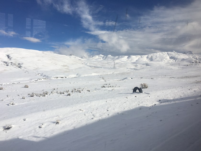
To get to Coroico from La Paz, you first have to pass over the mountains, so the van drove us a few hours to the starting point in the mountains at 4,700 meters (15,400 ft) above sea level. We would then ride down to 1,100 meters (3,600 ft) above sealevel. It had snowed the night before which complicated our arrival to the starting point but made for a beautiful, of very cold, starting point.
From white mountains, freezing fingers, and multiple layers, we quickly descended to green hills, greeted by the smell of the moisture and vegetation characteristic of the tropical jungle, (and making me nostalgic for Oxapampa). The views of the hills and valleys, and the river cutting through the valley below (way below), were indescribable. (Sorry, don’t have photos.)
Arriving in the valley, one perk of going with the tour is that we had access to a beautiful little resort with an all-you-can-eat buffet, rustic showers, and even a pool.
The two guides were also cool. One guy was a medical student and was explaining that to be a doctor in Bolivia, one has to study for 5 years, then do a one year internship in a hospital where they don’t pay you anything, and then ANOTHER one-year unpaid “rural internship” where you work in a rural site in “provincia”. (Ok, so this one’s not completely unpaid – the interns receive 15 pesos bolivianos ($2) per day.) Just when I thought the US doctor training program was not ideal…
As the van then continued back to La Paz, I caught a car for a 15-minute ride to the little city of Coroico. I arrived just as it started to rain, so I spent the evening resting and cooking myself a meal in the hostel.
Coroico is a small town with the streets buzzing with activity. There are many little stores (tiendas) and restaurants on every street, vendors selling vegetables and fruits in the street during the mornings, and kids running to and from school in the mornings and afternoons. At night, kiosks open up selling fried chicken and fries – which seems to be the Bolivian evening meal choice, second only to Silpancho – rice, potatoes, carrots, beets, tomato, chicken fried steak, with a fried egg on top. (To avoid an early heart attack and to be able to sleep at night, I cooked a stir fry of vegetables and quinoa for my evening meals, with the bonus of spending less than I would have eating out.)
The town was small enough that I quickly felt at home there. People weren’t immediately warm – everyone was busy living their lives and didn’t even notice a random tourist walking the streets, which I kind of liked. Often they didn’t even hear me greet them, (or were so surprised at a tourist greeting them that they didn’t know what to do.) But when I did get a chance to chat with someone (like the woman who sold me juice or the guy managing the hotel), they were super nice, chill, and helpful.
I read that there were three main sights to see in Coroico – the stations of the cross that lead up to a chapel on a hill with a nice view, and then from the chapel there are two 4-ish-hour roundtrip hikes – one to a hill that overlooks the city and the other to three waterfalls.
I packed my bag with swim gear, asked a couple of people how to get to the waterfalls, and then headed off, running, following a trail that wound around the side of a few massive hills. I was pretty disappointed when I arrived about an hour later and only saw a tiny fall with nowhere to swim, and it seemed that it was just a water capture point for the city. Maybe an appropriate thing to find, since I’m a water engineer, but disappointing.
So I ran back to the chapel, arrived at 4pm and decided to try to climb the overlook hill. The hill started as an open, desert-like hill covered with rocks, dry grasses, and only short bushes.
After about 30 minutes I was surprised to suddenly enter what was like jungle – thick trees blocking the sky and the smell of moist soil and vegetation. After a few minutes, I emerged again from the jungle and the trail opened up again to less dense vegetation and dried grass, only to turn into jungle again a few minutes later.
When the vegetation cleared, there were incredible views of the valley and the towns down below, including the little city of Coroico, which appeared much bigger from above than it seemed being in the city.
Towards the top, the hill turned into pure jungle, and I was sweating even though it was getting chilly as the sun started going down. Jogging uphill, I was thankful for the extra lung power I had gained being at altitude for almost two weeks. I didn’t want to get caught in the night in the jungle, so I decided I would turn around at 5:45 even if I didn’t make it to the top. I kept thinking I was near the top but would find that there was still more climb. I was pretty sure I wasn’t going to make it to the top, and then magically, at exactly 5:45 I arrived to the clearing at the top of the hill! Win!
The next day, I was just about to leave Coroico and I learned that the waterfall I went to was definitely not the waterfall that everyone goes to. I decided that I couldn’t leave without going to the waterfalls, so I started walking (this time the right direction), and then found a car to take me the rest of the way. When I got to the waterfall, I decided it had definitely been worth it! There was not much water in the cascade because I arrived just at the end of dry season, but there was a beautiful pool under the falls calling my name, (and two guys swimming there also calling me to join them).
The guys were from La Paz and had come out for the weekend just to enjoy this specific spot. With little hesitation, I was soon splashing around in the pool beneath the waterfall with them. Within a few minutes, another guy from La Paz showed up – he was showing around a friend from Quito, Ecuador who had come to visit Bolivia for a few weeks. We all became friends for the afternoon and I even ended up catching a bus back with the Ecuadorian woman and her Paceño friend.
Turns out that Coroico, and specifically the falls, are a nice little weekend escape for Paceños. With its warm climate and green hills, it’s a nice escape from the cold, altitude, and busy, tree-less city. I’m so glad I went off the beaten path to find this little gem (and to make a few more friends along the way)!
Ignore the jacket…it was actually warm in Coroico, but after swimming in the cold falls I needed to warm up
Famous Footnotes/Bonus Content
* The pros of going with the mountain bike tour were the sag wagon and the food included, but the cons were the cost (it was outside of my low budget but I gifted myself that day), and that it was so touristy that the group had to stop every few minutes so the guides could take photos of each person to later send us.
**I somehow lost my water bottle in the car that I took to the waterfalls, and I was pretty bummed, but then the driver showed up at the falls within 5 minutes, having noticed that I left it. Good, kind people in Coroico!
***Often when I mentioned that I went to Coroico, Bolivians asked me if I saw any black people. Actually, I didn’t. But Coroico is apparently part of the area where many African slaves were brought to work on haciendas and so many Afro-Bolivians live in the surrounding areas.
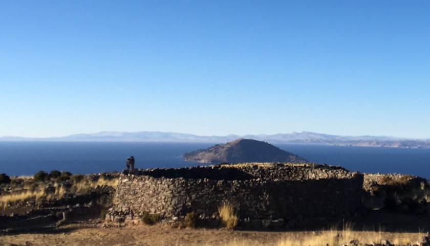
La Isla del Sol is the biggest Lake Titicaca island, and it is also the most visited by tourists, due to its convenient location just a 2-hour boat ride from Copacabana, the popular tourist stop between Bolivia and Peru.
It is apparent that the island has developed around tourism – there is an abundance of lodging (hospedajes) and restaurant options, and even signs pointing the way to tourist points of interest like overlook points.
You know international tourists come through a place in Bolivia if you find a pizza restaurant, and there are a ton of pizza restaurants on Isla del Sol.
I was really struck by the beautiful architecture and especially the facades of many of the hospedajes, most of which incorporated rock or pebble to adorn traditional adobe construction.
It is also close enough to the mainland peninsula (with a tiny tree-covered island in between), that it is connected to the electric grid of the mainland, unlike Isla de la Luna, which relies on solar panels.
Isla del Sol has three different communities and is less densely populated than Amantaní, with approximately the same population but spread throughout the 14-square-kilometer island (compared to Amantaní’s 9-square-km). (But both much larger than the tiny 1-square kilometer Isla de la Luna with just one community of 27 families).
Just like the other two islands I visited, the geography is that of a mountain rising out of the sea…er, lake. (It is very easy to forget that I am on a lake and not the sea!)
The point is that everything is uphill from the shore. And even walking around from place to place on the island is like hiking in the mountains – a lot of up and down (which always feels like there’s more up than down) at 3,800 meters of altitude.
The boat I came in arrived at the port Pilko Kaina with Incan ruins to explore.
From there to the rest of the island was a surprisingly long climb up.
I really wondered if I was going the right way and if all this climbing was going to be worth it in the end. But I persevered, meeting some friends and some awesome views along the way.
I eventually wandered upon two other lost tourists and soon we came to a house which turned out to also be a fancy restaurant on the edge of Yumani, the community most frequented in Isla del Sol and full of restaurants and hospedajes.
They stayed to enjoy some gourmet food while I continued along in search of a place to stay the night and a cheaper lunch since I was on a really tight budget, and running low on cash at this point.
The site where I did eat lunch was indescribably beautiful. The view of the lake was breathtaking (literally and figuratively at 4000 meters above sea level)… so blue, and so immense, stretching as far as the eye could see. The only sounds were a few birds and a distant conversation in Aymará, with the light sea, er, lake breeze whispering past my ears. Ultimate peace.
And it was the best meal I’d had since Amantaní – fresh trout from the lake with some fresh veggies.
Later, heading to the lookout point to catch the sunset I met and chatted with a local woman selling souvenirs who appeared slightly younger than me and who had curious and rowdy 2- and 4-year-olds. She had lived in São Paulo, Brazil and so not only spoke Aymará (the local language on the island) and Spanish, but also Portugués from her time in Brazil. She had returned to Bolivia because she said they had been treated like second class citizens, her husband robbed at gunpoint a few times, and other Bolivian migrant friends injured or killed…she said her experience was that there was no justice as the government didn’t really value their lives, safety, and rights as immigrant workers. (USA, can we please not be like that???? Pretty please.)
After doing yoga and watching the sunset with her and her kids, I headed to another overlook point.
There I met a super sweet couple – a Spanish woman and an Argentine who ended up staying two extra nights and exploring the whole island (even the northern part which we had been told could be dangerous because of an inter-community conflict that started two years ago), and they said it was incredibly beautiful!
Unfortunately I was running low on cash and had to return to Copacabana the next morning to change money and continue my journey. So, after a delicious dinner of trout from the lake (yes, again!) I headed to my hospedaje and had my last peaceful, Lake Titicaca island sleep.
The next morning, after watching the sunrise and eating breakfast, I headed down to the dock, past the Fuente del Inca and saw the grand island entrance to the Yumani community.
I had the pleasure of chatting with a few local women while waiting for my boat. This might have been one of the highlights of my stay here. Using my handy language chart, I practiced my Aymará with them, and we were all highly entertained (even if they were laughing AT me not WITH me at times!) Similar to Isla de la Luna, most people have their farms where they grow the typical sierra (highland) crops- quinoa, wheat, corn, and a variety of potatoes, and animals (mostly sheep), while the income from tourism helps provide something extra.
With a farewell photo, I said “juspara” (thank you) “jakisiñkama” (goodbye)! and boarded the boat for my last ride across the majestic Lake Titicaca.
Every morning at 8:30am, boats full of tourists leave Copacabana heading to Isla del Sol, with an option of stopping for an hour at Isla de la Luna. Planning just to go to Isla del Sol and stay the night, I boarded a boat and met up with the two traveler friends from London and Italy that I had met in my hostel.
It was a beautiful 2 hour boat ride and I even saw some little fish swimming along side of the boat. Instead of getting off at the first stop at the Isla del Sol, I stayed on with my new friends to go to the Isla de la Luna.
The boat only stops for an hour at Isla de la Luna and the guide on the boat says there’s not much to see there and you can do it in an hour…and they only give you an hour before the boat leaves to go to the Isla del Sol. And if the boat leaves without you, you’re stuck in the island until the next day because the boats only come once a day for an hour.*
Entering the island the smell of muña caught me by surprise and reminded me of my stay in Amantaní, the island in the north part of the lake. As I was walking up the stairs to enter the island with the other tourists, I passed a little 4-year-old boy who, without prompting, greeted me saying “Hi, my name is Miguel Ángel”! It was so adorable!
I started exploring late because I chatted for about 10 minutes with the guy who was charging for bathroom use, geeking out about the water and electricity access on the island. (Islands have always fascinated me because they present unique infrastructure challenges ripe for alternative energies and exploring the idea of sustainability.)
Geek out about the island’s infrastructure:
They used to not have power but now they use solar panels (“because the kids want their cell phones. And also tv.”) He said the panels are great but the batteries only last a couple of years and they have to be careful not to let them drain to zero or they stop working well. They use what look like basic car batteries that charge during the day.
They also have solar hot water heaters in most of the houses.
They use water from the lake but have to buy gas to power the pumps that pump the water up from the lake. (They charge for the bathroom in part to cover costs of the gas).
End Geek-out.
Finally, I headed up the hill to the ruins of the “temple of the virgins”, which was supposedly a type of boarding school for young women to learn to do womenly things in the Incan times.
There, I met an older woman from the island who explained that life living on Isla de la Luna is really calm and peaceful, and she liked it much better than the city (La Paz) where she lived for a few years. Here they grow their food, have a few animals- (llamas, pigs, chickens, sheep), they have fish farms within the lake, they and buy what they don’t have on the island from Copacabana. There’s a primary school and a church and a football field – everything they need, she said.
As I started to hike the hill from the temple to see what was on the other side of the island, I passed a woman knitting in the shade who asked if I was going to stay the night in the island.
“That’s an option?” I asked her.
Part of my travel purpose is to go off the beaten path and get to know some places and the people that live there… so when she said that her mother owned a hospedaje, I negotiated a price to include my meals, and I decided to stay the night instead of going back with the boat to Isla del Sol.
The boat companies from copacabana don’t promote the fact that there are hospedajes on the island, (maybe because it’s a tiny island and most tourists want more entertainment and conveniences? I don’t know.)
But if you are looking for a quiet and incredibly beautiful place to pass 24 hours (or more), where you can chat with one (or a few) of the 27 families that live on the island, learn about their daily lives, and walk along the perimeter of the 1-square-km island in the afternoon sun…then it’s worth the stay.
The tourists only come one hour per day, at the same time every day, and the community rotates selling things, collecting the entrance fee, collecting bathroom fees, and helping/keeping an eye on the tourists.
On the other side of the hill, and down the length of the island are the houses where the community (called Coati) lives…So the tourists only see the ruins and a view of both sides of the island from the top of the hill, but don’t see or go into the community, unless they stay the night.
The community of Coati, Isla de la Luna
The hospedaje where I stayed overlooks the lake, with a little pier extending into the lake. In the patio between the rooms are beautiful plants with flowers and the constant buzz of bees that I even hear from inside he room.
The quiet lapping of the waves on the shore can also be heard from inside if you listen closely.
This half of the island, the opposite side from where the tourists land, smells of muña for parts and eucalyptus for other parts.
I loved chatting with the woman who owned the hospedaje. It challenged my conversation skills a little because she wasn’t super talkative, but every time I asked her a question I saw her face light up a little and I felt her open up a little more, like she viewed me with a little less skepticism each time.
She commented that the president/government built part of the hospedaje last year (or at least convinced them that he did so they’ll vote for him at the end of this year), and the alcalde bought the water pump. The entrance fee to the island goes towards paying the locals to do restoration of the ruins or other community-based things.
The woman has 5 kids, one still living here on the island, a few in Copacabana and a few in other cities, but she’s content because they talk on the phone. When she first moved here with her husband (who is from here), there wasn’t running water or electricity so it was a rough adjustment for her, but she adapted, and now it is much easier with the solar power and pumped water. She feels at home now and likes that it’s quieter with less people than where she grew up, (in a community on the peninsula).
We chatted as the sun set over the pier, and she told me that tomorrow would be her turn to sell her artesanías in the temple so I would see her there when I leave.
In the morning, heading back over the hill to the other side of the island, I saw the little boy from the previous day, Miguel Ángel, walking with his mother, taking their sheep out to graze. She had a few of them on a leash, and the similarity to people walking their dogs in the morning made me smile. A few loose sheep stopped to eat and wouldn’t follow her so she sent Miguel Ángel to collect them, and I went to help herd sheep, while the talkative, friendly boy told me stories of his sheep.
This visit had a different feel than my stays on Ccotos and Amantaní, mostly because the business arrangement is different. Here, they are following a more traditional hotel-type tourism model, where the host is simply providing a space to stay, and doesn’t even live in the same area where the guest rooms are. Whereas in Amantaní and Ccotos they are following a homestay model where the tourist is a little more integrated into the daily life with the host – through sharing meals and sometimes community events, in addition to the guest rooms being more physically close to where the family lives and considered part of the family’s house.
While I personally preferred the homestay model and the culture-sharing atmosphere it fosters, I still greatly enjoyed my stay here. There aren’t many words to describe the peacefulness and beauty of this place, but hopefully you can catch a glimpse of it through the photos!
As I left the island in the morning for Isla del Sol, I saw the snow-covered peaks of the Cordillera Real in the distance, a reminder that I was on a lake in the middle of the Andes, not the ocean, and a foreshadowing of my future travels through Bolivia.
Famous Footnotes
*If you really needed to leave the island, you could pay a local a very high price to take you in a private boat to Isla del Sol or the mainland.
Copacabana, Bolivia is a tiny little border town on the coast of Lake Titicaca, just 30 minutes from the Peruvian border. It’s a popular tourist stop between the two countries, and that is evident by the fancier and pricier restaurants and hotels geared towards international travelers on two of the streets running from the plaza to the port, where the boats take off to visit Isla del Sol and Isla de la Luna.
Walking down these streets you hear people calling out insistently, “Isla del Sol! Isla del Sol!” “La Paz!” trying to sell tickets, competing with the 20 other people on the street doing the same (even though there seems to actually only be about 3-4 different actual companies. It’s an interesting system that I never fully understood.)
Copacabana had quite a few attractions but I only took advantage of really checking out three.
Trying to adjust to the altitude, just before sunset I ran along the coast of the lake and (ran-walked) up the famous Calavario hill, which is the hill overlooking the town and the lake with the
stations of the cross at the top. Watching the sun set over the lake while doing yoga was … indescribable. Like looking at a beautiful painting while doing yoga, only better. It was the most beautiful moment in Copacabana.
Copacabana is also famous for its Cathedral, and for blessing cars. Yep, you read that right. People bring their cars to Copacabana to get them blessed, a service offered every morning by the local priest.
But the cars have to look good for their baptism so there’s a whole series of tents set up to sell flowers and decorations for the cars in front of te cathedral every morning.
I happened to be there during a Peruvian holiday so I actually saw more Peruvian plates than Bolivian plates, as Peruvians took advantage of the 4-day weekend to cross the border and visit Bolivia.
I was staying at a really cozy hospedaje that I would recommend for people on a low budget: Hostal Sonia. I got quite a bit of writing done in one of the great common areas with natural light and a view of the lake.
I was surprised to hear the garbage truck drive by playing the same “reduce, reuse, recycle” song that the garbage truck in Oxapampa, Peru plays! (The garbage trucks play music so you know when they’re coming and can run out to put out your trash if you haven’t already.)
While I heard about a few other cool things to do in Copacabana, (like Hora del Inca, a pre-Incan astronomical observatory(!), Baño del Inca, and the nearby Kusijata with archeological stuff), I didn’t get a chance to check them out…next time. But I did hop in a boat full of international tourists to go visit Isla del Sol and Isla de la Luna.
On the many different boat rides over the next few days, I met some really great fellow travelers, who gave me great tips on logistics and trip planning, including another lone woman traveler from France, a brother and sister from Italy, a couple from France, three university students from Spain, two older women from Spain, and a couple from La Paz who were also chemical engineers working in the environmental field! (Needless to say, we geeked out, and they also showed me a good, cheap spot to eat they had found in Copacabana).
While Copacabana was much more touristy with little to none of the tranquil, community experiences I had come from in Peru, it was a good experience, and I loved connecting with other travelers!Next up…I will get a taste of the islands in the southern, Bolivian side of Lake Titicaca: Isla del Sol and Isla de la Luna.
Sometimes we travel long and hard to arrive at our destination. And then sometimes the journey itself is so beautiful and interesting that it is part of the destination.
Getting to Amantaní is one of the latter. The hour-long motorboat ride through the lake was was both fascinating and relaxing at the same time. A vast expanse like the ocean, but calm, with only minuscule waves, passing islands along the way that I had seen from the shore just a day before…and passing the shore that I had been on just the day before, staring out to where I now was in a boat!
When I arrived at the dock, I was greeted by a smiley and warm, short and round woman who introduced herself as Silveria, the wife of Romulo, with whom I had organized the stay. She led me up a steep sidewalk with many stairs along the way, and after just 5 minutes I was huffing and puffing with my 15 kilos of backpacks and just my second day in the altitude. But luckily, we had already arrived!
Their house is located close to the dock, and my room had big windows with an incredible view of the lake!
Just like in Ccotos, in the shade it’s cold and I need my 2-3 layers, but sitting in the sun for a few minutes I could wear just a long-sleeve or sometimes short sleeve t-shirt, so I sat in the sun while Silveria prepared lunch.
Chatting over a delicious lunch of local varieties of potatoes, an assortment of vegetables, and local bread, I learned that Silveria had run from one side of the island to the other in the morning, first helping her step-mom on her farm, then working on her own farm on the other side of the island, and then running to the dock to meet me. She said it took her about 30-45 minutes to run from each side of the island to the other.
Over lunch, we shared stories, getting along so well that we even began sharing about our childhoods and a summary version of our life stories! After a rough childhood, she was very happy to have a peaceful life with a nice house and a nice husband, living a good life without want. She reminded me of a sweet and hospitable southern woman, someone who had grown up in a machista culture and had a rough childhood but had made a better adult life for herself and lived constantly thankful for what she has now, moving and speaking in a manner that was both self conscious and humble, yet confident in its own way.
In Amantaní, similar to Ccotos and the surrounding areas, people’s first language is Quechua because that is what is spoken in the home. I asked if Quechua was taught in school, and the response I got was, “No, everyone knows Quechua so they don’t need to study it in school.” I was told that typically children speak only Quechua until age 5 when they begin going to school, where they start learning Spanish and school is pure Spanish.
It was interesting to me that, while speaking to Silveria, she was quite self conscious of her Spanish, even commenting that my Spanish was better than hers (though as we talked more and became more comfortable talking, her Spanish flowed more and more fluidly.)
In the late afternoon, Silveria walked me up to the path that led to the highest points on the island-two hills close together, each with a sanctuary to Pachamama* and Pachatata, respectively.
She left me and I continued to climb, slowly, step by step…up to 4,200 meters, my lungs wondering where all the oxygen went, and the temperature dropping rapidly. I was surprised as the land and hills began to give way to water on either side (apparently I had forgotten I was on an island).
My plan was to watch the sunset from there, but the clouds rolled in cutting it short. What I did find as I got closer to the sanctuaries was a ton of tourists! (And a ton of local women selling chullos* and sweaters and crafts and souvenirs all along the paths)! The tourists had all come out from hiding wherever they were staying on the island, and everyone had come to watch the sunset up here.
I got a little confused getting back to the house, and as I asked an older man who was walking with a child, he sent the little girl to walk me to the corner where I needed to turn. I found this simple reaction to be so strange and so kind – but very different from most places where everyone is in a hurry and busy with their own things and also worried about sending kids off alone, even for a few blocks.
That night over dinner, speaking with Romulo, I learned that the island is actually quite organized around the home-stay tourism and they usually partner with tour companies who bring in large groups of tourists at a time. The community is divided into 10 communities, and each community rotates being the host of a group of tourists, with each family in the community offering space in their house and meals to the visitors. Each community also has a community center where they perform traditional dances and have a party with the group of tourists. (I had bypassed this system, contacting Romulo directly, and he said this was a much better deal because he directly receives the payment, and they even have a problem with one tour company that never paid the island for hosting a group.)
I was really impressed by how organized the island of 500 families was. They meet every Sunday, first the whole island, and then they break into meetings just for each community. Romulo explained that it was their only way to get news since there wasn’t a radio station on the island just for news about the island (though they do get regional radio stations from Puno and Juliaca).
They also coordinate which communities plant which crops when, and they rotate, making sure the land has time to rest. Because of the population and limited amount of land, the island is not self-sustainable and the crops produced are not enough to feed everyone so they do have to buy food from the mainland in addition to what they produce. Because of this, the money brought by tourism is crucial for the residents.
The night was so quiet and peaceful and the stars so incredible!! And it was cold. I didn’t dare shower and I slept under about 6 heavy blankets. Before going to bed, they told me if I had to use the restroom to use the “pee bucket” under my bed instead of trying to brave the cold and go to the bathroom. I had heard of these “pee buckets” from other Peace Corps volunteers that lived in the mountains, but I had never seen them for myself. (Turns out it was just a plastic tub.)
The next morning I took a stroll along the shore…
And then we all had a crepe-like “pancake” breakfast, learning about each other’s families.
Later, Silveria walked me to another spot on the island that the tourists often like to visit, the Inca’s chair. To walk there, I noticed that she took time to put on a nice shawl, and she also brought along her knitting…and continued to knit as we walked there! (I was highly impressed.)
Everything on the island is somewhat of a climb…at this point I realized that as an island, it’s really just a big hill or mountain jutting out of the middle of the lake, with the middle of the island being the high points and the shore the low points, so you really have to climb to get anywhere unless you are literally just walking along the water.
I really fell in love with the island, with its stone paths connecting the 10 different communities. I saw the island to be filled with with trees, houses and farm plots. There are no vehicles – everyone walks. (Though I did see one motorcycle in the two days I was there.)
The Inca’s chair was a beautiful spot on the beach and I camped out there until lunch, writing, and then returned after lunch to watch the sunset.
Dinner was delicious and a really great conversation, including Romulo showing me a photo of Silveria and complimenting her to me (with her sitting there in the kitchen) saying what a beautiful wife he had and what a great cook she was. I practiced a few of the Quechua words they had taught me, commenting that the food was delicious and thanking them for it:
(My Quechua spelling is surely not correct, but that’s how I remembered to pronounce it.)
Muña- the minty-smelling herb that helps with the altitude and stomach problems. We had fresh muña tea every meal!
Before daylight broke the next morning, I left the warmth of the 6 heavy blankets and headed out to run/walk up to the highest point of the island, the sanctuaries to Pachamama and Pachatata, to watch the sun rise and start the day with some yoga and meditation at 4,000 meters (13,000 feet).
Starting at 3,800m, and climbing to 4,200m (13,000 feet) was not a walk in the park and I had to stop to breathe a few times and also take off some layers, but in about 45 minutes I reached the sanctuary and did a few sun salutations because, well, for obvious reasons.
While I was meditating I heard what sounded like a fan motor off to my left. Then I suddenly heard it in my my right ear, I opened my eyes and was amazed to see a hummingbird (“luli”) floating just one foot from my face, checking me out and whispering (quite loudly) in my ear, with its thousands-of-beats-per-minute wing-flapping motor. After 3 seconds it flew away, but left me feeling like I had just received a message from Pachamama delivered by a Chaski* in the form of a hummingbird.
After breakfast, I had to say goodbye, and I mentioned that I was sad to be leaving because I really felt at home with them and was so thankful for their hospitality, and as I saw their faces light up with genuine happiness, I was really touched to have met such kind people that opened their homes and lives to me for a couple of days!
When I had arrived, I had greeted them with the handshake, hug and air kiss that I was used to in Peru, but awkwardly found that they were expecting only the handshake. Out of habit I accidentally made that mistake twice! But upon leaving, they each reached out for a hug, and I felt a special connection to this family and this beautiful island in the middle of the highest navigable lake in the world.
Famous Footnotes:
*Pachamama – the Incan word for mother earth, which is revered with a god-like respect and reverence
*Chaskis were the Incan messengers that traveled the Incan roads delivering messages throughout the Incan Empire
*Luli – what Silveria called the hummingbird – maybe the Quechua or a local word for the hummingbird. She said it was a sign of good luck for my journey
*Chullo – the warm hat with ear flaps commonly used in the mountains of Peru and Bolivia. I learned from Romulo that if your ear flaps have dangly balls like mine, you can tie the earflaps back when you are eating so they don’t get in the way!
On August 21st I officially completed my Peace Corps service, and with my visa expiring within two days, I had to quickly head to the border.
(Which border? Stay tuned in future posts to find out!)
I love traveling, meeting new people, discovering new places, volunteering, (and apparently not making any money) so much that I decided to take this opportunity to make traveling and sharing my experiences with you my job for a few months. You’re welcome.
(Yes, this goes against every workaholic and opportunistic grain in my soul due to my American upbringing, but I hope that it will bring us all joy and be well worth it.)
What do you know about South America? From my experience growing up in the US, the majority of what I knew was from the show “Where in the World is Carmen Sandiego” (read singing the song). Now there’s what we hear in the news… The Amazon Rainforest is being threatened every day…(and now it’s being burned to a crisp!) Then there’s the FARC and drug trafficking in Colombia. The inflation and mass exodus in Venezuela. Maybe you have heard stories of high poverty rates or places where people barely have enough to eat, high levels of malnutrition, no clean drinking water. Or maybe you think of Machu Picchu, Carnival, or Patagonia.
While these are things that make the headlines or call attention to the tourist passing through for a week, they are not what define the people or the place, and they certainly don’t tell even half the story of what life is like living here.
So, in the next few months, I’ll be exploring a few corners of South America, meeting people, getting a taste of the lifestyles, the culture, the landscapes, politics, and the general vibe of the places where I land in my journey. While I’ll certainly be landing in some common tourist spots simply because they tend to be more accessible and able to receive an outsider, I will definitely see what I can do to go off the beaten path or at least explore places less commonly explored.
I have often thought that travel after Peace Corps would be pretty unfulfilling because I will never be able to really get to know a place, the people, the culture, like I did in my service. I went through a whole process of trying to fit in, trying to be more of a local and trying really, really hard to NOT be anything like a tourist. I didn’t want to be looking in from the outside, I wanted to be part of the place, experiencing it from the inside, understanding the reality of the people who live there and how they define the place. And after three years, I really felt like I became a part of my site Oxapampa, as it became a part of me.
So the idea of traveling to a place for just a few days or traveling to places geared for tourists seems kind of superficial. Window shopping. Peeking in from the outside and only seeing a tiny part of a reflection of reality and not getting a chance to see the human part of a place. I certainly don’t like the idea of being seen as a tourist…the foreign, often white person that doesn’t (often can’t) connect with the people because of a language barrier or because they are rushing through a packed schedule to see a bunch of places in a short amount of time. This creates the archetype of the tourist that the locals see – a kind of alien that comes to visit and has money, brings a stimulus to the economy, and will often pay more than the going price for things. Just like the locals rarely see tourists as individuals, the tourists rarely see the locals as individuals but rather as interestingly-dressed humans that are part of another world.
I know that through my travels I will not have the opportunity to get to know a place like I did Oxapampa and parts of Peru, but because I can now speak Spanish and have some experience living in Latin America, I have a few more tools to help me connect on a deeper level with people. I’m going to try to stay in places longer and take more time to get to know people and learn about their lives. I’ll be focusing on finding places where I can do:
Community-based Tourism
Eco-tourism, visiting National Parks and Reserves
Multi-day treks to immerse myself in the different geographies of a place
Voluntourism*
I know I’m still just scratching the surface, but with a few months, a flexible schedule, and the right mindset, I hope to experience the people and places of South America on a deeper level, and share that odyssey with you – and you won’t have to leave the comfort of your home!
Always the Famous Footnote…
*Voluntourism can be controversial for many because there are many accounts of how trying to volunteer for short periods of time in a place have actually created more negative impacts than positive impacts. Conscious of this, I will be choosing the way in which I volunteer very carefully, and I’ll tell you about it!
I have had the great fortune to have found some incredible friends in my site, and not one day passes that I am not thankful for them! With two of my best friends, we had been talking about escaping Oxapampa and traveling together…and this year we finally made it a reality! We left the high jungle, or “ceja de selva” (eybrow of the jungle) of Oxapampa and we headed north to the other side of the country, to the “ceja de selva” of Chachapoyas, in the department of Amazonas.
The arrow points to Chachapoyas, and the red dot is Oxapampa.
Chachapoyas hosts tons of international tourists who come to see Kuelap (sometimes referred to as the Machu Picchu of the north), the grand waterfall Gocta, and tons of other ruins, artefacts, and beautiful natural sites, all a day trip from the city of Chachapoyas, where there are plenty of accommodations.
We were lucky to find a special and got a cheap flight from Lima to Jaen, Cajamarca, and from Jaen, we took a 4-hour bus ride (MovilTours) to Chachapoyas. (Some people fly into Tarapoto and get a car to Chachapoyas, which is about 8 hours in car. Or, there is always the option to take a bus from Lima to Chachapoyas, which is about 20 hours, and worth paying for the more expensive seats on a luxury bus like Cruz del Sur.)
In Chachapoyas, we stayed in Backpackers Hostel, and each day we did a day trip from Chachapoyas. Our itinerary included:
Day 1: Rodriguez de Mendoza – Leo’s cave (Caverna de Leo) and hot sulfur springs (Aguas Termales)
Day 2: Kuelap
Day 3: Gocta (waterfall)
Day 4: Karajía
We wish we had had about 2-3 more days to be able to visit Leymebamba, which is 3 hours from Chacha and home to the Laguna de Los Condores and a museum with bones, mummies, and artefacts found around the laguna and in the area.
Day 1 Rodriguez de Mendoza. After eating breakfast in a small restaurant (and laughing until we cried when the waitress took Carolina (who is Argentinian) for a non-Spanish speaking tourist and spoke really loudly and slowly and simply to her in Spanish), we headed to the terminal, where we caught a car to go to Rodriguez de Mendoza (S/20). It was a beautiful 2-hour drive through the majestic, green, rolling hills. There were also palm trees, which we were told were brought in by an outside organization to cultivate, but they didn’t really turn into a big venture so they aren’t really maintained, but they remain an interesting feature in the landscape.
In Rodriguez de Mendoza, we took a 20 minute car ride (S/5) to where a man named Leo gives tours of a cave on his property (S/20). (Slightly less sketchy than it sounds, but worth it!) Leo is about in his 60s and he led us up a hill, through his beautiful property, filled with native plants, coffee plants, and fruit trees, to the opening of a cave. He gave us all flashlights and led us down into the cave, which was many stories deep, with different levels and tons of great formations. He claimed it was incredibly extensive and that he could lead a 6-hour hike through the cave and still not see everything, but since we only had one hour, he proceeded to tell us what he thought each formation resembled (Biblical figures, animals, etc.) We were a little disappointed because we would have much preferred to walk around and see more of the cave, but overall, it was a really cool cave (and a great hike to and from the cave), so I’m glad we did it, and I would recommend it.
We then took a car about 15 minutes (S/5) to a site with a natural spring feeding thermal baths (S/3). This was my first time in thermal baths and I was enchanted by the experience. There were two pools of turquoise water, in the middle of nature, surrounded beautiful scenery on all sides. I don’t think I’ve ever swam surrounded by mountains on all sides, a tiny drop in the middle of paradise. The sulfur smell took a while to wash out of our hair, but it was well-worth it. We ate at a restaurant just above the springs, on the same property, and were lucky enough that two different cars gave us rides back to Rodriguez de Mendoza, where we caught a combi (van) back to Chachapoyas (S/15), just in time to be able to arrive before dark.
Day 2. Kuelap – ruins from a fort of the Chachapoyas culture (1100-1400 AD), in the high selva of Amazonas, with a recently-built teleferico (ski-lift type of air transport) over the mountains to arrive at the entrance. (Fun Fact: Machu Picchu is also tucked in a high selva zone, but in Cusco.) We talked to a guide agency in the plaza and secured a day trip to Kuelap, with teleferico, entrance fees and lunch included for S/75. Unfortunately, it was a drizzly, grey day, so we didn’t get quite the spectacular photos that one normally gets at Kuelap, but even through the mist and clouds, it was spectacular…and I would say that the mist and clouds passing through the mountains gave it an enchanting feel in its own right.
The teleferico …getting into a pod with 8 people and crossing green mountains and valleys, from tens of meters above, was an experience in and of itself.
Arriving at Kuelap, we had a light, beautiful (even if foggy) hike up into the mountains, where we began to approach the remainders of watch towers and walls some 900-years old. Approaching the main grounds, the entire settlement was surrounded be a wall, many meters high.
Entering, we saw the outlines and remainders of different parts of a city, living quarters, temples, storage areas.
And a llama. (Not sure if they brought in the llama for show like they do at Machu Picchu, or if llamas actually live in the area, but I’m guessing the former since llamas tend to live at higher altitude…sorry to burst your bubble.)
Our guide explained that Kuelap was used by the Chachapoyas nation independently from 1100-1450AD. Though the Chachapoyas were overtaken by the Incas, the site continued in use and didn’t change much under Inca rule because the Incas tended to let the people they conquered continue with their way of life, implementing certain additional administrative requirements to manage their rule.
In the mid 1500s, the Spaniard conquistadores came, and while the Chachapoyas resisted the conquistadores longer than most, they were finally overcome and forced to leave the site of Kuelap. Our guide was a great storyteller, and I liked that he made a point to distinguish between “assumptions” and “facts backed by evidence” (a difference that is lately getting confused by many popular mass media sources).
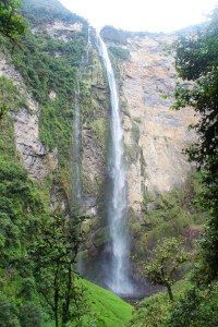
Day 3. Gocta – The 771-meter (2,530 ft) waterfall with two drops (registered as the 3rd or the 16th largest waterfall in the world, depending on who you ask). We wanted to do the hike to see the whole waterfall – both of the two drops, and we found someone who knew a guide from the village that could take us there and later pick us up for S/60.
The village that is near the waterfall (San Pablo de Valera) has organized themselves well and they require a guide from their village to accompany all visitors to the waterfall. (We paid our guide Maria S/40.) The village you pass through also charges an entrance fee (S/20), and they use the money to maintain and improve the trails to the waterfall, as well as to improve their own community. I really liked the system since it brings jobs and income to the local people while they maintain and conserve the natural area on their property, and also are able to share it with visitors.
The first stop was the pool at the base of the first drop. Unfortunately, we had another cloudy day without sun and with a little bit of rain a few times, but it was still an amazing hike with amazing views.
The second stop was a lookout point, where we could see both the upper and lower drops of the waterfall.
From there, because we had asked to see the lower drop as well, we continued the descent until we arrived at the huge pool at the very base of the fall. Again, it was cloudy, cold, and even rained a little, but that didn’t keep us from diving into the pool; afterall, how often does one get the opportunity to swim in the pool at the base of an incredible 771-meter waterfall? (Ok, I admit, it was way too cold to swim. I jumped in, screamed because it was so cold, and could only stand about 3 more minutes before I got out and hid under my rain poncho to warm up.)
From the pool, we descended about 1 hour to the nearby village where the hike ends. One of the local dogs had followed us from the very beginning, all the way to the village below, and my friends convinced our driver to let us drop the dog off closer to home.
Since we all have that adventurous spirit, we agreed that the all day hike was our favorite day of the whole trip…being surrounded by nature all day, bathing in a grand waterfall, climbing and descending, crossing through the mountains from one village to another, immersed in incredible landscapes…it was a perfect day for us all, one of the best in a lifetime.
Day 4: Karajía. For our last day, we decided on a half-day trip to Karajía (S/30 for a private car), which is where there are sarcophaguses (sarcophagi?) high up in a cliff .
It was a beautiful drive (as all the drives had been), that brought us to a little town, and from there, a short 30-minute hike to see the sarcophagi. You can’t get very close to them because they are high in the cliffs, but you can see them from below or from the sides.
Arrow points to the sarcophaguses
We dawdled a while, hiking around and taking photos and goofing off and enjoying the views, until we climbed back up the hill to the village.
Unfortunately, we only had four days to explore the area, but one could easily spend a week or more discovering Chachapoyas and the surrounding areas.
The amazing views, the history, the culture, the adventure….this trip had it all, with the best part being the memories shared, deepening our friendship, and finally traveling together – something we’d been talking about doing together for a year!
My oldest (host) sister is a teacher so she gets January-March off (summer vacation in the southern hemisphere). This year she promised her daughters, ages 6 and 8, that they would take a family vacation to Lima.
Aside: Since Lima is the capital city of Peru, I think a good comparison for the US would be like a family from a small, rural town taking 12-hour drive to vacation in Washington, DC… or maybe more like New York because it is a coastal mega city, like Lima.
The girls had never been to Lima before, and they had never seen the ocean, so it was going to be a great adventure! I really wanted to join them… to see the looks on their faces when they saw things like the ocean and the crowded city full of cars, for the first time. I wanted to go because they were going to go see sights in Lima that were more family-kids-oriented that I hadn’t known about and might not do on my own. And finally, I know my way around Lima a little bit because I have had to stay there multiple times for trainings and travel, so I wanted to help them navigate the city – which can be tricky if you don’t do it regularly.
Aside: My sister kept joking that she was embarrassed that a foreigner was showing her around her own capital city. It was definitely one of those moments where I recognized my privilege – even as a volunteer, not being paid much, simply being a part of Peace Corps gives me quite a few privileges that a lot of other people don’t enjoy, even paid trips to Lima and a network of friends and contacts throughout the country that help me learn how to navigate the city and the country.
So on a Wednesday morning, we all hopped on a bus for the 10 hour bus ride to Lima. (It was also the girls’ first time in a luxury bus, and I loved how the attendant very seriously took each of their tickets, checking their names off the list and treating them like adults.) I reserved us a hostel in Miraflores to be closer to our first destination: the beach. When we got there, I introduced them to their first ride on the Metropolitano, (the public transit line which is a bus system with its own separated lane), which took us from the bus terminal to the neighborhood Miraflores.
Before going to bed, we walked out to the Malecón – a sidewalk that goes along the cliffs of the beach, and has parks and greenspace along it. There are always people walking, running, picnicking, doing yoga, doing workouts, out on dates, or just hanging out looking at the ocean. We found a playground near the Larcomar mall, where the girls expended their energy from sitting on a bus all day.
The next morning, we hopped on a city bus (1.5 soles) and headed to the beach in Barranco, and the girls saw the ocean for the first time!
I think it was more exciting for me than them (I was a little underwhelmed by their reactions), but they had a great time and learned quickly about waves – how they surprise you and splash you in the face with salty water, and about sand – which doesn’t come out of your hair and swimsuit for a few days after rolling around in it like they did!
The second day we wanted to go to Parque de las Leyendas, so I found us an AirBnB closer to that area of town so we wouldn’t spend most of the day traveling there. Parque de las Leyendas is a zoo, built in the middle of some ruins from civilizations of the past. (I admit I was disappointed because it was really just a zoo and I didn’t see any “legends” or descriptions of the different ruins that were all throughout the zoo.)
We started with the different animals found in the different regions of Peru – coastal desert, highlands, and jungle. Then we saw a mock mine which explained the different minerals that are extracted from Peru, where we learned that Peru is one of the top 5 producers of the most common minerals of the world.
And we finished with the exotic animals from other parts of the world (the giraffe, zebra, and lions and tigers and bears, etc.) Everyone agreed at the end of the day that the huge, majestic, white tiger that paced back and forth impressed them the most…was it pacing back and forth thinking of how to escape and eat us, or wishing it could escape and run through the plains….?
That night we went to the Parque de las Aguas, in Parque de la Reserva, which has magnificent fountains, each lit up with lights, some with amazing colors. At 8:00pm the show began…a laser show projected onto the water of the fountains, featuring photos depicting the different food and landscapes form the 3 regions of Peru.
One of the fountains served as a splash park for kids, and my nieces had the best time. They had definitely never seen anything like it and they LOVED it. We had to ask the announcer to call them out by name to get them to come out to go home. I would guess that was the coolest part of the trip for them…the curiosity and fascination they had for the splash park fountain is what I had expected (and maybe hoped to see) for their first view of the ocean.
The final day was a trip to Gamarra to purchase clothes and supplies for the school year, which starts in March here. Gamarra is the biggest flea market you have ever seen…it is literally an entire neighborhood – streets and streets, blocks and blocks of shops. You can get just about anything you need for the cheapest price you can find in all of Peru. This is where my sister took the lead and showed me around.
Weekends are the busiest days – there are so many people that you can’t walk without rubbing shoulders with other people, and you need a running back’s skills to navigate through the crowds to get where you want to go. It helps to go with a Peruvian – both to navigate through, and to get better prices, (and I was told it’s more dangerous for people who look like tourists because they are targets for pick-pockets and people looking to take advantage of someone).
After a wonderful time exploring Lima together and getting to know each other better, we all had to head back to Oxapampa. A few weeks later, a fellow Peace Corps volunteer went with his family to Lima and they had a similar itinerary, so this gives you an idea of a typical family vacation to Lima for a family from “provincia”, or one of the other more rural areas outside of Lima.


 I think it was more exciting for me than them (I was a little underwhelmed by their reactions), but they had a great time and learned quickly about waves – how they surprise you and splash you in the face with salty water, and about sand – which doesn’t come out of your hair and swimsuit for a few days after rolling around in it like they did!


