Ischigualasto and Rainbow Canyon

I woke up early that morning in “Baldecitos”*, not really sure where I would be sleeping that night.

The French couple I had met, Silvia and Michel, were going to pick me up at 8am to tour the famous Parque Ischigualasto together, so I was pretty excited about that! (I would get a chance to get to know them, and I had overcome the challenge of seeing the park without my own car!)

But after that, my future was uncertain. I was learning to get comfortable with taking things day by day. Sometimes even hour by hour.

(In my travels, I keep a spreadsheet of dates and locations, transportation times and costs, etc., but it is more like a rough guide than a fixed plan. And the last few days I had really be improvising, especially as I’d discovered cute small towns and these national parks! Squirrel!)

A few minutes before 8am, I headed outside and found a car parked out front where we’d agreed to meet. As I approached, I was greeted by the bright smiling faces of Silvia and Michel, and I was happy to join the excited energy of heading off for a new adventure.

When we arrived at the park we were instructed that we would be joining a caravan of about 5 other vehicles, with the guide at the helm, and we would be stopping at certain spots along the way where we would get out, walk a short way, and the guide would share information with us.

Silvia and Michel, my French friends, in front of a large “mushroom” formation, a common formation seen in Parque Ischigualasto.

At the first stop, we parked behind a white van with Texas plates. I rubbed my eyes and looked again, but it was true that I wasn’t dreaming.

After checking out the landscapes of the “valle de la luna”, I heard a couple my age speaking in English and heading towards the van. Too shy to talk to them, I never learned if they were really from Texas.

Just kidding. If you believed that, you haven’t been reading my blogs enough to know that I’m rarely too shy to talk to someone.

So, it was there in the middle of Argentina, where I met Danika and Brady, a couple that had been living in El Paso, Texas and had been planning to travel through South America. A little over a year ago, their plans started coming together and they decided to do the journey by land from Texas to the southern tip of South America. They bought a van and turned the back part of it into a mini-apartment – equipped with a bed, shelves, cabinets, a stove, and even with walls decorated with photos – and then began their journey south. And now, we had been lucky enough to cross paths here in Parque Ischigualasto!

https://www.britannica.com/science/Triassic-Period

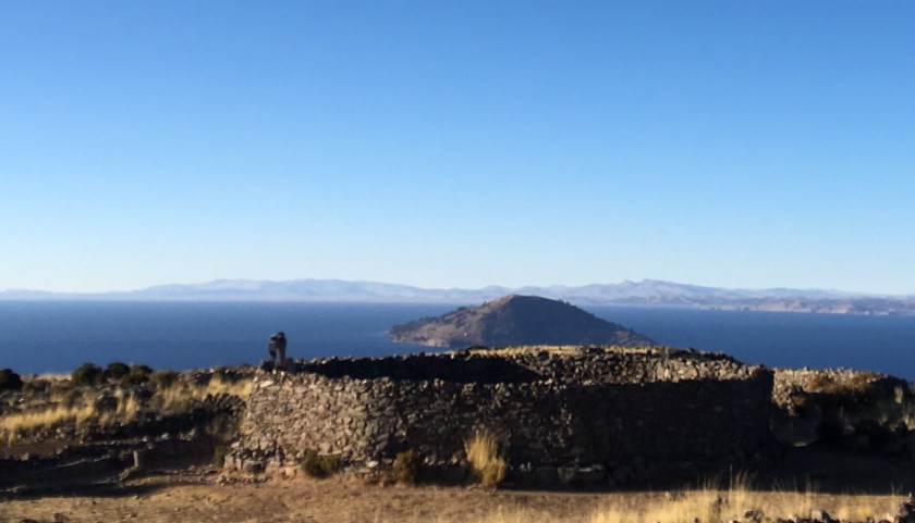
Parque Ischigualasto was quite a gem, with fossils from as far back as the Triassic Period – 250 MILLION years ago – when Pangea existed! (Remember Pangea? Back when the majority of the continents were united as one continent.)

So the parks (Ischigualasto and Talamapaya) are UNESCO World Heritage sites because they help tell the story of the evolution of land and life on Earth across time.

With so much time on its hands, the Earth had done some pretty creative things. Like creating these perfectly-shaped spherical rocks.

Precariously balanced towers of rock.

That sometimes do topple over.

I saw where the ancient Egyptians got their idea for the Sphynx. (The natural world had already created it!)

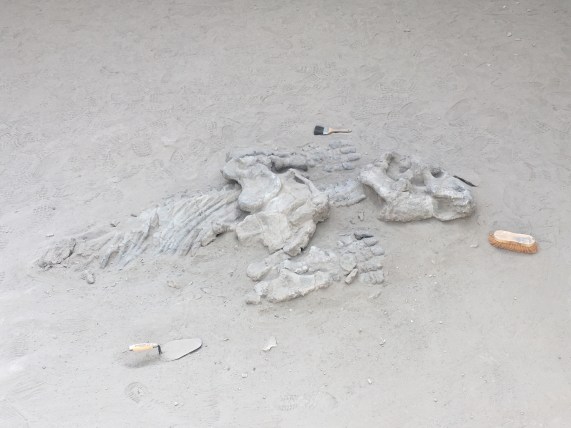
One stop included a museum where they told us about the dinosaurs and fossils that have been found in the area (many dinosaurs have been found in Argentina!) They explained how they carefully excavate fossils and determine their age (carbon dating), how they determine where they should dig to look for interesting things, and how they try to understand the geological processes that cause changes across the millennia.

The final stop was a showcase of the rock formations in their different stages of evolution, so you could essentially see the process that leads to the creation of the mushroom formations, as it happens over thousands of years.

We promised to come back to see these formations when they are mushrooms in a few thousand years.

Loving my time with Michel and Silvia and having also made two new friends, Danika and Brady, I realized that as a group of 5, we could do the tour of “cañon arco iris” and “ciudad perdida” (Rainbow Canyon and Lost City). (This is the tour that leaves from the southern entrance of Parque Talampaya and leaves only if a group forms.) They were all interested in the idea, so instead of trying to head to San Juan, I continued on with them, back towards Parque Talamapaya.

On the way, Silvia, Michel, and I shared travel stories and talked about everything under the sun. I learned that Michel had actually been to Talampaya before, more than a decade ago, before it was a national park. At that time, he had been able to drive his vehicle through the park to see the sights. Now only the tour companies are permitted to drive in the park, to minimize the human impact.

Michel had a project collecting photos of all the different animal crossing signs they saw along the way, so I took advantage and joined in the game – which also included trying to spot all the animals from the signs.

From top left, clockwise: Ostrich, Guanaco, Liebre, Fox

We arrived at the ArcoIris entrance to Talampaya just in time to be able to do an afternoon tour, and we even picked up an extra for the group – Alicia, a woman from Mar de Plata (a city in Argentina) that was on vacation traveling by motorcycle. (We also greeted a French cyclist passing through, brave or crazy enough to be cycling through the desert.)

The hike through Cañon Arco Iris and Ciudad Perdida was time travel through millions of years. We started with the red “youngest” rock formations and as we walked along we passed through tens of millions of years, finally arriving at the grey oldest rock formations, named “Ciudad Perdida” because of their shapes.

Leaping across tens of million of years, into Ciudad Perdida

Along the way, we could see how the seismic activity that created the Andes had lifted parts of earth’s crust out of the ground, exposing different layers of rock.

And we could see how the sun, wind, and rain changes the rock over millions of years, turning it into sand and reshaping it.

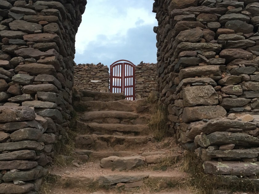
We also saw where the Incas might have gotten their idea for using rectangular stones for building walls that could withstand seismic activity…right there from nature herself.

You know when you meet someone that is so passionate about something that even if you never were interested in the topic before, they transmit their energy and enthusiasm to you and ignite an interest in you? (I’ve had some really good teachers with this talent, for example.) Well, our guide was like that. He was an easy-going and soft-spoken person, and when he talked about the the rocks and plants in the park and the history and science around it all, you could tell that he was really passionate about sharing this beautiful place with others (in his easy-going, soft-spoken kind-of-way).

Our guide Camilo lives in Pagancillo and the company that offers this tour is actually a co-op of independent guides, separate from the larger company at the main entrance of the park.

We finished the tour in the evening, and luckily, Silvia and Michel also loved staying in small towns, so I was happy to have already scouted out Pagancillo, the small town near the park. And I was really happy to be returning there to be able to see the friends I had made there, Dario and Marisel, once again.

That night, sharing wine and grapes (from their grape vine) with the family, the stars were shining brightly and it was a perfect opportunity to bust out the stargazing app and look at the stars. They were fascinated, as they hadn’t had the constellations pointed out to them before. So even though I was exhausted from a long day (that started in Baldecitos and had the surprise ending of being back here in Pagancillo), we walked down to the river where there were no lights to see the night sky in all its glory.**


Famous Footnotes:

*Baldecitos is the small town of about 10 houses, that is about 15km from the entrance to Parque Ischigualasto.

**While I was impressed by the centaur, whose hind leg is made up of the southern cross (only visible in the southern hemisphere), they were more impressed by the dog Sirius and Virgo.


PaNaChi – Family Fun in Colombia

I never would have thought that my travels through South America would include going to a theme park! But the best part about traveling is the surprises!

Parque Nacional Chicamocha (Panachi) is a theme park in Santander, Colombia built above the Chicamocha river valley and probably has the best views of any theme park I’ve ever been to.

One of its main highlights is the teleférico (elevated cable car) that takes you down into the river valley, floating above the river, and then back up to a mountainside across the river. (If you know how much I love teleféricos, you know I couldn’t pass this up!)

When you arrive on the mountain on the other side, there are restaurants with typical food from the Santander region, snacks, souvenirs, and you could even do a virtual reality session.

I ordered the mute (pronounced “mootay”)

Another highlight is the water park literally on the side of a mountain, with an amazing view overlooking the valley, with a mountain backdrop in the distance. (If you know how much I love swimming, you know I couldn’t pass that up either!)

There were a couple of water slides, a lazy river, different pools, and a few water park areas for kids.

Panachi also has different “xtreme” experiences like a bungee-jump type experience, swings that swing you over the side of a cliff, zip-lines, etc. all paid for separately.

It was really cool to see how some Colombian families spend vacation, and to see people out having fun! (And it was also cool that there weren’t a ton of people because I went during low season!)

Like many of my experiences here in Colombia, the park has a funky schedule (closed Monday and Tuesday during low season), and the teleférico also has its own schedule. I was surprised when they had told us we’d return from the teleférico in 2 hours; I thought it was just a really long ride … until they dropped us off on the other mountain after a 30-minute ride and left us there for an hour until it fired back up again to deliver us back to the park.*

Overall, it was a fun day, and highly recommended, for anyone, but especially as a family outing!

Famous Footnotes:

Still, 3+ years in Latin America and I still get surprised at things done differently. Some things get lost in translation, and some things just aren’t explained well or in a context that I understand, and I forget that sometimes one has to ask a lot of questions to clarify things. But, I have learned to appreciate surprises, go with the flow, and not stress (or stress less) when things don’t go as I planned or as I expected. And that is a gift that I value more than gold!

Barichara – “The Cutest Town in Colombia”

Turns out that Colombia is full of tiny adorable towns, and I might have to revise my statement from my previous blog that Guatapé is the cutest small town, especially because it turns out that BARICHARA is popularly known as the cutest town in Colombia (“el pueblo más lindo de Colombia”). (Also it’s a UNESCO world heritage site.)

Upon hearing that, I revised my travel plans and went to investigate.

I would have to say that Barichara certainly deserves the title, though I would not change my statement about Guatapé, which is cute in a different (colorful) kind of way.

I am so glad I had the pleasure of visiting the small town of Barichara and neighboring Guane, where, with the natural landscapes, tranquility, and friendliness of the people, you feel relaxed from just breathing in the air of the countryside. It’s no surprise that so many city-dwellers come here for vacations to decompress and take a break from the noise and rush of city life.

Heading north from Bogota in a bus, I watched the city landscapes transform into rolling green hills. My seat-mate lives in bogota but does construction projects in a rural area a couple hours outside of the city, so he takes on the role of tour guide and points out all the interesting things along the way.

As I see more and more cows grazing, he points out milking stations and informs me that we are in dairy country. We pass a town statue indicating that we are in the self-proclaimed milk capital of Colombia where you can get fresh dairy products like milk, cheese, and yogurt.

In between the cute, small, rural towns were grazing pastures, houses of brick or adobe, kilns with tall chimneys for making bricks, and I was completely surprised when we passed a series of coal mines.

About 7 hours later, when I arrived in San Gil, the air was filled with that familiar smell of burning wood or vegetation that I encountered when stepping off the airplane in El Salvador and in Cairo. From the busy little city of San Gil, I hopped on another bus that takes me to the small, quiet town of Barichara in about 30 minutes.

With its cobblestone streets, adobe buildings and colonial Spanish style balconies and flower pots, it almost seems like the town hasn’t changed much since it was a Spanish colonial hub in the 18th century.

And the views! Located in the hills above a river valley, there are multiple overlook points where you feel tiny as you stand in awe looking out over the the Suarez river far below and the mountain backdrop in the far distnce.

The town is connected to the nearby tiny town of Guane by “the Camino Real”, a stone path through the countryside that takes about 1.5-2 hours to hike. It used to be an Inca trail and more recently was a rehabilitated by a German engineer in the mid 1900s.

The hike to Guane was divine. The sun shone down, birds and insects were singing and chirping, there was a cool breeze, and while it was extremely hot in the sun, it was cool in the shade (and the path was mostly shaded by trees).

This is going to sound weird, but it was kind of welcoming to arrive to the village and be greeted by the light smell of smoke in the air and cow or horse poop. I guess those smells of rural areas grow on you after a while. ?

Guane was a kind of magical place for me.

The mirador provided an incredible view of the river valley with the river rushing through, and I spent some time there taking it all in, and later chatting with a Venezuelan artisan.

In the middle of Colombia, in this tiny little town of Guane, there is a hidden gem – a fascinating little museum that recounts the site’s history from millions of years ago to the present. (I wasn’t allowed to take photos inside, sorry!)

There are incredible fossils of fish and shells and plants from when the site was under the ocean. There are artifacts, some writing in pictographs, and even a mummy from the pre-Colombian Guane (the town is named after a group of indigenous people that lived in the region).

There are paintings from Spain that had been brought over during the colonial times. And there were coins – from the original “patacones”, (imperfectly round, made of silver from the colonial mines), to the perfectly formed colonial coins fabricated after mints were built, to the current coins in circulation in Colombia.

Unfortunately, the artifacts from the Guane people are pretty much all that remain because they were forced to stop speaking their language and practicing their customs many generations back. In fact, present-day Guane is where those indigenous Guanes that survived the epidemics were sent to be forced to forget their language and culture and be educated in the Spanish colonial language and culture in the 1700s. Ironically, this incredible museum exists largely thanks to a dedicated priest who worked tirelessly to compile the fossils and artifacts in the late 1900s.

Barichara and Guane are located in the department (state) of Santander, which has its own little sub culture, for which it is very proud. In addition to beautiful landscapes and fascinating history, I got a taste of the Santandereana food and music (specifically “bambuco”), and I felt very welcome thanks to the incredibly friendly Santandereanos.

In a very embarrassing moment in Guane I found I didn’t have enough cash to pay for my lunch. Thinking quickly I asked if I could leave the rest of the payment with someone in Barichara and without flinching the woman said it was not a problem and gave me the name of a store where I could leave it. I was much more worried about the situation than she was.

Finally, I have to note that the hotel where I stayed (“Quédate Aquí”) is run by the nicest woman EVER. She made me feel so at home, cooked delicious food, and emanated a really loving and caring spirit.

I wish I could have stayed a few more days here, but I was intrigued to check out a theme park nearby…which I’ll tell you about next!

Guatapé – Colombian Town of Colors and Warmth

The prize for the cutest, most beautiful, quietest-without-being-boring, small town goes to … Guatapé, a small town two hours from Medellín.

When I stepped off the bus, I was greeted by a few colorful buildings and thought “how cute”. But then I began walking through the streets in search of lodging, and I realized this was a city like no other. There weren’t just a few cute and colorful buildings, but looking down every single street my eyes were rewarded with a burst of color – and not tacky colorful houses but really cute, orderly and coordinated colors that made the atmosphere of the whole town feel pleasant.

Turns out, this Colombian lakeside town of 5,000 people is known as “la ciudad de zócalos”, because of the colorful, artistic baseboard decoration on the outside of each house.

The decorative band of designs typically depicts an aspect of daily life, history, or the homeowner’s or artist’s interests.

Though sometimes they are just colorful designs accenting the colors of the house.

The town reinvented itself in the 1980’s after the construction of a dam protected it from future flooding, and the town came together with the idea to adopt this signature style throughout the whole town. The result of their unified efforts is astounding.

This quiet town, 2 hours from Medellín is a popular weekend getaway for Paisas and a common stop for international travelers.

It is quiet most days of the year, except during the approximately 12 holidays of the year – during a holiday, the population explodes from 5 thousand to up to 15 or 20 thousand as visitors flood in from Medellín or other parts of the country. On the busiest days, there isn’t enough lodging and people have to return to Medellín for the night.*

I am not at all surprised at the popularity of Guatapé as a relaxing weekend escape.

First, it is most famous for “la piedra”, which is a tall rock rising above the landscape, offering an incredible view of this interesting lake-filled region.

The town has built stairways of 659 stairs up to the top of the rock and charges an entrance fee. While the touristy part at the entrance and the top didn’t appeal to me much, many would appreciate the opportunity to buy a cold drink or souvenirs, especially those who just do a day trip to the area. Either way, the view at the top is well worth the climb. It was really unlike anything I’d ever seen.

Back down on the ground, you could do lake activities like paddle boats, kayaking, going out in big boats, or renting jet skis.

You could walk or bike to the monasteries (one for women and one for men, though only the one for men was active).

You could rent a bike and do a loop around Guatapé, which of course is something I chose to do.

And this is where I really got a sense of how chill this town is. The bike rental place rented me a bike with zero collateral. I just wrote my name on a paper and said I’d bring the bike back before 6pm and they gave me a bike and helmet and said I could pay when I got back.

I got another feel for the small town life the day I walked around town and got my haircut. In the salon, I was greeted by a mestizo guy who informed me that the stylist was finishing lunch, and as we chatted I realized he was a neighbor just hanging out there. He was proud to be a Paisa, and enjoyed explaining to me how friendly they were.

While the woman was cutting my hair, two black teenagers came in and the woman greeted them enthusiastically. Turns out they were from Guatapé, but one was visiting from Medellin where he had gone to study. The woman had an aunt-like manner with the young neighbor boys, highlighting for me that small-town feel where everyone knows everyone and looks out for everyone.

In addition to the mix of mestizos and blacks (seen all over Colombia not just in Guatapé), the majority of people tending the restaurants (and those managing my hostel) were Venezuelan – also a common occurrence throughout Colombia right now.**

Turns out that I was in Guatapé at just the right time too … I was safely enjoying small-town life during the planned protests in Colombia this past weekend (21 Nov). While some of the bigger cities experienced cases of looting or disturbances that led to curfews, things in Guatapé were calm and quiet.

I am so lucky to have experienced this little gem in the middle of Colombia! Hopefully you will one day too!

Famous Footnotes:

*Oxapampa, twice as large as Guatapé with an urban population of 10,000, experiences a similar phenomenon during holidays as Limeños flee to the rural city looking for a quiet, nature-filled, relaxing holiday. Ironically, in both Oxapampa and in Guatapé, this surge of tourism turns the quiet town into a busier and noisier city – though still much quieter and relaxing than Lima or Medellín.

**As a neighbor to Venezuela, Colombia has received around 1 million Venezuelan immigrants in the last two years due to the economic crisis there.

Medellín’s Pride and Joy

The Metro is the pride and joy of Paisas* in Medellín. I admit that I was surprised to hear our tour guide say that and more surprised that the Metro was actually a stop in the walking tour! But he explained (through a very well-told and emotional story) that it is one of the city’s key symbols of a transforming and progressing city.
Like many mass transit projects, it took decades to complete, having to overcome political and financial hurdles, among all the other problems Medellín was suffering at the time. So when it did come to fruition, it became celebrated and is still a respected place that is clean and well-kept – and people behave themselves inside the Metro system.
(I was impressed with the public service message I heard on the train saying that women and girls ride comfortably and safely on the metro, free from comments or any type of harassment. Many metro systems in the world could use those messages, including DC!) The train efficiently gets you from one part of the city to another, and there are plenty of buses where the train doesn’t go. And my favorite part of the metro system… The teleférico! The elevated (ski-lift-type) cable car! Yep, similar to La Paz, (but different). In La Paz, the entire transport system was a teleférico. In Medellin, the main system is made up of trains (many elevated), and then a few final parts of the system include transfers from the train to a teleférico, which takes you up to parts of the city built on the sides of a mountain. To get to Parque Arvi, a public nature reserve, we took the train, transferred to one of the teleférico branches of the train, and then took another teleférico that would take us on a 30 minute ride to the park.
It was an incredible public transport experience, as the cable car carried us up a mountain, over the top of a densely populated community on the side of the mountain.
Then it continued as the community became less densely populated and later transformed into forest.
We sailed over the top of the forest in the pod, enjoying the view of the wilderness from above, and I was impressed by this low-impact way to transverse a natural area.
About 30 minutes later we arrived at the entrance to Parque Arvi, a public natural reserve with hiking trails, a river, and picnic and camping areas.
While the park was a great way to escape the city scene and immerse ourselves in nature, I have to say that the mass transit experience was the highlight of the day! Famous footnote: Paisa refers to a person from a cultural region in Colombia around and including Medellin.

Travelers

One of the cool things about traveling is meeting other travelers. I have met people from so many different countries, each with their own itinerary, their own purpose of traveling, their own way of traveling, and their unique perspective on the people and places they are seeing.

Many people have some artistic and/or social goal as their vessel carrying them through their travels and guiding them along the way, like me and my blog-writing project.

Like Lucas, the photographer from Denver who was trying to capture photos of people who still maintain some practices from their indigenous ancestors and who hopes to be able to portray their culture in cool ways so that it is enticing to youth to learn and preserve their culture. (He was just the second other American I have met so far traveling!)

And like Noel from Switzerland who is traveling volunteering. She hasn’t seen all the tourist sites in Peru but rather has spent more than a month in two sites, volunteering and getting to know the place and the people on a deeper level. First she did a volunteer program in Trujillo that she paid quite a bit for but didn’t actually receive much help from the organization she paid, and finally towards the end of her 5-week stay she started to get a feel for how she could actually be of service to the community. Here in Iquitos she did a 19-day boat ride with 9th wave along the Napo river border with Ecuador where they stopped at communities along the way. There she connected with one community and decided to stay for about 5 weeks to teach English, now that she would be able to use what she learned from her first experience to make this one more impactful.

Then there are the parapenters. This couple from France worked on a farm in California to raise money to be able to travel and with that money has been traveling for about 8 months. They are traveling with an extra backpack that has their parapenting gear because everywhere they go, they look for spots to go paragliding. Since there’s a whole community of people who paraglide, It’s also a great way that they are able to meet locals in each place they go as well as meeting other travelers from around the world who paraglide.

And recently I met a 26-year-old Swiss woman who looked suspiciously Latina… and it turns out that she was born in Colombia and adopted by a Swiss family when she was 6 years old. She doesn’t remember her life before adoption, including didn’t remember any Spanish, so she had come to Colombia to attend a Spanish school in Cartegena. Having finished classes, I met her when she was speaking Spanish quite well! She is a nurse and had taken a month off to volunteer at a clinic in Peru and then travel a little around Colombia to know her homeland a little more.

These are only a few snapshots of some of the different people I have met along the way and the motives that drive them in their journeys.

Isla del Sol

La Isla del Sol is the biggest Lake Titicaca island, and it is also the most visited by tourists, due to its convenient location just a 2-hour boat ride from Copacabana, the popular tourist stop between Bolivia and Peru.

It is apparent that the island has developed around tourism – there is an abundance of lodging (hospedajes) and restaurant options, and even signs pointing the way to tourist points of interest like overlook points.

You know international tourists come through a place in Bolivia if you find a pizza restaurant, and there are a ton of pizza restaurants on Isla del Sol.

I was really struck by the beautiful architecture and especially the facades of many of the hospedajes, most of which incorporated rock or pebble to adorn traditional adobe construction.

It is also close enough to the mainland peninsula (with a tiny tree-covered island in between), that it is connected to the electric grid of the mainland, unlike Isla de la Luna, which relies on solar panels.

Isla del Sol has three different communities and is less densely populated than Amantaní, with approximately the same population but spread throughout the 14-square-kilometer island (compared to Amantaní’s 9-square-km). (But both much larger than the tiny 1-square kilometer Isla de la Luna with just one community of 27 families).

Just like the other two islands I visited, the geography is that of a mountain rising out of the sea…er, lake. (It is very easy to forget that I am on a lake and not the sea!)

The point is that everything is uphill from the shore. And even walking around from place to place on the island is like hiking in the mountains – a lot of up and down (which always feels like there’s more up than down) at 3,800 meters of altitude.

The boat I came in arrived at the port Pilko Kaina with Incan ruins to explore.

From there to the rest of the island was a surprisingly long climb up.

I really wondered if I was going the right way and if all this climbing was going to be worth it in the end. But I persevered, meeting some friends and some awesome views along the way.

I eventually wandered upon two other lost tourists and soon we came to a house which turned out to also be a fancy restaurant on the edge of Yumani, the community most frequented in Isla del Sol and full of restaurants and hospedajes.

They stayed to enjoy some gourmet food while I continued along in search of a place to stay the night and a cheaper lunch since I was on a really tight budget, and running low on cash at this point.

The site where I did eat lunch was indescribably beautiful. The view of the lake was breathtaking (literally and figuratively at 4000 meters above sea level)… so blue, and so immense, stretching as far as the eye could see. The only sounds were a few birds and a distant conversation in Aymará, with the light sea, er, lake breeze whispering past my ears. Ultimate peace.

And it was the best meal I’d had since Amantaní – fresh trout from the lake with some fresh veggies.

Later, heading to the lookout point to catch the sunset I met and chatted with a local woman selling souvenirs who appeared slightly younger than me and who had curious and rowdy 2- and 4-year-olds. She had lived in São Paulo, Brazil and so not only spoke Aymará (the local language on the island) and Spanish, but also Portugués from her time in Brazil. She had returned to Bolivia because she said they had been treated like second class citizens, her husband robbed at gunpoint a few times, and other Bolivian migrant friends injured or killed…she said her experience was that there was no justice as the government didn’t really value their lives, safety, and rights as immigrant workers. (USA, can we please not be like that???? Pretty please.)

After doing yoga and watching the sunset with her and her kids, I headed to another overlook point.

There I met a super sweet couple – a Spanish woman and an Argentine who ended up staying two extra nights and exploring the whole island (even the northern part which we had been told could be dangerous because of an inter-community conflict that started two years ago), and they said it was incredibly beautiful!

Unfortunately I was running low on cash and had to return to Copacabana the next morning to change money and continue my journey. So, after a delicious dinner of trout from the lake (yes, again!) I headed to my hospedaje and had my last peaceful, Lake Titicaca island sleep.

The next morning, after watching the sunrise and eating breakfast, I headed down to the dock, past the Fuente del Inca and saw the grand island entrance to the Yumani community.

I had the pleasure of chatting with a few local women while waiting for my boat. This might have been one of the highlights of my stay here. Using my handy language chart, I practiced my Aymará with them, and we were all highly entertained (even if they were laughing AT me not WITH me at times!) Similar to Isla de la Luna, most people have their farms where they grow the typical sierra (highland) crops- quinoa, wheat, corn, and a variety of potatoes, and animals (mostly sheep), while the income from tourism helps provide something extra.

With a farewell photo, I said “juspara” (thank you) “jakisiñkama” (goodbye)! and boarded the boat for my last ride across the majestic Lake Titicaca.

Isla de la Luna

Every morning at 8:30am, boats full of tourists leave Copacabana heading to Isla del Sol, with an option of stopping for an hour at Isla de la Luna. Planning just to go to Isla del Sol and stay the night, I boarded a boat and met up with the two traveler friends from London and Italy that I had met in my hostel.

It was a beautiful 2 hour boat ride and I even saw some little fish swimming along side of the boat. Instead of getting off at the first stop at the Isla del Sol, I stayed on with my new friends to go to the Isla de la Luna.

The boat only stops for an hour at Isla de la Luna and the guide on the boat says there’s not much to see there and you can do it in an hour…and they only give you an hour before the boat leaves to go to the Isla del Sol. And if the boat leaves without you, you’re stuck in the island until the next day because the boats only come once a day for an hour.*

Entering the island the smell of muña caught me by surprise and reminded me of my stay in Amantaní, the island in the north part of the lake. As I was walking up the stairs to enter the island with the other tourists, I passed a little 4-year-old boy who, without prompting, greeted me saying “Hi, my name is Miguel Ángel”! It was so adorable!

I started exploring late because I chatted for about 10 minutes with the guy who was charging for bathroom use, geeking out about the water and electricity access on the island. (Islands have always fascinated me because they present unique infrastructure challenges ripe for alternative energies and exploring the idea of sustainability.)

Geek out about the island’s infrastructure:

They used to not have power but now they use solar panels (“because the kids want their cell phones. And also tv.”) He said the panels are great but the batteries only last a couple of years and they have to be careful not to let them drain to zero or they stop working well. They use what look like basic car batteries that charge during the day.

They also have solar hot water heaters in most of the houses.

They use water from the lake but have to buy gas to power the pumps that pump the water up from the lake. (They charge for the bathroom in part to cover costs of the gas).

End Geek-out.

Finally, I headed up the hill to the ruins of the “temple of the virgins”, which was supposedly a type of boarding school for young women to learn to do womenly things in the Incan times.

There, I met an older woman from the island who explained that life living on Isla de la Luna is really calm and peaceful, and she liked it much better than the city (La Paz) where she lived for a few years. Here they grow their food, have a few animals- (llamas, pigs, chickens, sheep), they have fish farms within the lake, they and buy what they don’t have on the island from Copacabana. There’s a primary school and a church and a football field – everything they need, she said.

As I started to hike the hill from the temple to see what was on the other side of the island, I passed a woman knitting in the shade who asked if I was going to stay the night in the island.

“That’s an option?” I asked her.

Part of my travel purpose is to go off the beaten path and get to know some places and the people that live there… so when she said that her mother owned a hospedaje, I negotiated a price to include my meals, and I decided to stay the night instead of going back with the boat to Isla del Sol.

The boat companies from copacabana don’t promote the fact that there are hospedajes on the island, (maybe because it’s a tiny island and most tourists want more entertainment and conveniences? I don’t know.)

But if you are looking for a quiet and incredibly beautiful place to pass 24 hours (or more), where you can chat with one (or a few) of the 27 families that live on the island, learn about their daily lives, and walk along the perimeter of the 1-square-km island in the afternoon sun…then it’s worth the stay.

The tourists only come one hour per day, at the same time every day, and the community rotates selling things, collecting the entrance fee, collecting bathroom fees, and helping/keeping an eye on the tourists.

On the other side of the hill, and down the length of the island are the houses where the community (called Coati) lives…So the tourists only see the ruins and a view of both sides of the island from the top of the hill, but don’t see or go into the community, unless they stay the night.

The community of Coati, Isla de la Luna

The hospedaje where I stayed overlooks the lake, with a little pier extending into the lake. In the patio between the rooms are beautiful plants with flowers and the constant buzz of bees that I even hear from inside he room.

The quiet lapping of the waves on the shore can also be heard from inside if you listen closely.

This half of the island, the opposite side from where the tourists land, smells of muña for parts and eucalyptus for other parts.

I loved chatting with the woman who owned the hospedaje. It challenged my conversation skills a little because she wasn’t super talkative, but every time I asked her a question I saw her face light up a little and I felt her open up a little more, like she viewed me with a little less skepticism each time.

She commented that the president/government built part of the hospedaje last year (or at least convinced them that he did so they’ll vote for him at the end of this year), and the alcalde bought the water pump. The entrance fee to the island goes towards paying the locals to do restoration of the ruins or other community-based things.

The woman has 5 kids, one still living here on the island, a few in Copacabana and a few in other cities, but she’s content because they talk on the phone. When she first moved here with her husband (who is from here), there wasn’t running water or electricity so it was a rough adjustment for her, but she adapted, and now it is much easier with the solar power and pumped water. She feels at home now and likes that it’s quieter with less people than where she grew up, (in a community on the peninsula).

We chatted as the sun set over the pier, and she told me that tomorrow would be her turn to sell her artesanías in the temple so I would see her there when I leave.

In the morning, heading back over the hill to the other side of the island, I saw the little boy from the previous day, Miguel Ángel, walking with his mother, taking their sheep out to graze. She had a few of them on a leash, and the similarity to people walking their dogs in the morning made me smile. A few loose sheep stopped to eat and wouldn’t follow her so she sent Miguel Ángel to collect them, and I went to help herd sheep, while the talkative, friendly boy told me stories of his sheep.

This visit had a different feel than my stays on Ccotos and Amantaní, mostly because the business arrangement is different. Here, they are following a more traditional hotel-type tourism model, where the host is simply providing a space to stay, and doesn’t even live in the same area where the guest rooms are. Whereas in Amantaní and Ccotos they are following a homestay model where the tourist is a little more integrated into the daily life with the host – through sharing meals and sometimes community events, in addition to the guest rooms being more physically close to where the family lives and considered part of the family’s house.

While I personally preferred the homestay model and the culture-sharing atmosphere it fosters, I still greatly enjoyed my stay here. There aren’t many words to describe the peacefulness and beauty of this place, but hopefully you can catch a glimpse of it through the photos!

As I left the island in the morning for Isla del Sol, I saw the snow-covered peaks of the Cordillera Real in the distance, a reminder that I was on a lake in the middle of the Andes, not the ocean, and a foreshadowing of my future travels through Bolivia.

Famous Footnotes

*If you really needed to leave the island, you could pay a local a very high price to take you in a private boat to Isla del Sol or the mainland.

Island Life (Amantaní)

Sometimes we travel long and hard to arrive at our destination. And then sometimes the journey itself is so beautiful and interesting that it is part of the destination.

Getting to Amantaní is one of the latter. The hour-long motorboat ride through the lake was was both fascinating and relaxing at the same time. A vast expanse like the ocean, but calm, with only minuscule waves, passing islands along the way that I had seen from the shore just a day before…and passing the shore that I had been on just the day before, staring out to where I now was in a boat!

When I arrived at the dock, I was greeted by a smiley and warm, short and round woman who introduced herself as Silveria, the wife of Romulo, with whom I had organized the stay. She led me up a steep sidewalk with many stairs along the way, and after just 5 minutes I was huffing and puffing with my 15 kilos of backpacks and just my second day in the altitude. But luckily, we had already arrived!

Their house is located close to the dock, and my room had big windows with an incredible view of the lake!

Just like in Ccotos, in the shade it’s cold and I need my 2-3 layers, but sitting in the sun for a few minutes I could wear just a long-sleeve or sometimes short sleeve t-shirt, so I sat in the sun while Silveria prepared lunch.

Chatting over a delicious lunch of local varieties of potatoes, an assortment of vegetables, and local bread, I learned that Silveria had run from one side of the island to the other in the morning, first helping her step-mom on her farm, then working on her own farm on the other side of the island, and then running to the dock to meet me. She said it took her about 30-45 minutes to run from each side of the island to the other.

Over lunch, we shared stories, getting along so well that we even began sharing about our childhoods and a summary version of our life stories! After a rough childhood, she was very happy to have a peaceful life with a nice house and a nice husband, living a good life without want. She reminded me of a sweet and hospitable southern woman, someone who had grown up in a machista culture and had a rough childhood but had made a better adult life for herself and lived constantly thankful for what she has now, moving and speaking in a manner that was both self conscious and humble, yet confident in its own way.

In Amantaní, similar to Ccotos and the surrounding areas, people’s first language is Quechua because that is what is spoken in the home. I asked if Quechua was taught in school, and the response I got was, “No, everyone knows Quechua so they don’t need to study it in school.” I was told that typically children speak only Quechua until age 5 when they begin going to school, where they start learning Spanish and school is pure Spanish.

It was interesting to me that, while speaking to Silveria, she was quite self conscious of her Spanish, even commenting that my Spanish was better than hers (though as we talked more and became more comfortable talking, her Spanish flowed more and more fluidly.)

In the late afternoon, Silveria walked me up to the path that led to the highest points on the island-two hills close together, each with a sanctuary to Pachamama* and Pachatata, respectively.

She left me and I continued to climb, slowly, step by step…up to 4,200 meters, my lungs wondering where all the oxygen went, and the temperature dropping rapidly. I was surprised as the land and hills began to give way to water on either side (apparently I had forgotten I was on an island).

My plan was to watch the sunset from there, but the clouds rolled in cutting it short. What I did find as I got closer to the sanctuaries was a ton of tourists! (And a ton of local women selling chullos* and sweaters and crafts and souvenirs all along the paths)! The tourists had all come out from hiding wherever they were staying on the island, and everyone had come to watch the sunset up here.

I got a little confused getting back to the house, and as I asked an older man who was walking with a child, he sent the little girl to walk me to the corner where I needed to turn. I found this simple reaction to be so strange and so kind – but very different from most places where everyone is in a hurry and busy with their own things and also worried about sending kids off alone, even for a few blocks.

That night over dinner, speaking with Romulo, I learned that the island is actually quite organized around the home-stay tourism and they usually partner with tour companies who bring in large groups of tourists at a time. The community is divided into 10 communities, and each community rotates being the host of a group of tourists, with each family in the community offering space in their house and meals to the visitors. Each community also has a community center where they perform traditional dances and have a party with the group of tourists. (I had bypassed this system, contacting Romulo directly, and he said this was a much better deal because he directly receives the payment, and they even have a problem with one tour company that never paid the island for hosting a group.)

I was really impressed by how organized the island of 500 families was. They meet every Sunday, first the whole island, and then they break into meetings just for each community. Romulo explained that it was their only way to get news since there wasn’t a radio station on the island just for news about the island (though they do get regional radio stations from Puno and Juliaca).

They also coordinate which communities plant which crops when, and they rotate, making sure the land has time to rest. Because of the population and limited amount of land, the island is not self-sustainable and the crops produced are not enough to feed everyone so they do have to buy food from the mainland in addition to what they produce. Because of this, the money brought by tourism is crucial for the residents.

The night was so quiet and peaceful and the stars so incredible!! And it was cold. I didn’t dare shower and I slept under about 6 heavy blankets. Before going to bed, they told me if I had to use the restroom to use the “pee bucket” under my bed instead of trying to brave the cold and go to the bathroom. I had heard of these “pee buckets” from other Peace Corps volunteers that lived in the mountains, but I had never seen them for myself. (Turns out it was just a plastic tub.)

The next morning I took a stroll along the shore…

And then we all had a crepe-like “pancake” breakfast, learning about each other’s families.

Later, Silveria walked me to another spot on the island that the tourists often like to visit, the Inca’s chair. To walk there, I noticed that she took time to put on a nice shawl, and she also brought along her knitting…and continued to knit as we walked there! (I was highly impressed.)

Everything on the island is somewhat of a climb…at this point I realized that as an island, it’s really just a big hill or mountain jutting out of the middle of the lake, with the middle of the island being the high points and the shore the low points, so you really have to climb to get anywhere unless you are literally just walking along the water.

I really fell in love with the island, with its stone paths connecting the 10 different communities. I saw the island to be filled with with trees, houses and farm plots. There are no vehicles – everyone walks. (Though I did see one motorcycle in the two days I was there.)

The Inca’s chair was a beautiful spot on the beach and I camped out there until lunch, writing, and then returned after lunch to watch the sunset.

placeholder://

Dinner was delicious and a really great conversation, including Romulo showing me a photo of Silveria and complimenting her to me (with her sitting there in the kitchen) saying what a beautiful wife he had and what a great cook she was. I practiced a few of the Quechua words they had taught me, commenting that the food was delicious and thanking them for it:

“Sumaq micqvi” – delicious food!
“Yoshparasonki” – Thank you!

(My Quechua spelling is surely not correct, but that’s how I remembered to pronounce it.)

Muña- the minty-smelling herb that helps with the altitude and stomach problems. We had fresh muña tea every meal!

Before daylight broke the next morning, I left the warmth of the 6 heavy blankets and headed out to run/walk up to the highest point of the island, the sanctuaries to Pachamama and Pachatata, to watch the sun rise and start the day with some yoga and meditation at 4,000 meters (13,000 feet).

Starting at 3,800m, and climbing to 4,200m (13,000 feet) was not a walk in the park and I had to stop to breathe a few times and also take off some layers, but in about 45 minutes I reached the sanctuary and did a few sun salutations because, well, for obvious reasons.

While I was meditating I heard what sounded like a fan motor off to my left. Then I suddenly heard it in my my right ear, I opened my eyes and was amazed to see a hummingbird (“luli”) floating just one foot from my face, checking me out and whispering (quite loudly) in my ear, with its thousands-of-beats-per-minute wing-flapping motor. After 3 seconds it flew away, but left me feeling like I had just received a message from Pachamama delivered by a Chaski* in the form of a hummingbird.

After breakfast, I had to say goodbye, and I mentioned that I was sad to be leaving because I really felt at home with them and was so thankful for their hospitality, and as I saw their faces light up with genuine happiness, I was really touched to have met such kind people that opened their homes and lives to me for a couple of days!

When I had arrived, I had greeted them with the handshake, hug and air kiss that I was used to in Peru, but awkwardly found that they were expecting only the handshake. Out of habit I accidentally made that mistake twice! But upon leaving, they each reached out for a hug, and I felt a special connection to this family and this beautiful island in the middle of the highest navigable lake in the world.

Famous Footnotes:

*Pachamama – the Incan word for mother earth, which is revered with a god-like respect and reverence

*Chaskis were the Incan messengers that traveled the Incan roads delivering messages throughout the Incan Empire

*Luli – what Silveria called the hummingbird – maybe the Quechua or a local word for the hummingbird. She said it was a sign of good luck for my journey

*Chullo – the warm hat with ear flaps commonly used in the mountains of Peru and Bolivia. I learned from Romulo that if your ear flaps have dangly balls like mine, you can tie the earflaps back when you are eating so they don’t get in the way!