One of the cool things about traveling is meeting other travelers. I have met people from so many different countries, each with their own itinerary, their own purpose of traveling, their own way of traveling, and their unique perspective on the people and places they are seeing.
Many people have some artistic and/or social goal as their vessel carrying them through their travels and guiding them along the way, like me and my blog-writing project.
Like Lucas, the photographer from Denver who was trying to capture photos of people who still maintain some practices from their indigenous ancestors and who hopes to be able to portray their culture in cool ways so that it is enticing to youth to learn and preserve their culture. (He was just the second other American I have met so far traveling!)
And like Noel from Switzerland who is traveling volunteering. She hasn’t seen all the tourist sites in Peru but rather has spent more than a month in two sites, volunteering and getting to know the place and the people on a deeper level. First she did a volunteer program in Trujillo that she paid quite a bit for but didn’t actually receive much help from the organization she paid, and finally towards the end of her 5-week stay she started to get a feel for how she could actually be of service to the community. Here in Iquitos she did a 19-day boat ride with 9th wave along the Napo river border with Ecuador where they stopped at communities along the way. There she connected with one community and decided to stay for about 5 weeks to teach English, now that she would be able to use what she learned from her first experience to make this one more impactful.
Then there are the parapenters. This couple from France worked on a farm in California to raise money to be able to travel and with that money has been traveling for about 8 months. They are traveling with an extra backpack that has their parapenting gear because everywhere they go, they look for spots to go paragliding. Since there’s a whole community of people who paraglide, It’s also a great way that they are able to meet locals in each place they go as well as meeting other travelers from around the world who paraglide.
And recently I met a 26-year-old Swiss woman who looked suspiciously Latina… and it turns out that she was born in Colombia and adopted by a Swiss family when she was 6 years old. She doesn’t remember her life before adoption, including didn’t remember any Spanish, so she had come to Colombia to attend a Spanish school in Cartegena. Having finished classes, I met her when she was speaking Spanish quite well! She is a nurse and had taken a month off to volunteer at a clinic in Peru and then travel a little around Colombia to know her homeland a little more.
These are only a few snapshots of some of the different people I have met along the way and the motives that drive them in their journeys.
Torotoro was an unplanned surprise adventure that I stumbled across in Bolivia and now I can’t imagine my journey without it.
I had never heard of Torotoro until I arrived in La Paz, where two different people recommend it to me within my first day there. My friend Gabriela said I HAD to see because, as a person that likes outdoors adventures, it was a must-see while in Bolivia.
I decided to do the 2-bus journey from La Paz in one day, leaving at 7am and arriving around midnight (due to some bad luck in my layover).*
Heading out of the densely-packed, busy La Paz towards Cochabamba**, the road soon turned into wide open spaces, with a mix of adobe and brick houses, often many kilometers apart. The landscapes were reminiscent of the Peruvian Andes highlands (sierra), from plains to red rock mountains, and then winding through the hills above a valley, with short little bushes dotting the yellow brown hills.
Torotoro is at an altitude of 2,800 meters (9,000 ft) with a rocky mountainous landscape, but also has a very unique look and feel. The colorful and pointy, oddly shaped hills and rock formations may remind an American of the Southwest, especially South Texas, New Mexico, and Arizona, and also parts of the Rocky Mountains. While the temperature is cool, the days were mostly sunny, and it is noticeably 1,000 meters lower than La Paz, giving one a relief from the cold and altitude of La Paz.
In the tiny town of Torotoro, most people wear the typical rural Bolivian dress- women in colorful skirts, and men in pants and a vest. Most people wear brimmed hats (sombreros), though there are different types between the men and women. But there are two unique things I see here that I haven’t seen in other parts of Bolivia (or Peru):
First, a good proportion of people have official work vests, signaling that many people are employed in the tourism industry, working either for the government or a tourism business.
The other, which I absolutely love, is that there are many guys (mostly older men) that wear the typical Andean “chullo” hat with ear flaps, but these chullos have a long pointy top, like an elf hat…and they wear the pointy part standing up! (Sorry, I don’t have photos of the local dress styles.)
Torotoro is such a tiny town, that even though the tourists stay in hotels around the middle of town, integrated with the houses of the locals, tourist activities feel very separate from local activities, and so it has a bit of a tourist town feel.
The locals have a kind of wary-ness towards me, surely from having had many a varying experience with tourists, and it takes a few minutes of conversation for them to relax and feel more comfortable conversing. I tried to chat with a street food vendor who was also serving some locals, and she was really hesitant to talk. Finally, remembering that I was in a Quechua-speaking region, I tried to speak with the little bit of Quechua I had learned in the northern Lake Titicaca island Amantani. “Soma pollo,” (delicious chicken), I told her. “Yosparasunki,” (thank you)! When she realized I was trying to speak Quechua she smiled (half laughing at me) and then taught me to say “Reposa” (bye).
Torotoro is also a national park, and due to the efforts to protect it, they have recently implemented a strict system for visiting the park, where you always have to go with a guide. (You pay 100 Bolivian Pesos for a park entry fee and then you pay separately for each guided tour.)
The system of contracting a guide is interesting because there is a set cost for each guide and you can have up to 6 people in a group with a guide. That means that most people come just before the office opens in the morning and afternoon to look for other people that want to do the same tour so they can form a group of six to split the cost. Sometimes it works out beautifully and sometimes no one shows up to do the tour you want to do. (But for the two most popular tours, even in low season, there were always people in the early morning looking to form a group. The afternoons had fewer people, though I did get lucky my first day and found a couple late in the afternoon to go see dinosaur tracks and the canyon.)
That’s right…dinosaur tracks! Who knew that in the middle of Bolivia, there are dinosaur tracks!???!?
Many businesses use the dinosaur tracks for their marketing strategy
The area used to be swampy area and over the millennia it dried up and turned to rock, preserving tracks of those massive herbivores and vicious carnivores that roamed the area thousands of years ago.
All in one tour (“El Vergal”), you pass dinosaur tracks and walk along an historic river with amazing geologic formations, leading to the majestic Chiflón canyon.
Just when we were about to leave the rim to begin our descent into the canyon, we caught sight of a graceful condor soaring above the canyon…and then another…and then another. They had emerged just in time to paint the already amazing landscape with their graceful flight paths.
We then climbed down into the canyon, passing a lemon-mint smell of the bodje tree, and later transversing the boulder-filled base for about a kilometer until we arrived at some beautiful waterfall cascades with green-blue pools below.
What a refreshing swim in that beautiful canyon pool!
The next day I successfully formed a group of 6 with my two French neighbors and a group of 3 other French tourists wanting to do a full day tour of the “Ciudad de Itas” and the Umajalanta Caverns.
We first took a 4×4 out to the grand rock formations of the City of Itas, and on the 40-minute drive climbing into the mountains, there were four different languages buzzing about in the vehicle – the guides speaking Quechua in the front, the three tourists in the back speaking French, my French neighbors and I speaking in Spanish in the middle, and the tourists in the back speaking to me in English.
The “Ciudad de Itas” was a hike through incredible rock formations and mountains.
Among many cool highlights were an almost completely dark cave-like space with just a tiny slot of light filtering through from above called “cueva del diablo”, and ancient drawings of llamas and the sun and earth goddess/god preserved in the rock in some cave-like spaces.
Do you see the llama?
We were also led through a maze of rock to a secret hiding place that was a kind of hidden canyon between rocks where the natives would hide stolen cattle during the 18th and 19th centuries, before the land reform times. This was when the Spanish had taken over large swaths of land, and a wealthy, well-connected Spanish “patron” would run an agricultural businesses on “haciendas” (large farms), often practically enslaving the locals while making profits exporting products across the country or abroad. (Again I was grateful for having read Isabel Allende’s “House of Spirits” to have a sense of the history around this time period.)
Another point of interest amidst the rocks was a large opening in a cave-live space in the rocks called the “cathedral” where the locals during Incan times held a gathering to celebrate the gods and goddesses of the earth (Pachamama) and the sun (Tatainti). They would have a type of pot-luck called “A’tapi”, and they would give an offering to Pachamama called “Tcha’lla”.
We also saw photo-luminescent bacteria that glows this green color from one angle but up close it just looks like brown slime on the rocks.
After having climbed to the highest part of the Torotoro area, we then descended below the surface of the earth, to explore the Umajalanta Caverns. While not the most beautiful cave I’ve ever seen, it was definitely the most fun!
Hiking, climbing, repelling, crawling, and scootching through this cave was a fun adventure (and led by an experienced guide and plenty of ropes, it was not as hard or scary as it sounds.) Unfortunately, many of the beautiful formations had been damaged in the decades before it became a protected part of the national park, (due mostly to people not knowing that touching the formations would damage them but also due to some vandalism).
This image is on the 10-boliviano bill
However, there were also signs of hope where the stalagmites and stalactites had started growing again since the cave has been protected for two decades now (since 1989).
I was so happy to have found this little gem in the middle of Bolivia, to explore such a beautiful place, and to support the protection of some natural areas.***
Famous Footnotes
*While I arrived smoothly from La Paz to Cochabamba (other than a hot bus), I had bad luck catching a ride to Torotoro. The buses go “colectivo” style which means they wait until enough passengers come to fill them and then they leave. I waited 3 hours and then it was getting dark and no more passengers were coming so the company passed me off to another company that was supposedly leaving soon but still didn’t actually leave for another hour. I arrived at midnight in Torotoro and needed the next morning to recover from travels.
** Many people told me to “be careful” in Cochabamba. Luckily I had nothing but good experiences with the people there. When I asked at the terminal how to get to the vans for Torotoro, the woman didn’t know so asked a coworker who not only told me which car to take, he flagged down the car and ran the half block to where it stopped to explain to the driver where I was going and to ask him to let me know when we arrived!
***While I would definitely call this an “eco-tourism” experience, the jury is still out on whether it counts as “community-based tourism”. While on the surface it seems to bring some income to many locals, there were rumors that the government actually gets most of the proceeds and that there was a wealthy and foreign family somehow making most of the profits. I wasn’t there long enough to find out to what extent these were true, but even if the government was making profit, they were also employing quite a few people (remember all the vests?)
Side note: There were a few other short tours that I didn’t make it to (like a huge fossilized turtle), so while you can see the biggest attractions in 2 days, it is definitely a place one could stay 3-4 days, especially just to relax in a calm and quiet little village in a beautiful place with a great climate, (though there aren’t tourist attractions outside of the guided tours).
Since I wasn’t able to hike to the Yungas (the lower altitude, subtropical side of the Bolivian Andes) from the mountains, I decided to bike there. In bicycle you can really see the scenery, feel the change in climate, and really experience each moment along the way with all your senses. Sometimes you can even see the change in wildlife along the way.
Since I didn’t know where and how to rent a bike, the easiest and quickest way was to go along with one of the touristy tours that rent you the bike, gear, guide, support van, and transportation to a starting point and back and that advertise the route as Death Road or “the world’s most dangerous road”. Actually called “North Yungus Road” or “Coroico Road”, the route is a windy, steep downhill dirt road that used to be the primary route to Coroico, before they built a new paved route that is supposed to be a little less windy and steep and therefore has fewer incidences of cars going too fast and finding themselves flying off the cliff. (An estimated 300 travelers were killed annually when this was the primary route to Coroico).
As a mountain bike route, it’s not too dangerous since it was designed for cars and so is actually fairly wide. That said, it would be dangerous for someone that isn’t used to biking and tried to ride like a crazy person. I found it to be a challenging but not too unlike many rides I did regularly in Oxapampa. Going with the tour had its pros and cons*, but overall it was awesome, and definitely a great way to get to the lower jungle town of Coroico where I wanted to go.
To get to Coroico from La Paz, you first have to pass over the mountains, so the van drove us a few hours to the starting point in the mountains at 4,700 meters (15,400 ft) above sea level. We would then ride down to 1,100 meters (3,600 ft) above sealevel. It had snowed the night before which complicated our arrival to the starting point but made for a beautiful, of very cold, starting point.
From white mountains, freezing fingers, and multiple layers, we quickly descended to green hills, greeted by the smell of the moisture and vegetation characteristic of the tropical jungle, (and making me nostalgic for Oxapampa). The views of the hills and valleys, and the river cutting through the valley below (way below), were indescribable. (Sorry, don’t have photos.)
Arriving in the valley, one perk of going with the tour is that we had access to a beautiful little resort with an all-you-can-eat buffet, rustic showers, and even a pool.
The two guides were also cool. One guy was a medical student and was explaining that to be a doctor in Bolivia, one has to study for 5 years, then do a one year internship in a hospital where they don’t pay you anything, and then ANOTHER one-year unpaid “rural internship” where you work in a rural site in “provincia”. (Ok, so this one’s not completely unpaid – the interns receive 15 pesos bolivianos ($2) per day.) Just when I thought the US doctor training program was not ideal…
As the van then continued back to La Paz, I caught a car for a 15-minute ride to the little city of Coroico. I arrived just as it started to rain, so I spent the evening resting and cooking myself a meal in the hostel.
Coroico is a small town with the streets buzzing with activity. There are many little stores (tiendas) and restaurants on every street, vendors selling vegetables and fruits in the street during the mornings, and kids running to and from school in the mornings and afternoons. At night, kiosks open up selling fried chicken and fries – which seems to be the Bolivian evening meal choice, second only to Silpancho – rice, potatoes, carrots, beets, tomato, chicken fried steak, with a fried egg on top. (To avoid an early heart attack and to be able to sleep at night, I cooked a stir fry of vegetables and quinoa for my evening meals, with the bonus of spending less than I would have eating out.)
The town was small enough that I quickly felt at home there. People weren’t immediately warm – everyone was busy living their lives and didn’t even notice a random tourist walking the streets, which I kind of liked. Often they didn’t even hear me greet them, (or were so surprised at a tourist greeting them that they didn’t know what to do.) But when I did get a chance to chat with someone (like the woman who sold me juice or the guy managing the hotel), they were super nice, chill, and helpful.
I read that there were three main sights to see in Coroico – the stations of the cross that lead up to a chapel on a hill with a nice view, and then from the chapel there are two 4-ish-hour roundtrip hikes – one to a hill that overlooks the city and the other to three waterfalls.
I packed my bag with swim gear, asked a couple of people how to get to the waterfalls, and then headed off, running, following a trail that wound around the side of a few massive hills. I was pretty disappointed when I arrived about an hour later and only saw a tiny fall with nowhere to swim, and it seemed that it was just a water capture point for the city. Maybe an appropriate thing to find, since I’m a water engineer, but disappointing.
So I ran back to the chapel, arrived at 4pm and decided to try to climb the overlook hill. The hill started as an open, desert-like hill covered with rocks, dry grasses, and only short bushes.
After about 30 minutes I was surprised to suddenly enter what was like jungle – thick trees blocking the sky and the smell of moist soil and vegetation. After a few minutes, I emerged again from the jungle and the trail opened up again to less dense vegetation and dried grass, only to turn into jungle again a few minutes later.
When the vegetation cleared, there were incredible views of the valley and the towns down below, including the little city of Coroico, which appeared much bigger from above than it seemed being in the city.
Towards the top, the hill turned into pure jungle, and I was sweating even though it was getting chilly as the sun started going down. Jogging uphill, I was thankful for the extra lung power I had gained being at altitude for almost two weeks. I didn’t want to get caught in the night in the jungle, so I decided I would turn around at 5:45 even if I didn’t make it to the top. I kept thinking I was near the top but would find that there was still more climb. I was pretty sure I wasn’t going to make it to the top, and then magically, at exactly 5:45 I arrived to the clearing at the top of the hill! Win!
The next day, I was just about to leave Coroico and I learned that the waterfall I went to was definitely not the waterfall that everyone goes to. I decided that I couldn’t leave without going to the waterfalls, so I started walking (this time the right direction), and then found a car to take me the rest of the way. When I got to the waterfall, I decided it had definitely been worth it! There was not much water in the cascade because I arrived just at the end of dry season, but there was a beautiful pool under the falls calling my name, (and two guys swimming there also calling me to join them).
The guys were from La Paz and had come out for the weekend just to enjoy this specific spot. With little hesitation, I was soon splashing around in the pool beneath the waterfall with them. Within a few minutes, another guy from La Paz showed up – he was showing around a friend from Quito, Ecuador who had come to visit Bolivia for a few weeks. We all became friends for the afternoon and I even ended up catching a bus back with the Ecuadorian woman and her Paceño friend.
Turns out that Coroico, and specifically the falls, are a nice little weekend escape for Paceños. With its warm climate and green hills, it’s a nice escape from the cold, altitude, and busy, tree-less city. I’m so glad I went off the beaten path to find this little gem (and to make a few more friends along the way)!
Ignore the jacket…it was actually warm in Coroico, but after swimming in the cold falls I needed to warm up
Famous Footnotes/Bonus Content
* The pros of going with the mountain bike tour were the sag wagon and the food included, but the cons were the cost (it was outside of my low budget but I gifted myself that day), and that it was so touristy that the group had to stop every few minutes so the guides could take photos of each person to later send us.
**I somehow lost my water bottle in the car that I took to the waterfalls, and I was pretty bummed, but then the driver showed up at the falls within 5 minutes, having noticed that I left it. Good, kind people in Coroico!
***Often when I mentioned that I went to Coroico, Bolivians asked me if I saw any black people. Actually, I didn’t. But Coroico is apparently part of the area where many African slaves were brought to work on haciendas and so many Afro-Bolivians live in the surrounding areas.
La Paz. Don’t be fooled by its name. As two Paceños told me, contrary to its name, La Paz is not so peaceful and serene. It has the hustle and bustle of any capital city. And , they noted, there is always a protest somewhere about something, so there are always police in the street. Sure enough, the day I arrived, when I turned onto the street with my hostel, two blocks of the road were blocked off, full of tents blocking the street. Miners had camped out in the street to hold a demonstration, (and they were still there when I left a few days later). But at the same time, besides it being full of people like any big city, it wasn’t NOT a peaceful place, that’s to say it didn’t feel dangerous or violent; on the contrary it felt fairly welcoming and relatively safe, for a large city.
La Paz. The capital of Boliva. Nope. Another misconception. Sucre is the capital of Bolivia and home to the judicial power of Bolivia, while La Paz is the government seat, home to the executive and legislative power, but is NOT the capital, as the (biased?) tour guide from Sucre emphasized to us. Meanwhile, many will say that La Paz is highest capital city in the world, at 3,600 meters (11,800 ft) above sea level, saying that La Paz is the “second capital” or “the de facto capital” of Bolivia since it is home to the executive and legislative powers. You decide.
La Paz. Where you go to get a good butt. Every street is either a steep climb or a steep descent. Most sidewalks are actually stairs, or they have steps every few meters. You really have to pay attention to where you’re walking just walking down the sidewalk.
In just 5 minutes walking down the street I saw two blind men passing with their guide sticks and I thought, wow, what an extra challenge to be blind AND live in La Paz.
La Paz. Good people. Like any big city, no one pays you any attention while you’re just walking along (unless they are vendors trying to sell you something), but every time I did have the opportunity to talk to someone everyone was incredibly helpful and friendly. (Don’t get me wrong, there is crime and there are parts of the city that are more dangerous than others, so like any big city I had to be aware of my surroundings, but also like any big city, I got the vibe that most people are just busy trying to do life and happy to help someone out if they can.)
La Paz. The streets of La Paz (some cobblestone streets but mostly paved) are filled with traffic – cars, taxis, and mostly mass transit minivans, and a ton of foot traffic too. But the traffic would be a lot worse if it weren’t for the teleferico… why dig a tunnel to have a subway when you can do mass transit by air?
La Paz. Space is at a premium, and every little bit space is used. From the ground I noticed this, but from the air, it was truly obvious. “From the air?” you ask.
If I hadn’t seen it with my own eyes, I wouldn’t have believed it. The “teleferico” is a recently-installed form of public mass transit using ski-lift style cable car pods. It was like a scene out of a futuristic movie, as the pods smoothly sailed across the air, crossing the city like floating pods. It was so cool to watch them from the ground advancing towards the station and then docking smoothly like a space ship into the platform.
And then to ride in the pods above the city! I did a kind of loop around the city, taking the white, orange, red, silver, and then purple line.
I haven’t been this awestruck in a while. (And I have taken the teleferico across the green hills in Chachapoyas to see the Kuelap ruins!) I was overwhelmed by the sheer density and expansiveness of the city. I was amazed that I was looking down at the city from above. I was envious that some people ride in this every day to commute to work! I was trying to take it all in…and then the setting sun casting it glow on the snow-capped and colorful mountains in the distance.
I was so awestruck, I admit I was giddy. The enginerd in me was fascinated with the brilliant transportation solution, the curious explorer in me was enthralled at being able to explore the city from above, the geek in me felt like I was a star in a futuristic sci fi movie.
In that hour in the teleferico, I fell in love with La Paz. (I have never met a city without trees (or with so few trees) that I loved, but La Paz might be opening my mind.) I felt like I was part of the future. In La Paz, the sort-of capital of Bolivia.
Bonus Content: Food in Bolivia
Chatting with a Paceña friend I made in the hostel, I learned about a few of the typical foods unique to La Paz and Bolivia. Gracias Valeria!
-“Api” is a blue corn drink (like chicha morada for you Peruvians), but it’s often served warm and thick and with a pastry (pastel o buñuelo which is like a sopapillo – fried dough with honey)
-“Plato paceño” is usually comprised of fried cheese, potatoes, corn, habas, and often a slice of beef, and it’s often served with “chairo” soup.
-“Chairo” is a soup that usually has “chuño” (a black native potato), turnip, habas, carrot, peeled corn, barley, finely chopped potatoes, and the secret ingredient yerba buena
Chairo
-“Fricasé” in Bolivia is a yellow stew of aji (chile), native potato (chuño), Andean corn (mote), with chicken or pork
-“Sopa de maní” is peanut soup, which is a soup with a peanut-based broth and potatoes and vegetables
Sopa de maní
-“P’esque” is a thick quinoa with milk, sometimes topped cheese or with tomato and onion on top.
In addition to the traditional foods, I had the honor of eating at an exquisite vegan restaurant, Ali Pacha, with an incredibly sweet and amazing friend of a friend. (Thank you, Gabriela!)
There they used local foods and did vegan twists on typical foods too. It was great!
And they had the fanciest bathroom I’ve ever seen.
Famous Footnotes
*”Paceños” are people from La Paz
**There are a lot of really cool things to do in La Paz besides the teleferico and eating, I just didn’t get a chance to check them all out. Stay tuned for a list of cool things to do in La Paz that I hope to do if I ever (when I) return!
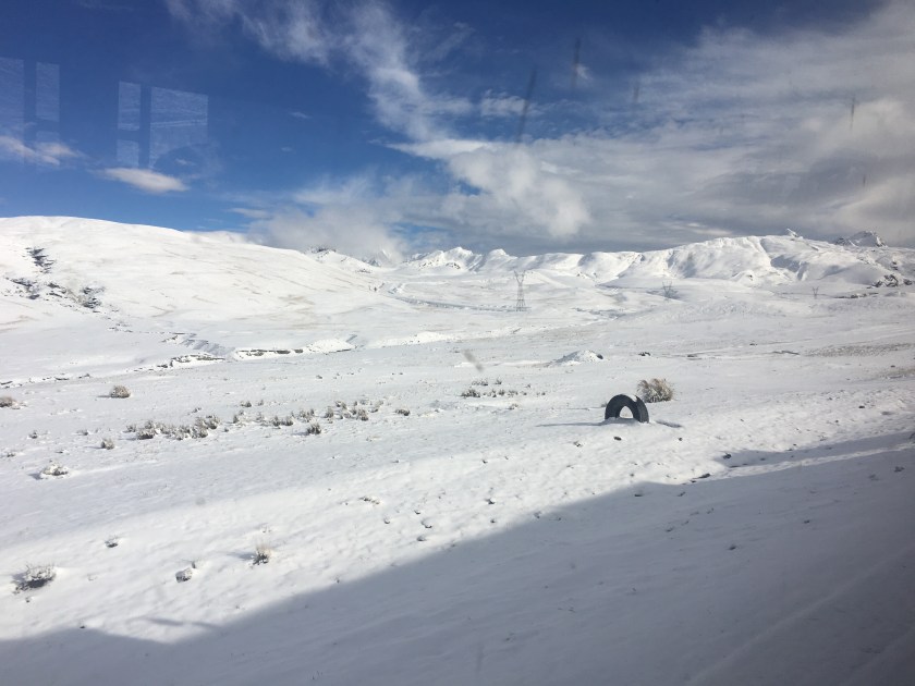
After a ridiculously cold and uncomfortable night (the first night camping is always the hardest), I was happy for day break so we could start hiking to go find the glacier lake.
If the first day was pure climbing, the second day was pure rock scramble – my favorite way to hike (and I’m not being sarcastic).
Add the fact that there was snow on the ground, and I was in heaven! Actually, it was more like hail or frozen rain because it was tiny little white ice balls, like I’d never seen before. But whatever it was, it was white and beautiful and made that wonderful crunching sound beneath our feet.
We climbed up and down (mostly up), over about 4 ridges on the side of a mountain, crossing a few landslides, literally climbing on the face of the mountain much of the time, and it was exhilarating. I fell once but I caught myself and didn’t die! Win!
We didn’t talk much because we needed all the air for breathing, as the air was getting thinner and thinner as we gained altitude. We both were chewing coca leaf to keep from getting altitude sickness.
As we crossed over the side of the great peak Illampu, the view suddenly opened up to reveal the beautiful glacier lake.
The grand Illampu rises over the left of the lake, while Ancouma rose over the right side (though Ancouma was hiding in clouds).
At the far end of the lake, the snowy side of a mountain seemed to be constantly feeding the lake with a glacier and avalanches.
The lake created an optical illusion such that it was actually much larger than it seemed; after 20 minutes of hiking I still hadn’t arrived to the far side where the snow and ice was falling into the lake, so I headed back since my guide was a little anxious to get back.
Every few minutes I would hear the distant sound of avalanches, but I could never find them when I looked up into the mountains.
The next day, we headed across the mountain pass to see some ruins, a couple of overlook points, and the Spanish Gold trail. We were walking in the clouds the whole way down, so unfortunately I didn’t get to see some of the amazing views. Despite the fog, I still loved it!
We normally would have hiked about 5-6 hours and camped one more night, with a campfire at a mirador, but with all the fog and my stomach acting up, I convinced Eduardo to to do an 8-hour hike that would bring us all the way back to Sorata in one day. Turns out we would have gotten rained on in the night if we had camped, and I didn’t have the most waterproof tent. Win #2!
The day was long and challenged my glutes again, but I enjoyed it just the same.
We hiked along the Spanish trail or the Gold trail, which is the trail that was used by the Spanish colonial rule to deliver gold from a mine in the mountains down to Sorata, carried by the locals who were used as slaves in the gold mining business. (My first night in Sorata I had stayed in a hostel that seemed like a really old house, and I later learned that it used to be the place where the slaves (indigenous people) delivered the gold to the Spanish.)
Walking along the Gold Trail, glutes screaming, sore shoulders, I thought about how this would be torture if someone was forcing me to do it, (especially for their own profit and not for me). But since I had chosen to do it, and I could go at my own pace and enjoy the scenery, and I was not doing it every day, it was something I actually paid to do. Privilege.
Eduardo continued to tell me the history of Sorata while walking this trail. He explained how the Spanish enslaved the locals not only for mining but they also set up the big haciendas, where the Spanish “patron” treated the locals like slaves to work the land and produce crops as efficiently as possible while the patron then got rich from selling the products, sometimes on the international markets that he had access to. The conversation invoked memories or reading Isabel Allende’s “House of Spirits”.
Eduardo went on to say that there came a time when the young rebelled and received a few more rights so they weren’t so much like slaves, but it wasn’t until later with the big land reform policies that the patrons left and locals could own their own land and reap the benefits from it.
Since then, he said, the community has organized itself so that each person owns their land where they live, and then the land in the hills above the community is common land so that anyone in the community can farm it. They meet once a month to resolve community issues and they rotate the leader of the community every year. Anyone with land in the community is registered on the “roster” and therefore has rights to farm the community land and also has the responsibility to serve their rotation as leader of the community for one year.
As I arrived back to Sorata, I could not believe that we had walked that entire distance. I had left behind the busy world of getting everywhere fast, and I had reunited with the age-old tradition of walking. I was just stunned at how two legs, two feet, could take me across massive hills and high up into the mountains, across distances and through terrain that seemed impossible, or difficult at best, to cross. It was a reminder how much I appreciate my feet and also the power of the human spirit and body.
Bonus Content: What do the kids do in the evenings in Sorata? As I made my way back to my hostel, all along the way, kids were playing with the same top-like toy in the streets, so I stopped at one group of kids and asked an older kid to show me what they were playing. He was super shy at first but I finally got him to show me on camera, and he let me try a few times too.
(Unfortunately I am having technical difficulties uploading videos here, but you can find the video on Facebook).
As I was walking on Isla de la Luna in Lake Titicaca, I caught my breath as I looked across the lake and saw grand white peaks rising out of the horizon.
If you know me, you know that I have a love affair with mountains, and especially those majestic white, snow-covered mountains (“nevadas”). The mountains seductively said to me “You’ve hiked in the Peruvian Andes, are you up for the Bolivian Andes?”
So after leaving Copacabana, instead of taking the usual route to La Paz, I got off the bus early and caught a few cars to get to Sorata, a small mining town of about 4,000 people about 3 hours from La Paz and a starting and ending point for a few different treks through the Bolivian Andes.
I had heard that Sorata was a mining town, but I was still blown away when I saw a sign in a store off the main plaza that said “I buy gold. I sell mercury.”
I had laughed when my uncle heard I was going to Bolivia and told me to take a metal detector and to look for gold…but turns out he knew what he was talking about!
Other than the sign about gold, the town reminded me of any small mountain town in Peru. With a nice plaza in the center,* the main church and municipality building off the plaza, and shops filling the streets around the plaza. And because the town is on the side of a mountain, the streets off of one side of the plaza were an incredibly steep climb up, while the streets off the other side were a steep descent.
I arrived on Sunday when they had their “feria”, or market day, when people from the surrounding areas bring their products to sell – potatoes, acacha (a long, skinny, knobby potato), habas (a big, protein-filled bean), snap peas, herbs, carrots, green beans. Similar to Peru, they would bring their big colorful “manta”, spread it out on the ground and neatly arrange their products to sell. Common to all markets I’ve ever seen in Peru and Bolivia, there were many different vendors, all selling the same things.
I had sought out a local, Sorata-based guide association and “Eduardo”, a local guide met me in the plaza when I arrived and introduced me to his wife and daughter who were enjoying a Sunday walking in the plaza.
I was fascinated with the option of doing an 11-day trek through the Andes that included climbing a snow-capped peak and ending in the “Yungus” (the lower altitude, warm climate of the jungle on the other side (east) of the Andes, but I wasn’t able to pull together a group to do it with. Since it would be just me and the guide, I decided to do a 3-4-day trek to a glacier lake between two snow-capped peaks, “Illampu” (Aymará for “fat of the llama”) and “Ancouma” (Aymará for “white snow”).
That evening we bought food and supplies and the next morning we started off from the town’s center, which is located low in the hills at 2,600 meters above sea level (8,500 ft). Eduardo pointed to the mountains in the far distance. I could not believe that we were going to arrive all the way there walking, (and with 15-20 kilos in my backpack) within a day. But he confirmed that we would do it. So I just put one foot in front of the other and waited to see what would happen.
It happened to be “Día del peatón”, or “Pedestrian Day”, the one day of the year in Bolivia where cars weren’t permitted to drive, which was lucky for us because our hike started along a dirt road, and when cars (illegally driving that day) did pass by, they kicked up a ton of dust which didn’t help breathing through the uphill climb.
Finally we got off the road and the smell of eucalyptus (one of my favorite smells of all time) filled the air and I realized we were walking through a eucalyptus forest.
Fun fact: Eucalyptus is an invasive from Australia that sucks the water and nutrients out of the soil…. But it produces wood quickly so people keep it around.
Later, the climb got steeper and the smell changed to muña. Another smell that I love, and this time there’s no worry about it being an invasive species. Muña is native here, it’s used in tea and is helpful preventing and alleviating the effects of altitude.
The first day was pure steep, uphill climb, like climbing stairs for 6 hours, without any flat parts to rest, so we took breaks every 30 minutes or so. It reminded me of the constant climb up Volcán Misti in Arequipa, including the burning glutes with every step (yep, for 6 hours).
My guide is a really nice guy who’s been a guide since 1993. He started as the front desk staff at a hostel that did tours. Trekking tourism started to boom in Sorata and one day they needed a guide so he went out with a group, and he loved it, and they loved him. He knew his way through the mountains because as a kid he used to take sheep out to graze through the mountains to make cash and as a curious spirit, he would go exploring new parts every time.
As more and more tourists flooded to Sorata to do treks, he formed the Association of Guides in Sorata, which ultimately had 30 guides and 20 arrieros (donkey handlers), all professionally trained. He loved meeting people from all over the world, learning from them, and exploring with them. He especially loved learning about new foods and ways to cook in the mountains. He picked up English and even a little French and Hebrew.
Everything was great until 2003. That’s when the Bolivian gas conflict exploded, with the country divided between plans to build a gas pipeline to export gas to the US and Mexico and a growing movement calling for Bolivia to build a local processing plant to get more value from their product and to meet internal gas needs before exporting. Between internal protests and international relationship problems, the booming tourism suddenly halted.
Since then, tourism in Sorata is starting to pick back up, but now most of the tours are dominated by agencies out of La Paz that charge double or more and often contract local guides anyway. When Eduardo goes out with big groups, his wife sometimes comes along to help, and his sons had come along a few times too, (but they didn’t enjoy it as much).
We ate lunch at 3,800 meters (12,500 ft), (the same altura as lago Titicaca), and then after about 3 more hours of climbing, we arrived at our campsite at at 4,200 meters (13,800 ft), a mountain lake “Lago Chillata”.
“Chillata” is Aymará for “the sacred lake where people go to pray, sobbing for help from the divine”). Or, to the Incas before Catholicism, the lake was called “Kotaato” – Aymará for “the lake in the middle of the rocks”.
Here, the clouds roll in thick around 4pm every afternoon and the fog hangs around until the middle of the night, where it clears up and the temperature drops below freezing.
As the clouds are rolling past, visibility sometimes would clear for just a few seconds, leaving an incredible view of the sun setting on the great white peaks of Illampu and Ancouma. (Many times I ran to a high point to get a photo, and within 10 seconds it was already covered in fog again by the time I got there.)
Tomorrow we’ll be able to leave the heavy stuff at the campsite as we head towards the great peaks to find the glacier lake that is tucked between them.
*Famous Footnote/Bonus content:
While wandering around the plaza the night before the trek, I saw a group of people speaking English in the plaza. I approached them and learned they were a chapter of Engineers Without Borders doing an Eco-bathroom project in a nearby rural town! I find my people all over the world!
La Isla del Sol is the biggest Lake Titicaca island, and it is also the most visited by tourists, due to its convenient location just a 2-hour boat ride from Copacabana, the popular tourist stop between Bolivia and Peru.
It is apparent that the island has developed around tourism – there is an abundance of lodging (hospedajes) and restaurant options, and even signs pointing the way to tourist points of interest like overlook points.
You know international tourists come through a place in Bolivia if you find a pizza restaurant, and there are a ton of pizza restaurants on Isla del Sol.
I was really struck by the beautiful architecture and especially the facades of many of the hospedajes, most of which incorporated rock or pebble to adorn traditional adobe construction.
It is also close enough to the mainland peninsula (with a tiny tree-covered island in between), that it is connected to the electric grid of the mainland, unlike Isla de la Luna, which relies on solar panels.
Isla del Sol has three different communities and is less densely populated than Amantaní, with approximately the same population but spread throughout the 14-square-kilometer island (compared to Amantaní’s 9-square-km). (But both much larger than the tiny 1-square kilometer Isla de la Luna with just one community of 27 families).
Just like the other two islands I visited, the geography is that of a mountain rising out of the sea…er, lake. (It is very easy to forget that I am on a lake and not the sea!)
The point is that everything is uphill from the shore. And even walking around from place to place on the island is like hiking in the mountains – a lot of up and down (which always feels like there’s more up than down) at 3,800 meters of altitude.
The boat I came in arrived at the port Pilko Kaina with Incan ruins to explore.
From there to the rest of the island was a surprisingly long climb up.
I really wondered if I was going the right way and if all this climbing was going to be worth it in the end. But I persevered, meeting some friends and some awesome views along the way.
I eventually wandered upon two other lost tourists and soon we came to a house which turned out to also be a fancy restaurant on the edge of Yumani, the community most frequented in Isla del Sol and full of restaurants and hospedajes.
They stayed to enjoy some gourmet food while I continued along in search of a place to stay the night and a cheaper lunch since I was on a really tight budget, and running low on cash at this point.
The site where I did eat lunch was indescribably beautiful. The view of the lake was breathtaking (literally and figuratively at 4000 meters above sea level)… so blue, and so immense, stretching as far as the eye could see. The only sounds were a few birds and a distant conversation in Aymará, with the light sea, er, lake breeze whispering past my ears. Ultimate peace.
And it was the best meal I’d had since Amantaní – fresh trout from the lake with some fresh veggies.
Later, heading to the lookout point to catch the sunset I met and chatted with a local woman selling souvenirs who appeared slightly younger than me and who had curious and rowdy 2- and 4-year-olds. She had lived in São Paulo, Brazil and so not only spoke Aymará (the local language on the island) and Spanish, but also Portugués from her time in Brazil. She had returned to Bolivia because she said they had been treated like second class citizens, her husband robbed at gunpoint a few times, and other Bolivian migrant friends injured or killed…she said her experience was that there was no justice as the government didn’t really value their lives, safety, and rights as immigrant workers. (USA, can we please not be like that???? Pretty please.)
After doing yoga and watching the sunset with her and her kids, I headed to another overlook point.
There I met a super sweet couple – a Spanish woman and an Argentine who ended up staying two extra nights and exploring the whole island (even the northern part which we had been told could be dangerous because of an inter-community conflict that started two years ago), and they said it was incredibly beautiful!
Unfortunately I was running low on cash and had to return to Copacabana the next morning to change money and continue my journey. So, after a delicious dinner of trout from the lake (yes, again!) I headed to my hospedaje and had my last peaceful, Lake Titicaca island sleep.
The next morning, after watching the sunrise and eating breakfast, I headed down to the dock, past the Fuente del Inca and saw the grand island entrance to the Yumani community.
I had the pleasure of chatting with a few local women while waiting for my boat. This might have been one of the highlights of my stay here. Using my handy language chart, I practiced my Aymará with them, and we were all highly entertained (even if they were laughing AT me not WITH me at times!) Similar to Isla de la Luna, most people have their farms where they grow the typical sierra (highland) crops- quinoa, wheat, corn, and a variety of potatoes, and animals (mostly sheep), while the income from tourism helps provide something extra.
With a farewell photo, I said “juspara” (thank you) “jakisiñkama” (goodbye)! and boarded the boat for my last ride across the majestic Lake Titicaca.
Every morning at 8:30am, boats full of tourists leave Copacabana heading to Isla del Sol, with an option of stopping for an hour at Isla de la Luna. Planning just to go to Isla del Sol and stay the night, I boarded a boat and met up with the two traveler friends from London and Italy that I had met in my hostel.
It was a beautiful 2 hour boat ride and I even saw some little fish swimming along side of the boat. Instead of getting off at the first stop at the Isla del Sol, I stayed on with my new friends to go to the Isla de la Luna.
The boat only stops for an hour at Isla de la Luna and the guide on the boat says there’s not much to see there and you can do it in an hour…and they only give you an hour before the boat leaves to go to the Isla del Sol. And if the boat leaves without you, you’re stuck in the island until the next day because the boats only come once a day for an hour.*
Entering the island the smell of muña caught me by surprise and reminded me of my stay in Amantaní, the island in the north part of the lake. As I was walking up the stairs to enter the island with the other tourists, I passed a little 4-year-old boy who, without prompting, greeted me saying “Hi, my name is Miguel Ángel”! It was so adorable!
I started exploring late because I chatted for about 10 minutes with the guy who was charging for bathroom use, geeking out about the water and electricity access on the island. (Islands have always fascinated me because they present unique infrastructure challenges ripe for alternative energies and exploring the idea of sustainability.)
Geek out about the island’s infrastructure:
They used to not have power but now they use solar panels (“because the kids want their cell phones. And also tv.”) He said the panels are great but the batteries only last a couple of years and they have to be careful not to let them drain to zero or they stop working well. They use what look like basic car batteries that charge during the day.
They also have solar hot water heaters in most of the houses.
They use water from the lake but have to buy gas to power the pumps that pump the water up from the lake. (They charge for the bathroom in part to cover costs of the gas).
End Geek-out.
Finally, I headed up the hill to the ruins of the “temple of the virgins”, which was supposedly a type of boarding school for young women to learn to do womenly things in the Incan times.
There, I met an older woman from the island who explained that life living on Isla de la Luna is really calm and peaceful, and she liked it much better than the city (La Paz) where she lived for a few years. Here they grow their food, have a few animals- (llamas, pigs, chickens, sheep), they have fish farms within the lake, they and buy what they don’t have on the island from Copacabana. There’s a primary school and a church and a football field – everything they need, she said.
As I started to hike the hill from the temple to see what was on the other side of the island, I passed a woman knitting in the shade who asked if I was going to stay the night in the island.
“That’s an option?” I asked her.
Part of my travel purpose is to go off the beaten path and get to know some places and the people that live there… so when she said that her mother owned a hospedaje, I negotiated a price to include my meals, and I decided to stay the night instead of going back with the boat to Isla del Sol.
The boat companies from copacabana don’t promote the fact that there are hospedajes on the island, (maybe because it’s a tiny island and most tourists want more entertainment and conveniences? I don’t know.)
But if you are looking for a quiet and incredibly beautiful place to pass 24 hours (or more), where you can chat with one (or a few) of the 27 families that live on the island, learn about their daily lives, and walk along the perimeter of the 1-square-km island in the afternoon sun…then it’s worth the stay.
The tourists only come one hour per day, at the same time every day, and the community rotates selling things, collecting the entrance fee, collecting bathroom fees, and helping/keeping an eye on the tourists.
On the other side of the hill, and down the length of the island are the houses where the community (called Coati) lives…So the tourists only see the ruins and a view of both sides of the island from the top of the hill, but don’t see or go into the community, unless they stay the night.
The community of Coati, Isla de la Luna
The hospedaje where I stayed overlooks the lake, with a little pier extending into the lake. In the patio between the rooms are beautiful plants with flowers and the constant buzz of bees that I even hear from inside he room.
The quiet lapping of the waves on the shore can also be heard from inside if you listen closely.
This half of the island, the opposite side from where the tourists land, smells of muña for parts and eucalyptus for other parts.
I loved chatting with the woman who owned the hospedaje. It challenged my conversation skills a little because she wasn’t super talkative, but every time I asked her a question I saw her face light up a little and I felt her open up a little more, like she viewed me with a little less skepticism each time.
She commented that the president/government built part of the hospedaje last year (or at least convinced them that he did so they’ll vote for him at the end of this year), and the alcalde bought the water pump. The entrance fee to the island goes towards paying the locals to do restoration of the ruins or other community-based things.
The woman has 5 kids, one still living here on the island, a few in Copacabana and a few in other cities, but she’s content because they talk on the phone. When she first moved here with her husband (who is from here), there wasn’t running water or electricity so it was a rough adjustment for her, but she adapted, and now it is much easier with the solar power and pumped water. She feels at home now and likes that it’s quieter with less people than where she grew up, (in a community on the peninsula).
We chatted as the sun set over the pier, and she told me that tomorrow would be her turn to sell her artesanías in the temple so I would see her there when I leave.
In the morning, heading back over the hill to the other side of the island, I saw the little boy from the previous day, Miguel Ángel, walking with his mother, taking their sheep out to graze. She had a few of them on a leash, and the similarity to people walking their dogs in the morning made me smile. A few loose sheep stopped to eat and wouldn’t follow her so she sent Miguel Ángel to collect them, and I went to help herd sheep, while the talkative, friendly boy told me stories of his sheep.
This visit had a different feel than my stays on Ccotos and Amantaní, mostly because the business arrangement is different. Here, they are following a more traditional hotel-type tourism model, where the host is simply providing a space to stay, and doesn’t even live in the same area where the guest rooms are. Whereas in Amantaní and Ccotos they are following a homestay model where the tourist is a little more integrated into the daily life with the host – through sharing meals and sometimes community events, in addition to the guest rooms being more physically close to where the family lives and considered part of the family’s house.
While I personally preferred the homestay model and the culture-sharing atmosphere it fosters, I still greatly enjoyed my stay here. There aren’t many words to describe the peacefulness and beauty of this place, but hopefully you can catch a glimpse of it through the photos!
As I left the island in the morning for Isla del Sol, I saw the snow-covered peaks of the Cordillera Real in the distance, a reminder that I was on a lake in the middle of the Andes, not the ocean, and a foreshadowing of my future travels through Bolivia.
Famous Footnotes
*If you really needed to leave the island, you could pay a local a very high price to take you in a private boat to Isla del Sol or the mainland.
Copacabana, Bolivia is a tiny little border town on the coast of Lake Titicaca, just 30 minutes from the Peruvian border. It’s a popular tourist stop between the two countries, and that is evident by the fancier and pricier restaurants and hotels geared towards international travelers on two of the streets running from the plaza to the port, where the boats take off to visit Isla del Sol and Isla de la Luna.
Walking down these streets you hear people calling out insistently, “Isla del Sol! Isla del Sol!” “La Paz!” trying to sell tickets, competing with the 20 other people on the street doing the same (even though there seems to actually only be about 3-4 different actual companies. It’s an interesting system that I never fully understood.)
Copacabana had quite a few attractions but I only took advantage of really checking out three.
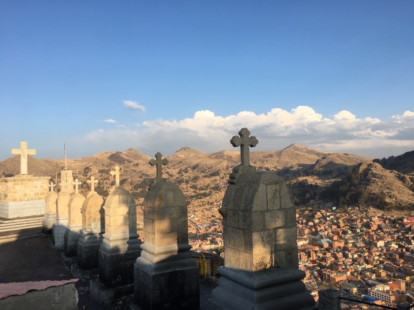
Trying to adjust to the altitude, just before sunset I ran along the coast of the lake and (ran-walked) up the famous Calavario hill, which is the hill overlooking the town and the lake with the
stations of the cross at the top. Watching the sun set over the lake while doing yoga was … indescribable. Like looking at a beautiful painting while doing yoga, only better. It was the most beautiful moment in Copacabana.
Copacabana is also famous for its Cathedral, and for blessing cars. Yep, you read that right. People bring their cars to Copacabana to get them blessed, a service offered every morning by the local priest.
But the cars have to look good for their baptism so there’s a whole series of tents set up to sell flowers and decorations for the cars in front of te cathedral every morning.
I happened to be there during a Peruvian holiday so I actually saw more Peruvian plates than Bolivian plates, as Peruvians took advantage of the 4-day weekend to cross the border and visit Bolivia.
I was staying at a really cozy hospedaje that I would recommend for people on a low budget: Hostal Sonia. I got quite a bit of writing done in one of the great common areas with natural light and a view of the lake.
I was surprised to hear the garbage truck drive by playing the same “reduce, reuse, recycle” song that the garbage truck in Oxapampa, Peru plays! (The garbage trucks play music so you know when they’re coming and can run out to put out your trash if you haven’t already.)
While I heard about a few other cool things to do in Copacabana, (like Hora del Inca, a pre-Incan astronomical observatory(!), Baño del Inca, and the nearby Kusijata with archeological stuff), I didn’t get a chance to check them out…next time. But I did hop in a boat full of international tourists to go visit Isla del Sol and Isla de la Luna.
On the many different boat rides over the next few days, I met some really great fellow travelers, who gave me great tips on logistics and trip planning, including another lone woman traveler from France, a brother and sister from Italy, a couple from France, three university students from Spain, two older women from Spain, and a couple from La Paz who were also chemical engineers working in the environmental field! (Needless to say, we geeked out, and they also showed me a good, cheap spot to eat they had found in Copacabana).
While Copacabana was much more touristy with little to none of the tranquil, community experiences I had come from in Peru, it was a good experience, and I loved connecting with other travelers!Next up…I will get a taste of the islands in the southern, Bolivian side of Lake Titicaca: Isla del Sol and Isla de la Luna.
As much as I would have loved to stay longer in the paradise of Amantaní, my visa had expired and I had to flee the country (Peru charges a fee for every day you overstay your visa.)
While not unsurprising, crossing the border between Peru and Bolivia was not a smooth process for me because of my expired visa, my very flexible backpackers itinerary, and my US citizenship.
At Peruvian immigration I had to had to jump through a whole series of hoops (including taking a taxi to the bank in a nearby town to pay the fee for overstaying my visa). But they didn’t put me in a detention center or deport me back to the US, so instead of complaining about the inconveniences I’m just thankful that Peru Immigrations is more humane than the US when it comes to visas and immigration.
Bolivian immigrations also gave me a hard time, but that was kind of expected. As a fellow traveler pointed out to me, the American passport is one of the most powerful , or widely accepted, passports in the world. Almost all countries will let us visit with few problems. Meanwhile, if you happen to be born in a North African country, like my traveler friend, she was only able to travel to a handful of countries with her passport (until she moved to France and got a French passport).
Whole US citizens enjoy this travel freedom, the US is one of the countries that restricts entry simply for a person’s country of origin.
Bolivia is one of the countries in the world that has a reciprocity policy for US citizens – since the US makes Bolivians (and most South Americans) pay a high visa application fee and puts strict (and sometimes arbitrarily interpreted) requirements that many people don’t meet so they end up not getting the visa and losing the application fee, without obtaining a visa to travel to the US…Bolivia puts a high fee for US citizens wanting to enter Bolivia. (Unfortunate because many US travelers disagree with the US immigration policy and they are the ones that bear the cost, but I would do the same if I was Bolivia.)
So after paying my fee, changing money, and finally passing Peruvian immigration, I walked down the road to Bolivian immigration, thinking I had my paperwork in order but finding out I was wrong. They hassled me about my itinerary and made me retype it, mostly because I didn’t have hotels reserved in advance since I was on a backpackers plan where I would find a hostal in each place I went. Actually, the real real reason was that they were just following policy…the US hassles Bolivians about entering the US, looking for any reason not to let them in, so they were doing the same.
Interestingly, their attitude towards me changed when I heard them speaking Aymará so I tried to joke with them and throw in some words in Aymará from the cheat sheet that Romulo (my host from Amantaní) had given me.
Maybe it’s that when I tried to connect with them and their culture they realized I wasn’t a stuck up and racist American. Or, maybe an American trying to pronounce words in Aymará was more entertaining than a frustrated and tired American being hassled about being let into the country. Either way, they loosened up, joked with me, accepted my paperwork without further hassle, and let me in the country.
This was a perfect example of how my travels have been like a video game – something I picked up along the way helped me pass to the next level.
When I was staying in the island Amantaní, I enjoyed great conversations with the couple with whom I stayed, including conversations about politics. From Romulo (the husband), I learned about the divide in culture and language between the different sides of the lake Titicaca – the part north of Puno is Quechua-speaking, and south of Puno and into Bolivia is Aymará-speaking.
The day that I had planned to leave the island Amantaní, we got word from a teacher who lives in Puno and travels to the island for the weekdays to teach, that there was going to be a huge protest that would block the main roads between Puno and Bolivia.
The regional governor for the whole region of Puno had just been charged and put in jail for leading protests that destroyed state property a few years back. As the region of Puno is culturally divided between people who speak Quechua and those who speak Aymará, this was the first regional governor that was from the Aymará culture (almost always a Quechua-speaking governor had been elected).
Because of this, many Aymará people were upset with the ruling, believing that it was a political move to oust their leader, and so they would be protesting by blocking the roads hoping to release the governor. (This type of protest, in which the roads are blocked is somewhat common in Peru, and the good thing is that it is usually planned a few days in advance so that people get word and know not to travel those days.)
So along with this history and culture lesson about the Puno region, Romulo showed me a chart that translated a few basic words between Quechua, Aymará, Spanish, and even English, and he told me me take a photo of it.
Little did I know, he was the wizard giving me the magic wand that I would later need to open the door to taking me to the next level of my video game Odyssey – from Peru to Bolivia.
Bonus Round: After finally arriving to the plaza in Copacabana, I was struggling with google maps trying to find my airbnb because there were no street signs. Suddenly, someone calls my name, and it’s one of the guys who worked in the immigration office. A little creepy, yes. I asked myself if he was following me, and I was kind of cautious answering him. But it turned out that he happened to live nearby (it’s a really small town), and he was just being nice and helpful. When we found the place, he wished me a safe journey and left me feeling like that magic wand of connecting with people through their own language had turned obstacles into friends helping me along the way.
Bienvenida a Bolivia! The Bolivian adventure begins! ??